

No appreciable damage was caused by this tornado, but it was witnessed and photographed by diners at the Elmhirst Inn on Rice Lake. The tornado had the appearance of a classic tropical waterspout as it moved across the lake, then onto land as a slender elephant trunk tornado. It’s path was 2 kilometres long and 100 metres wide.
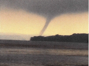
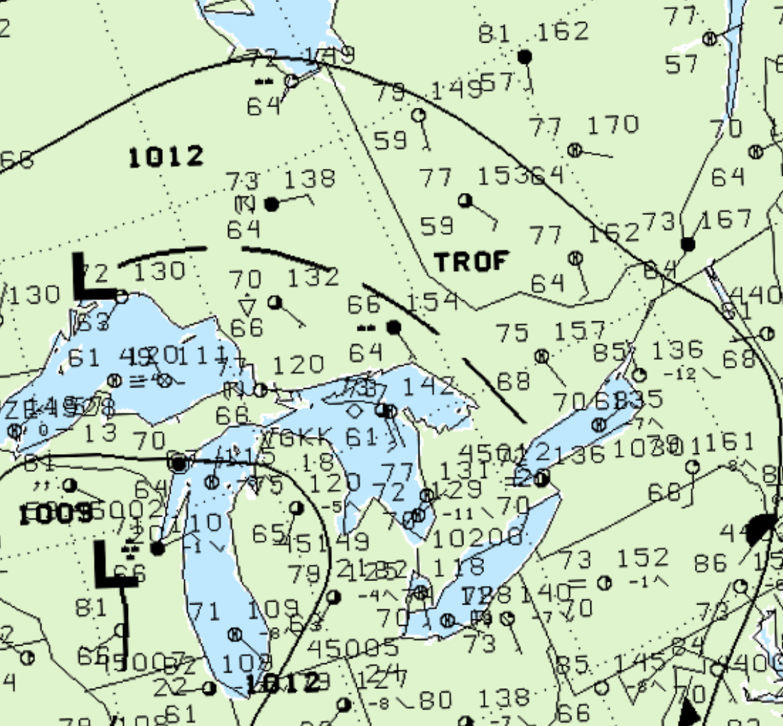
Figure 2 depicts the surface observations at 5:00 pm EDT, which shows a trough of low pressure moving across southern Ontario. This trough was the focus for thunderstorms and ultimately this F0 tornado.
According to Environment and Climate Change Canada (2018), an F0 tornado touched down at 6:30 pm CDT near Keene, ON. The path of the tornado was not documented by ECCC, but its maximum width was 100 metres. The tornado caused no fatalities, injuries or property damage.
Sources
Snelling, W. (2010, January 16). RICE LAKE TORNADO, AUGUST 2, 2003. Message posted to http://www.ontariostorms.com/showthread.php?t=217
NWS Weather Prediction Center Surface Analysis Archive. (2017). Surface analysis 21Z Sat Aug 2 2003. Retrieved from: https://www.wpc.ncep.noaa.gov/archives/web_pages/sfc/sfc_archive.php
Environment and Climate Change Canada Data. (2018). Canadian National Tornado Database: Verified Events (1980-2009) – Public. Retrieved from: http://donnees.ec.gc.ca/data/weather/products/canadian-national-tornado-database-verified-events-1980-2009-public/