

This slender EF0 tornado was brief and weak, producing no damage as it touched down in a field near Kenilworth, outside of Arthur. The tornado was spawned from a light shower that barely appeared as more than a blip on Doppler radar.
CANWARN spotter and storm chaser Dave Patrick recorded the event, with video showing a long and slim funnel cloud condensing downward. He was able to confirm that the circulation did reach the ground twice, though it occurred in a remote forested area and so no damage was detected.
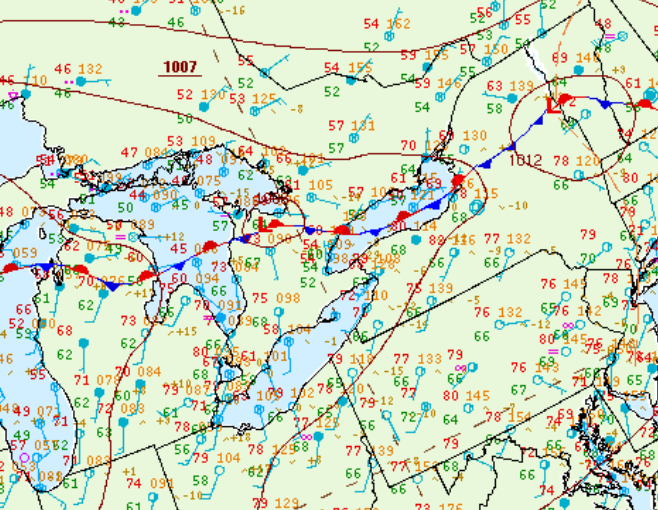
Figure 1 depicts the surface observations at 5:00 pm EDT, which shows an outflow boundary in Grey-Bruce County in southern Ontario. This boundary promoted storm development throughout the afternoon and evening hours of June 1st, which ultimately led to this tornado.
Sources
NWS Weather Prediction Center Surface Analysis Archive. (2017). Surface analysis 21Z Sat Jun 1 2013. Retrieved from: https://www.wpc.ncep.noaa.gov/archives/web_pages/sfc/sfc_archive.php