

This F2 tornado tore through Pipestone Point Peninsula south of Kenora at 4:00 pm. Boats were tossed and destroyed, cottages were blown apart with their debris scattered in the lake, and extensive swaths of forest were torn down.
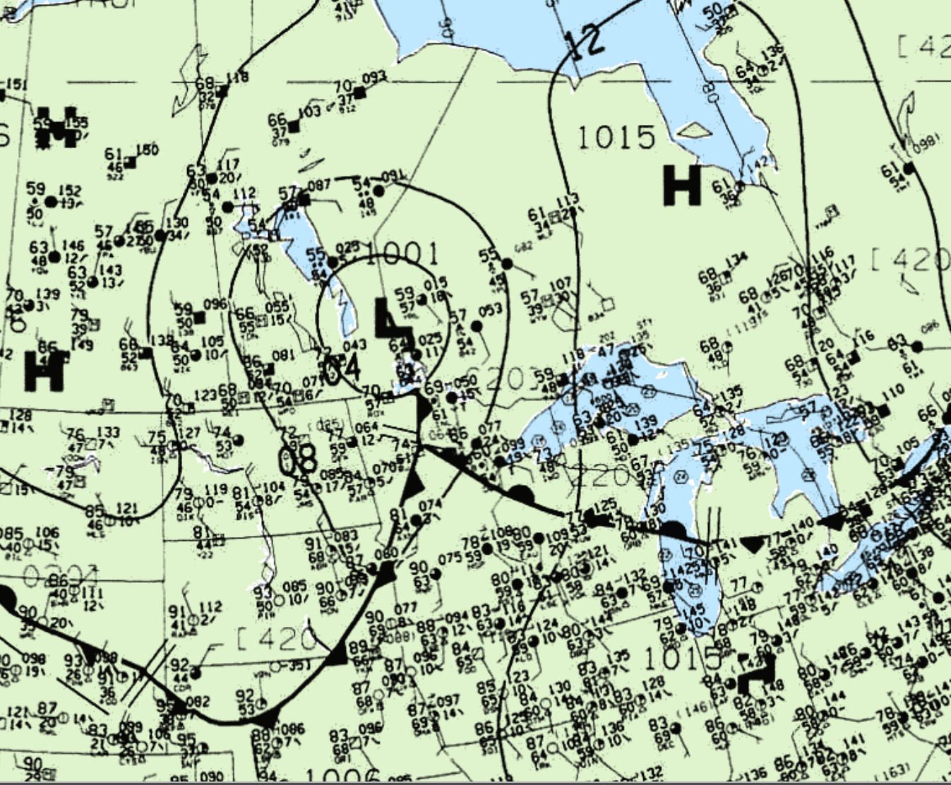
Figure 1 depicts the surface observations at 4:00 pm CDT (the time of the tornado), which depicts a strong low pressure on the Manitoba/Ontario border with an occluded front just west of Kenora. This frontal boundary became the focus for strong thunderstorms and ultimately this F2 tornado.
According to Environment and Climate Change Canada (2018), an F2 tornado touched down at 4:04 pm CDT near Kenora, ON. The track and width of the tornado was not documented by ECCC. Fatalities, injuries and property damage were not catalogued by ECCC.
Source
NWS Weather Prediction Center Surface Analysis Archive. (2017). Surface analysis 21Z Thu Jun 30 1994. Retrieved from: https://www.wpc.ncep.noaa.gov/archives/web_pages/sfc/sfc_archive.php
Environment and Climate Change Canada Data. (2018). Canadian National Tornado Database: Verified Events (1980-2009) – Public. Retrieved from: http://donnees.ec.gc.ca/data/weather/products/canadian-national-tornado-database-verified-events-1980-2009-public/