THE TORNADO THAT RAVAGED KINMOUNT
This short but intense tornado developed just southwest of Kinmount and tore directly through the south end of town. It spun up on the west side of Highway 45, snapping trees in a narrow swath as it crossed the road and passed over the Burnt River. On the east side of the river it rapidly intensified and began to widen.
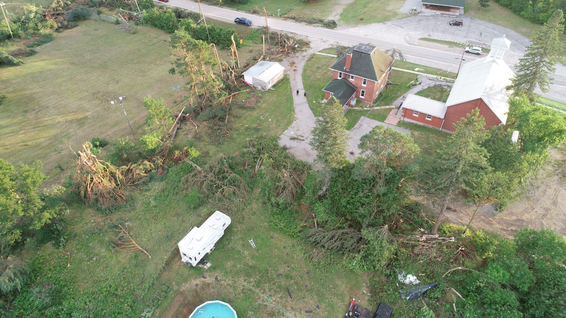
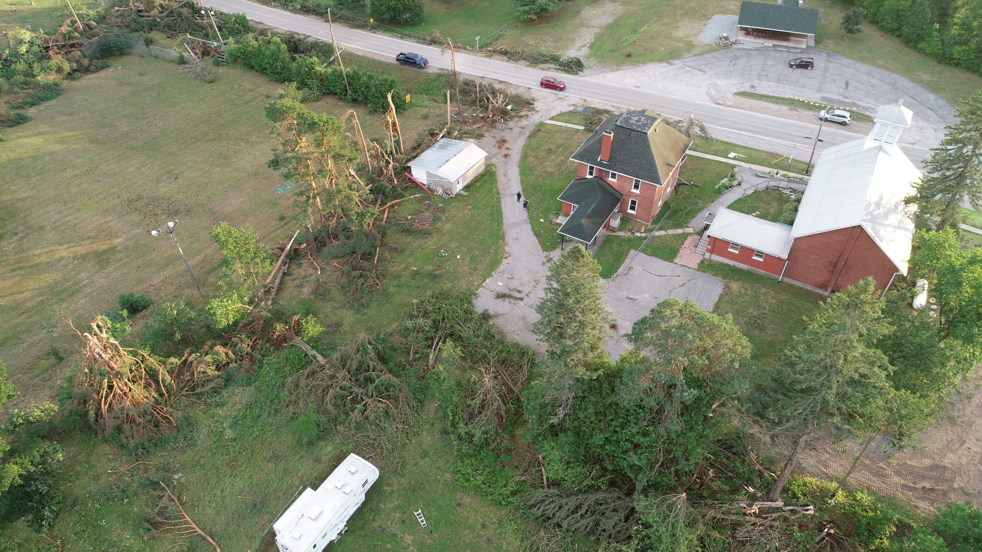
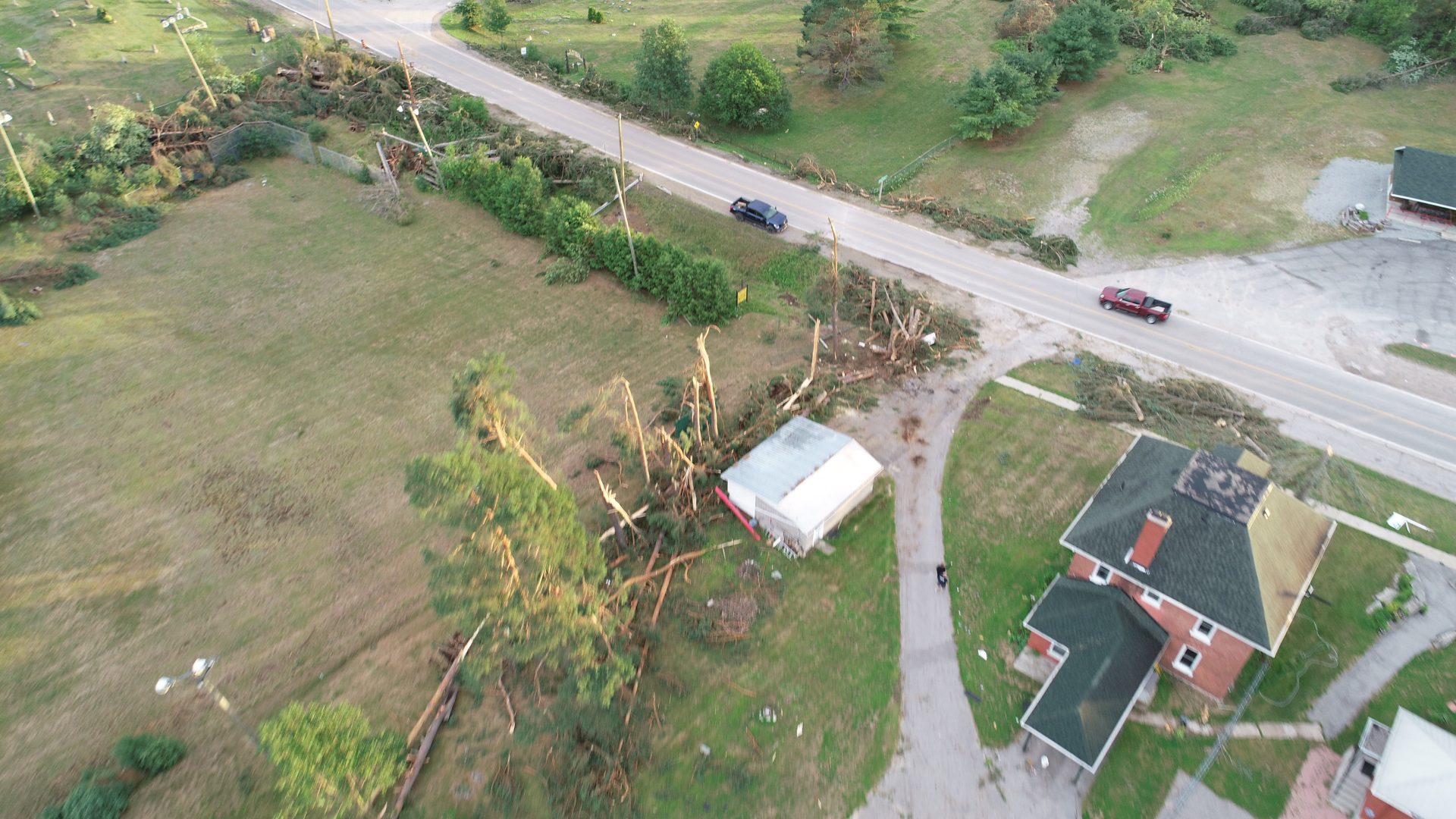
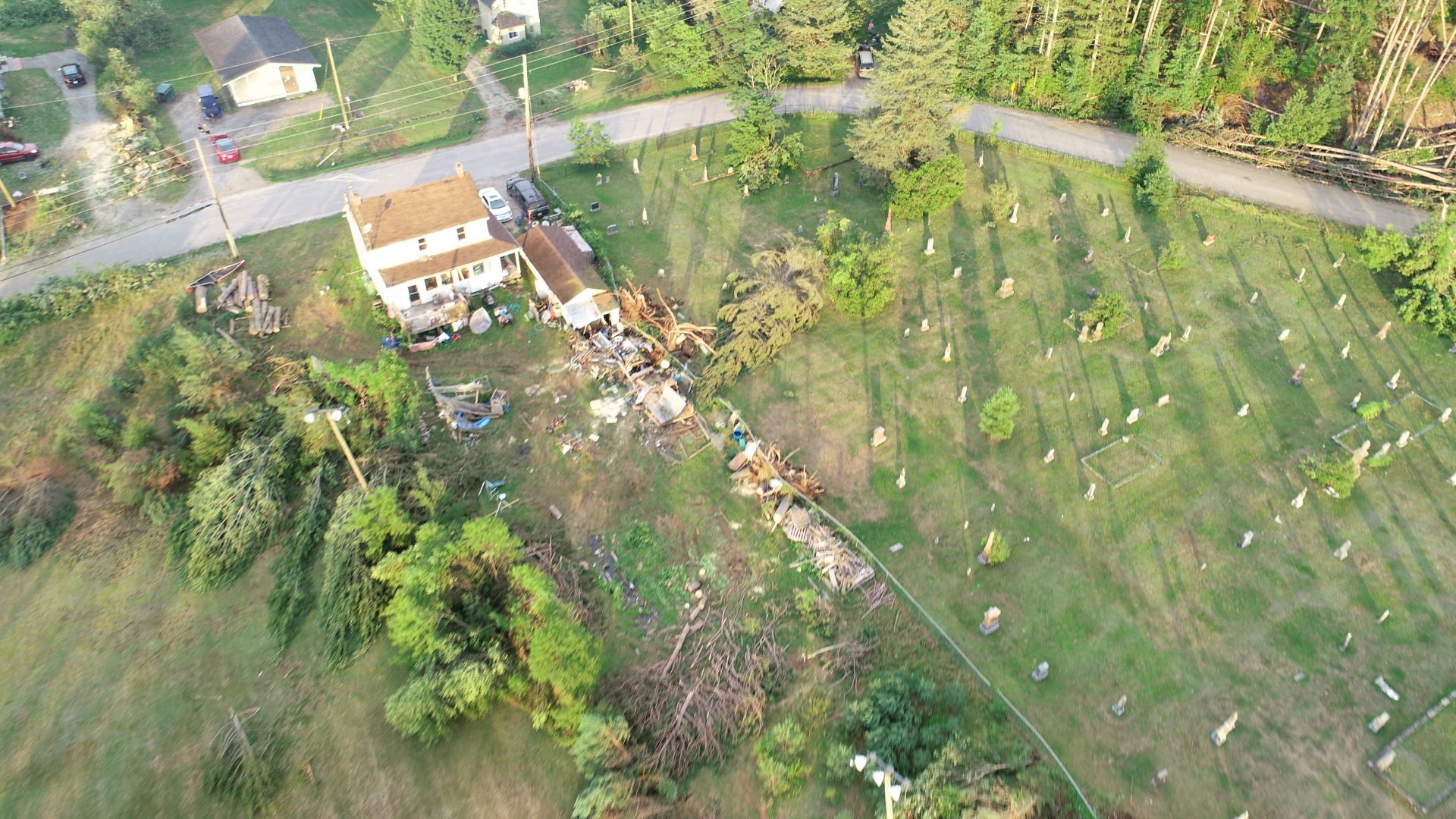
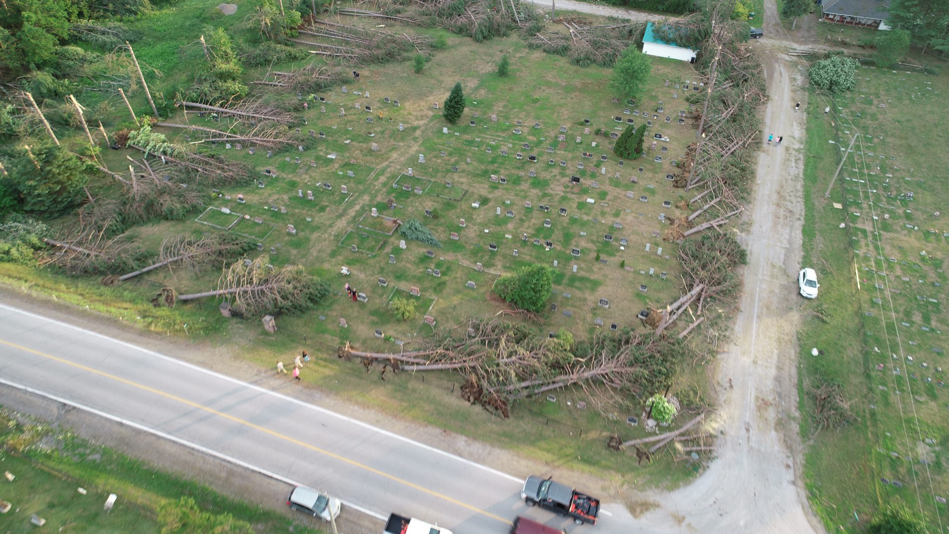
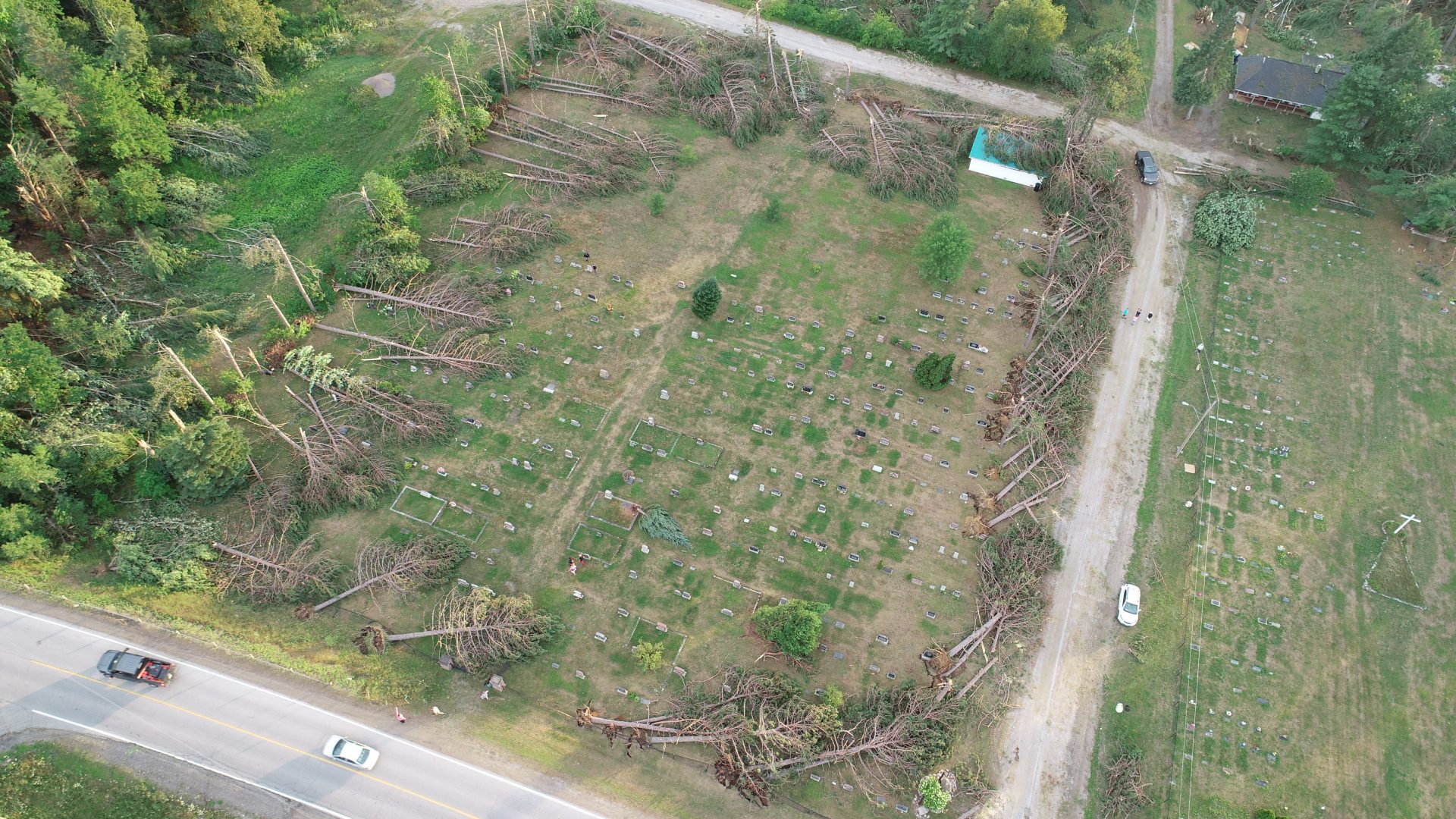
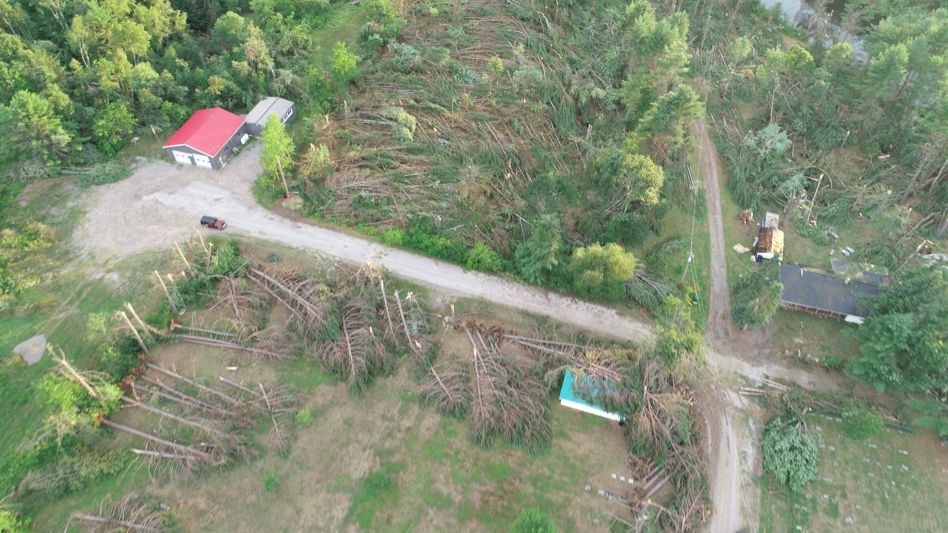
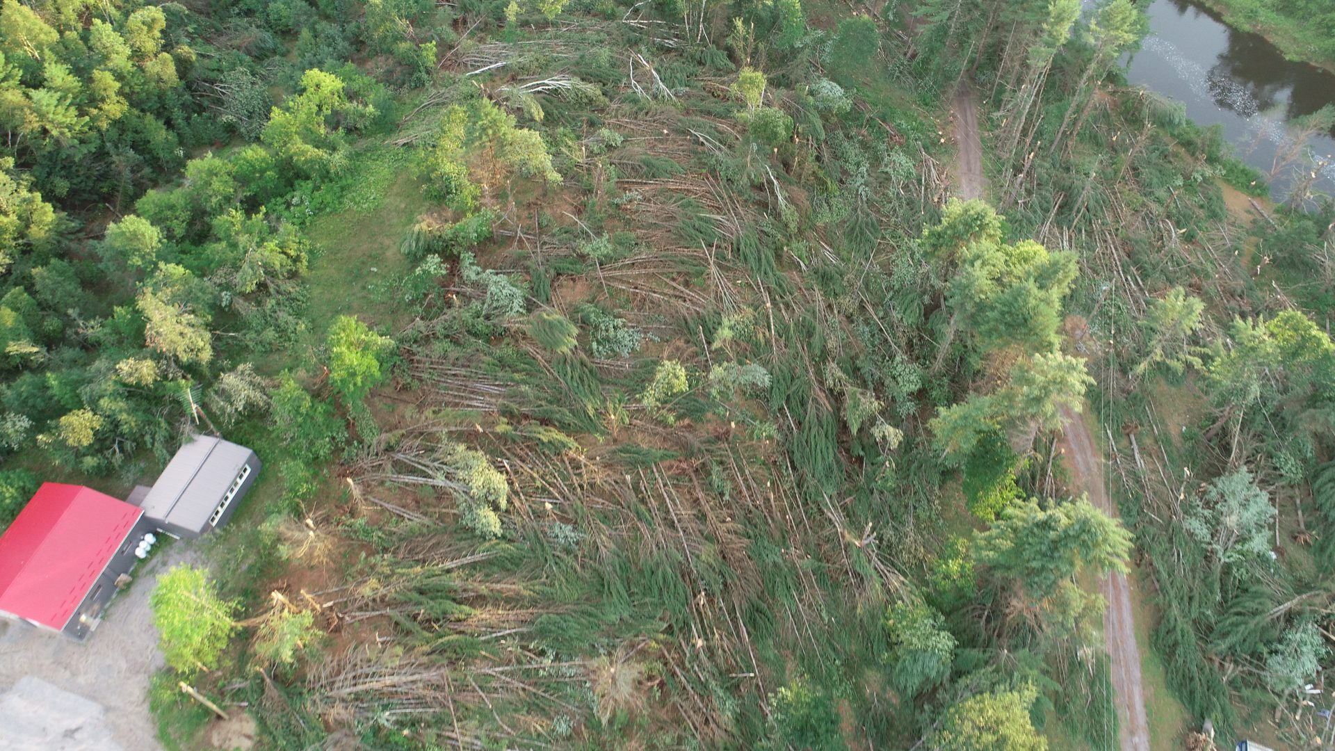
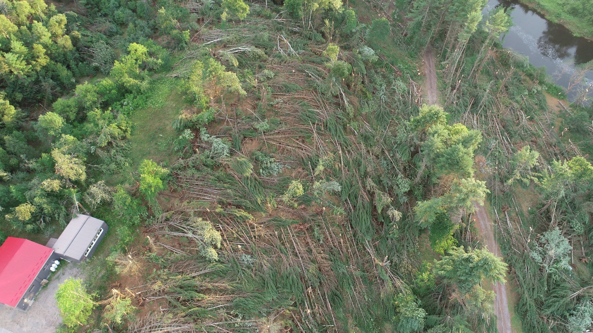
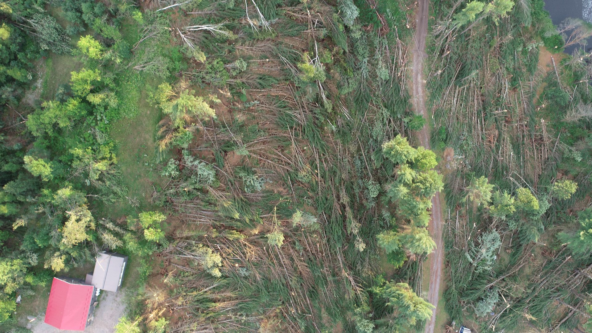
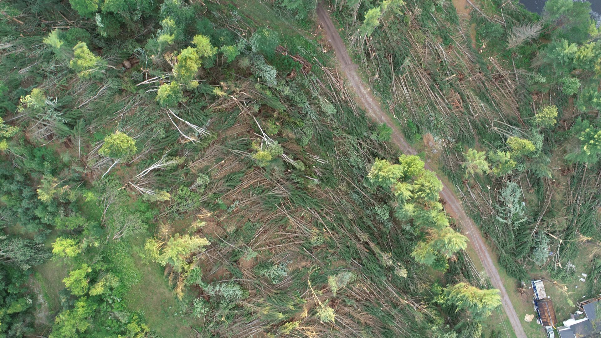
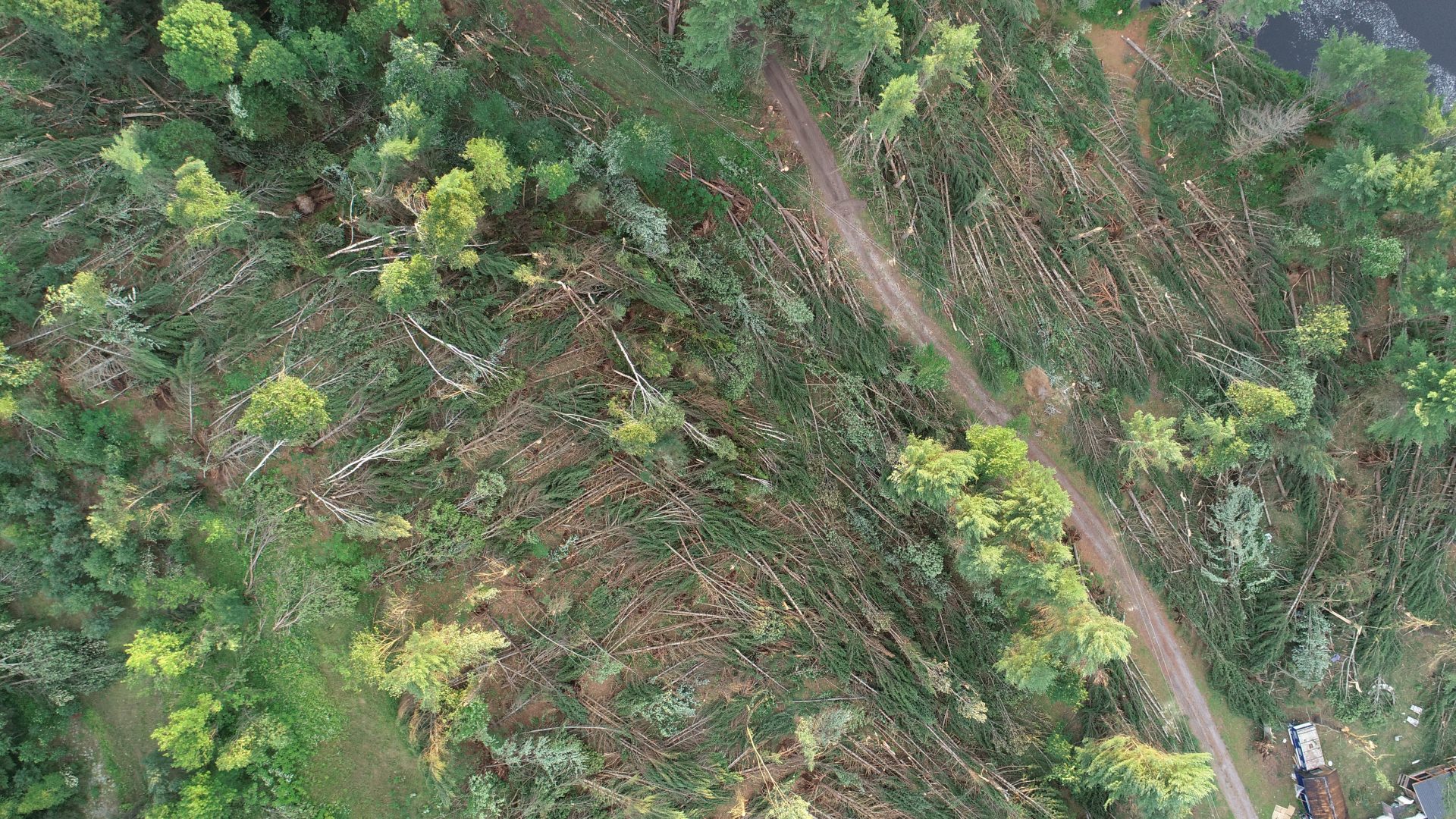
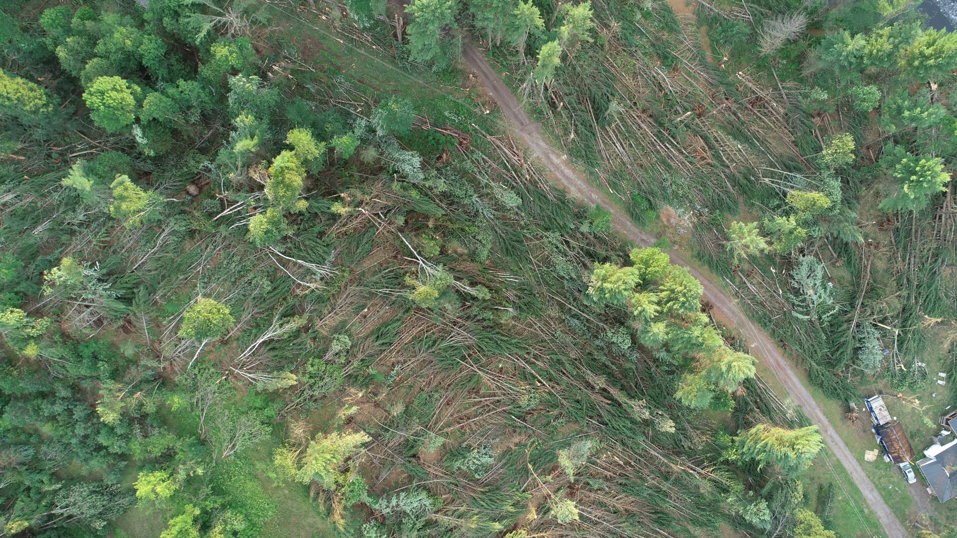
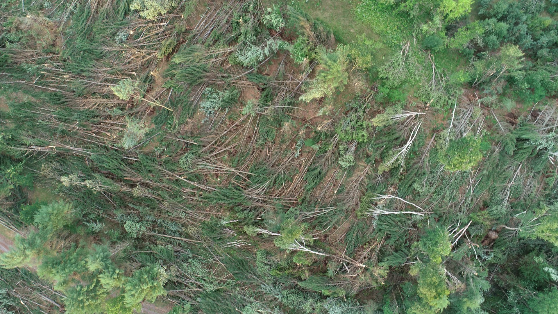
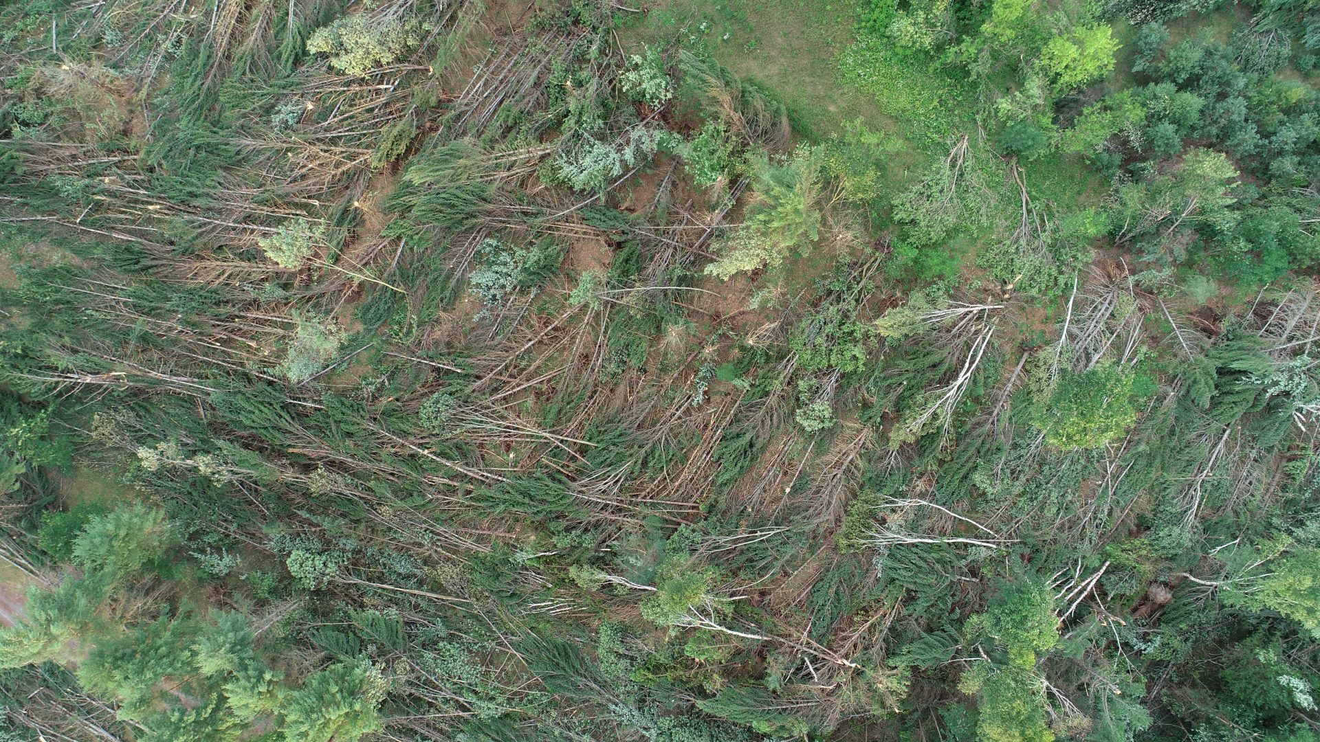
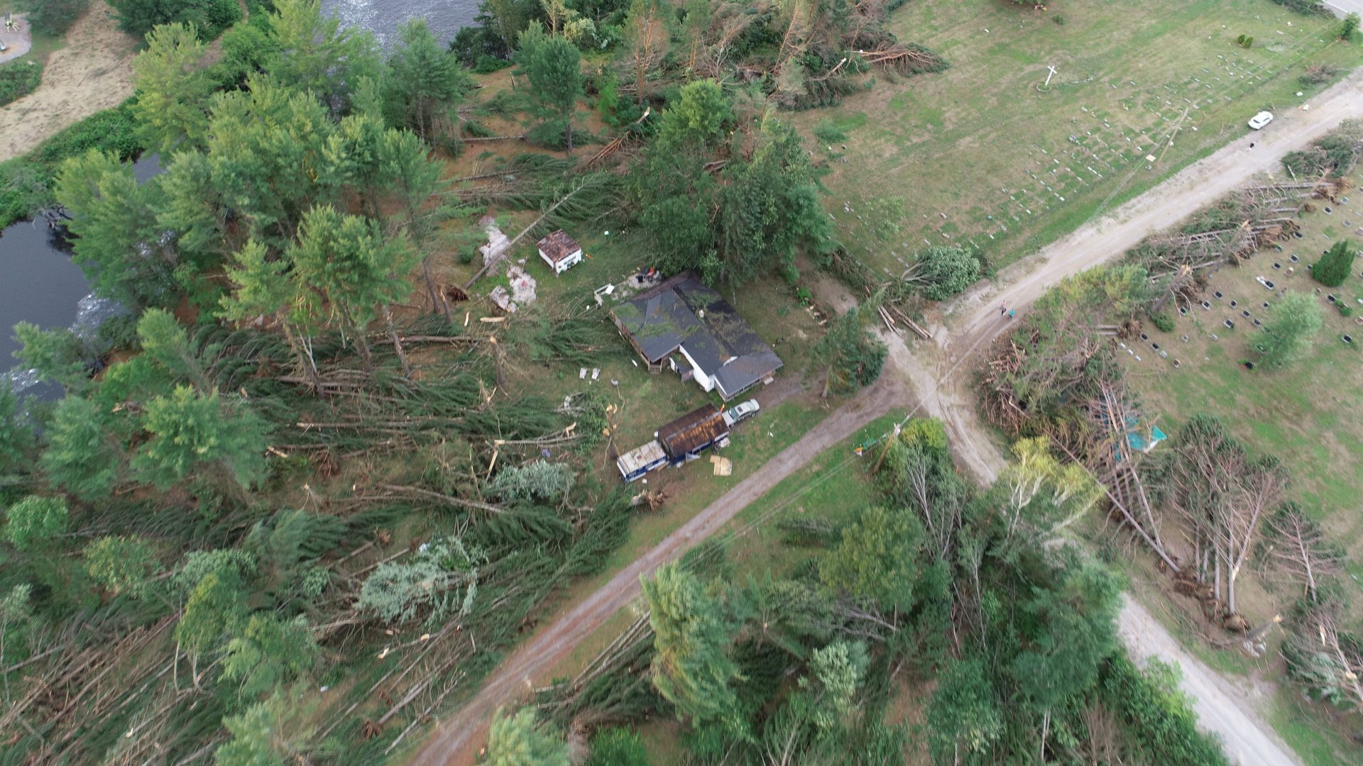
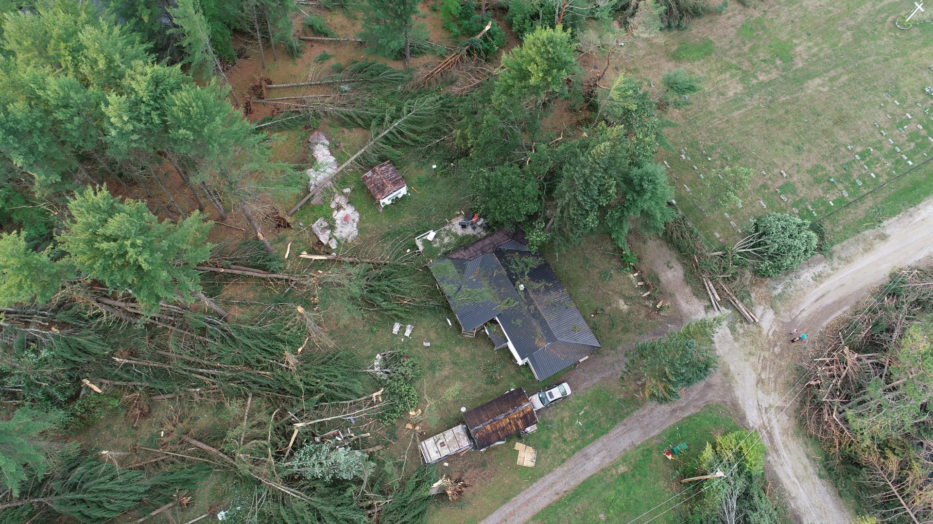
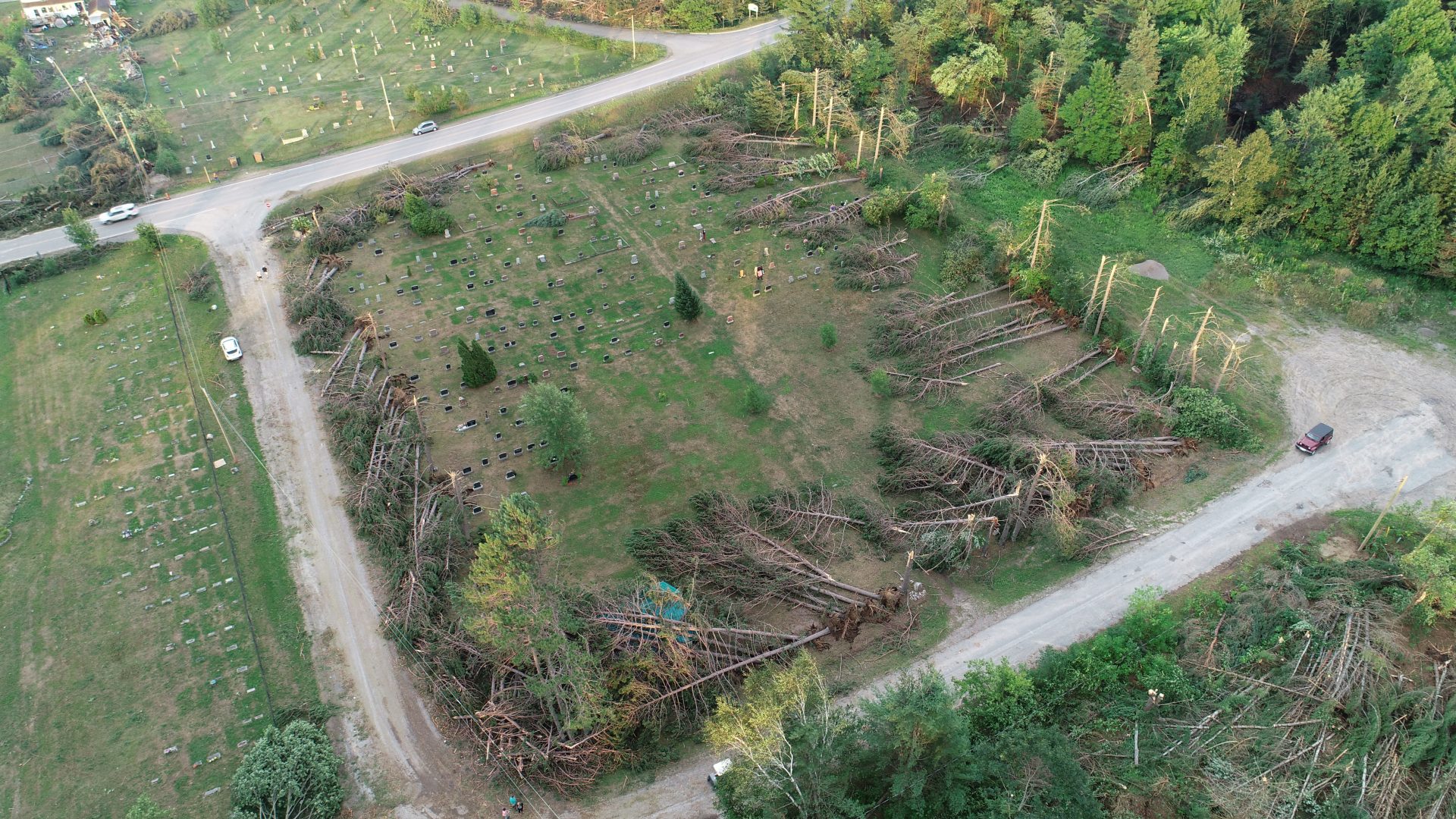
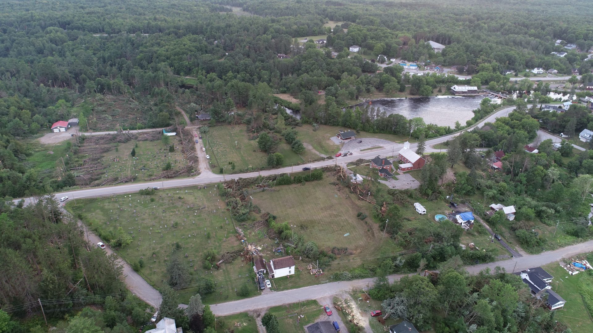
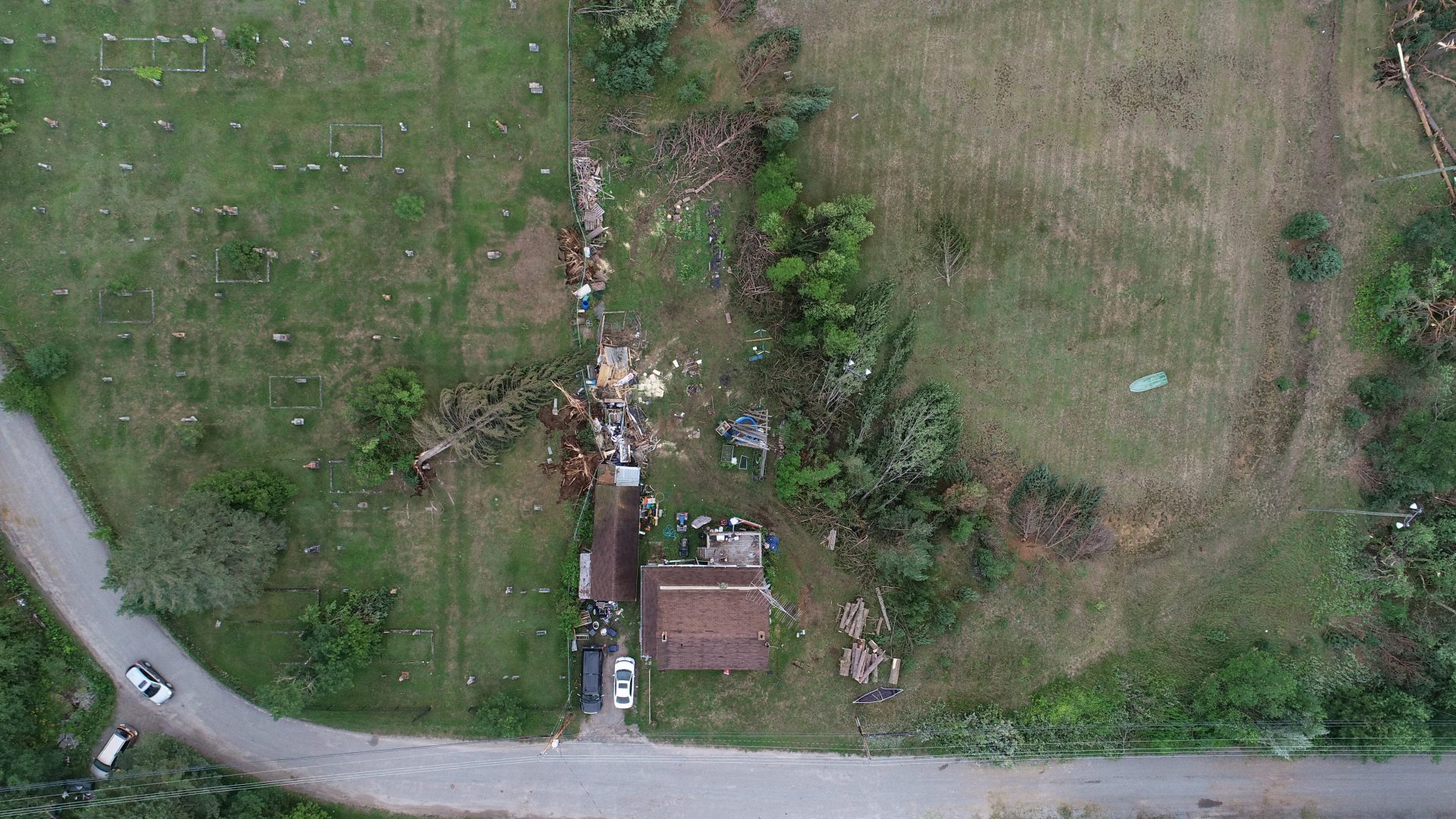
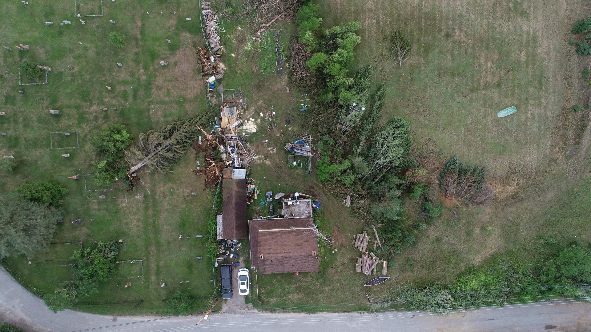
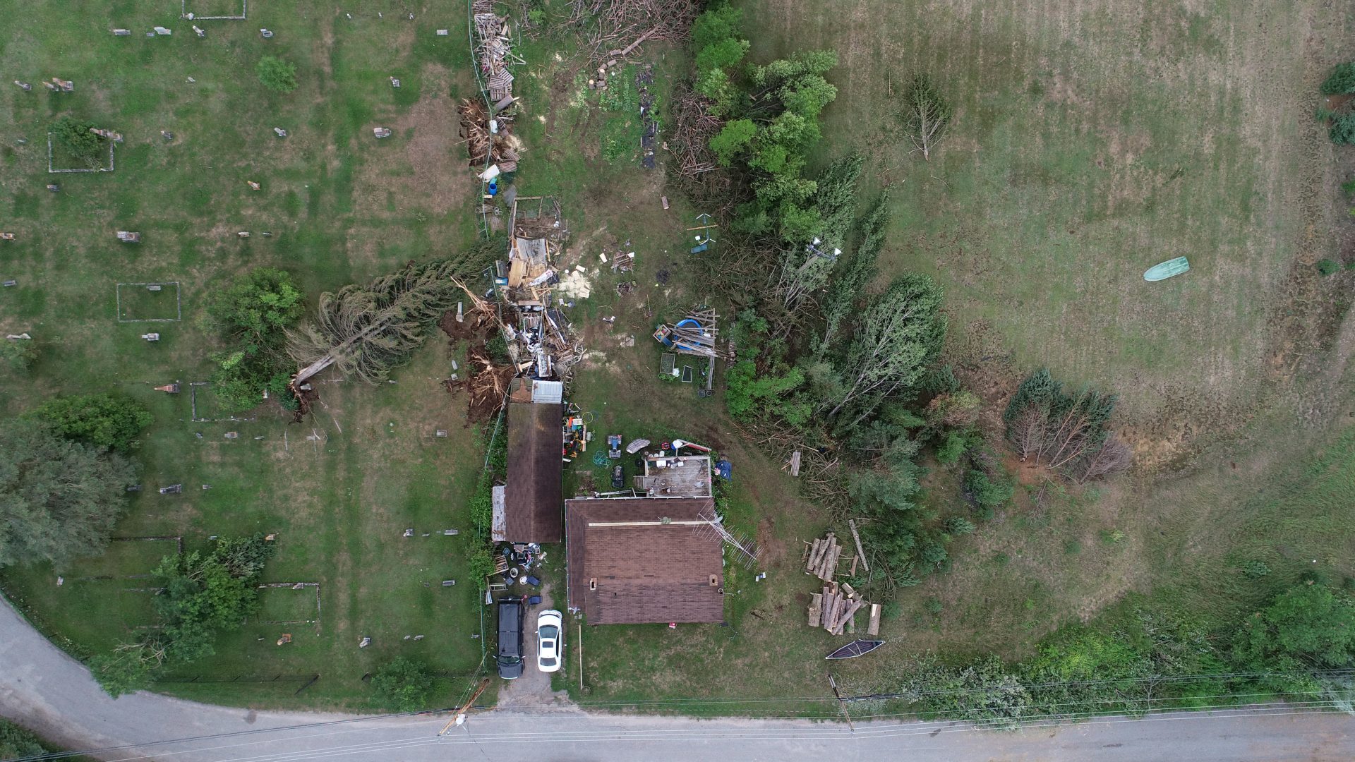
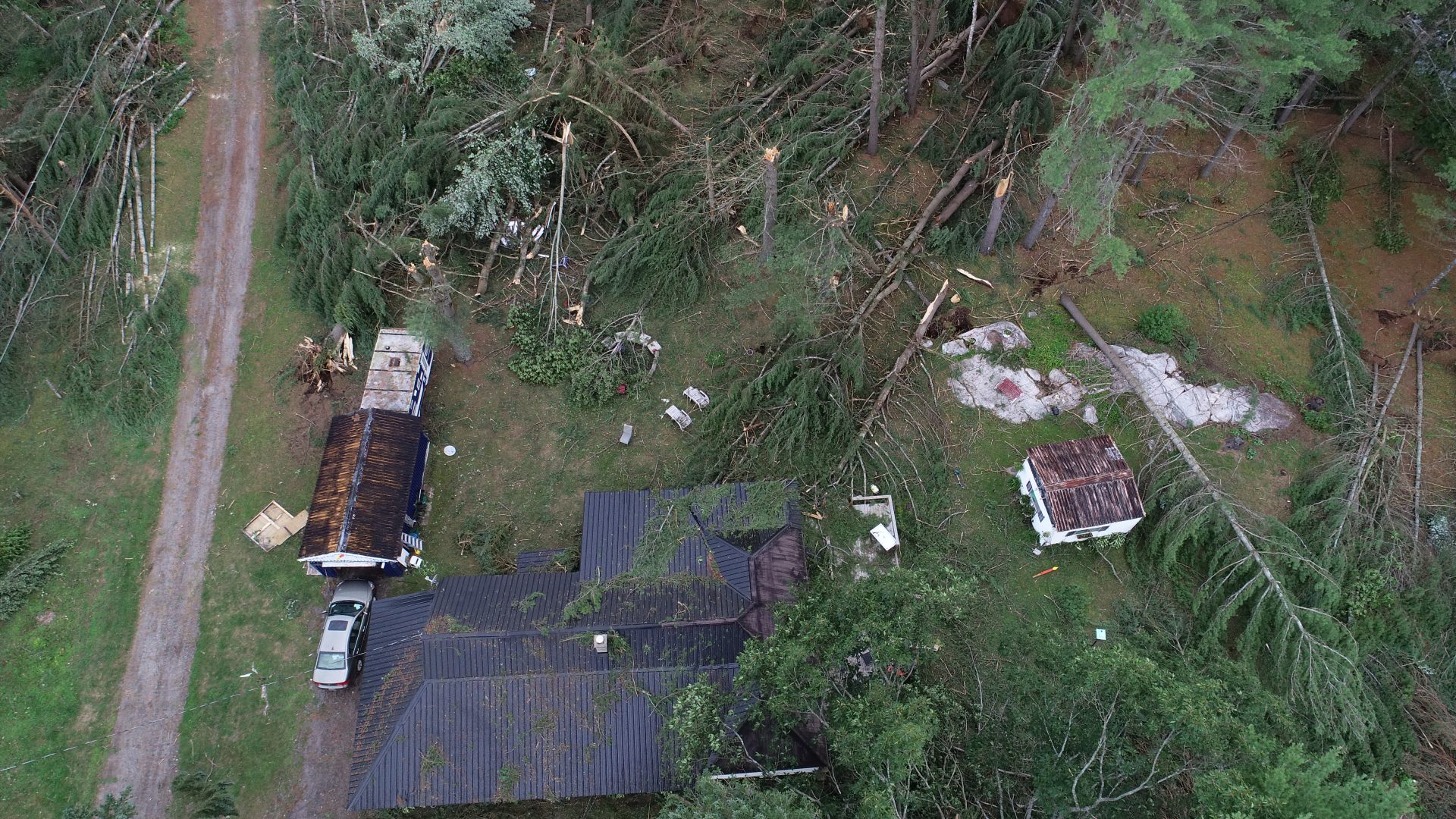
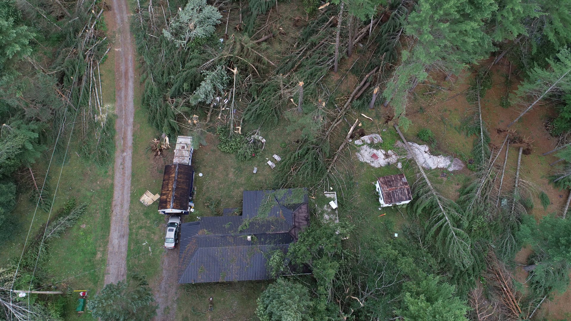
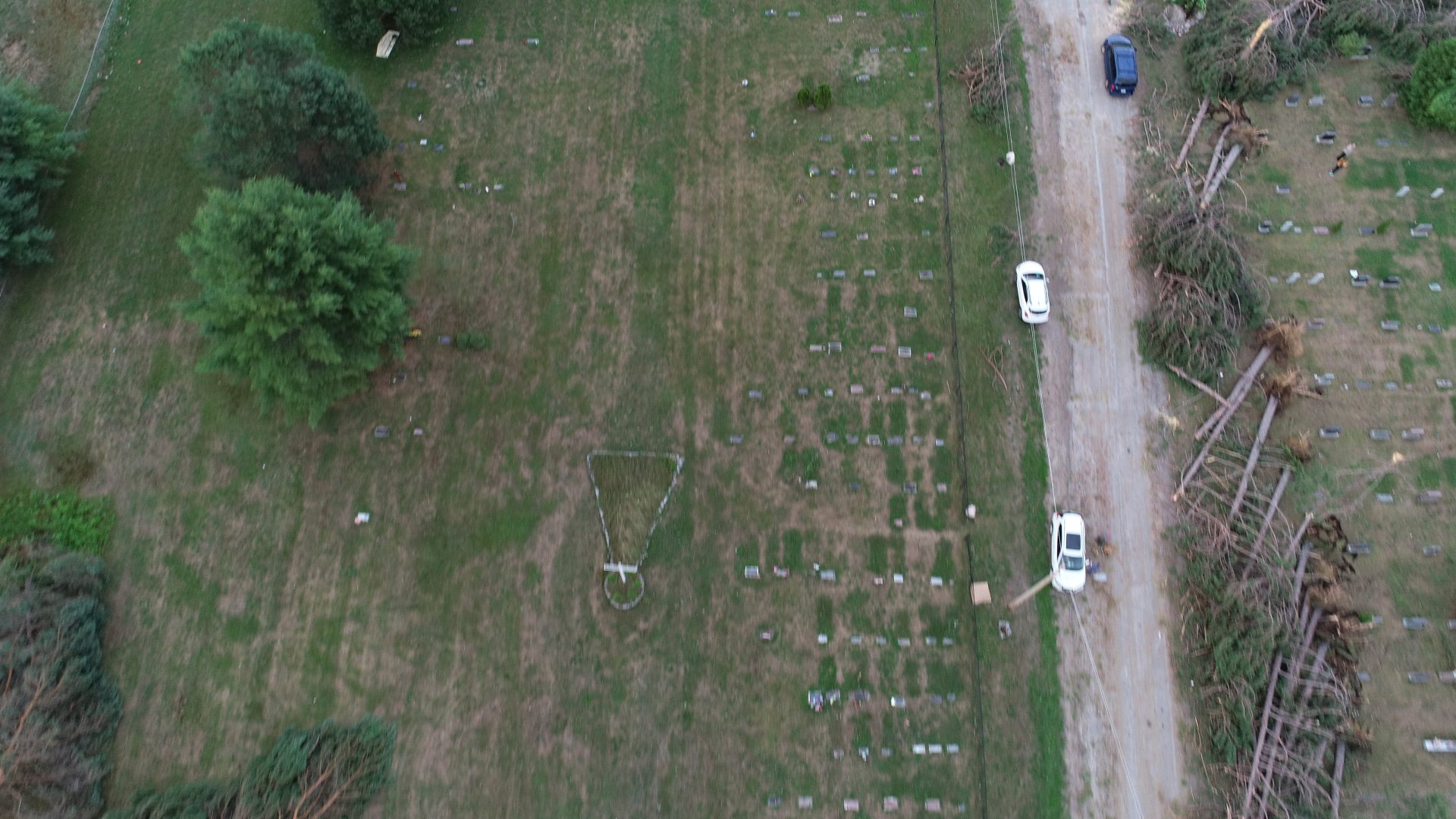
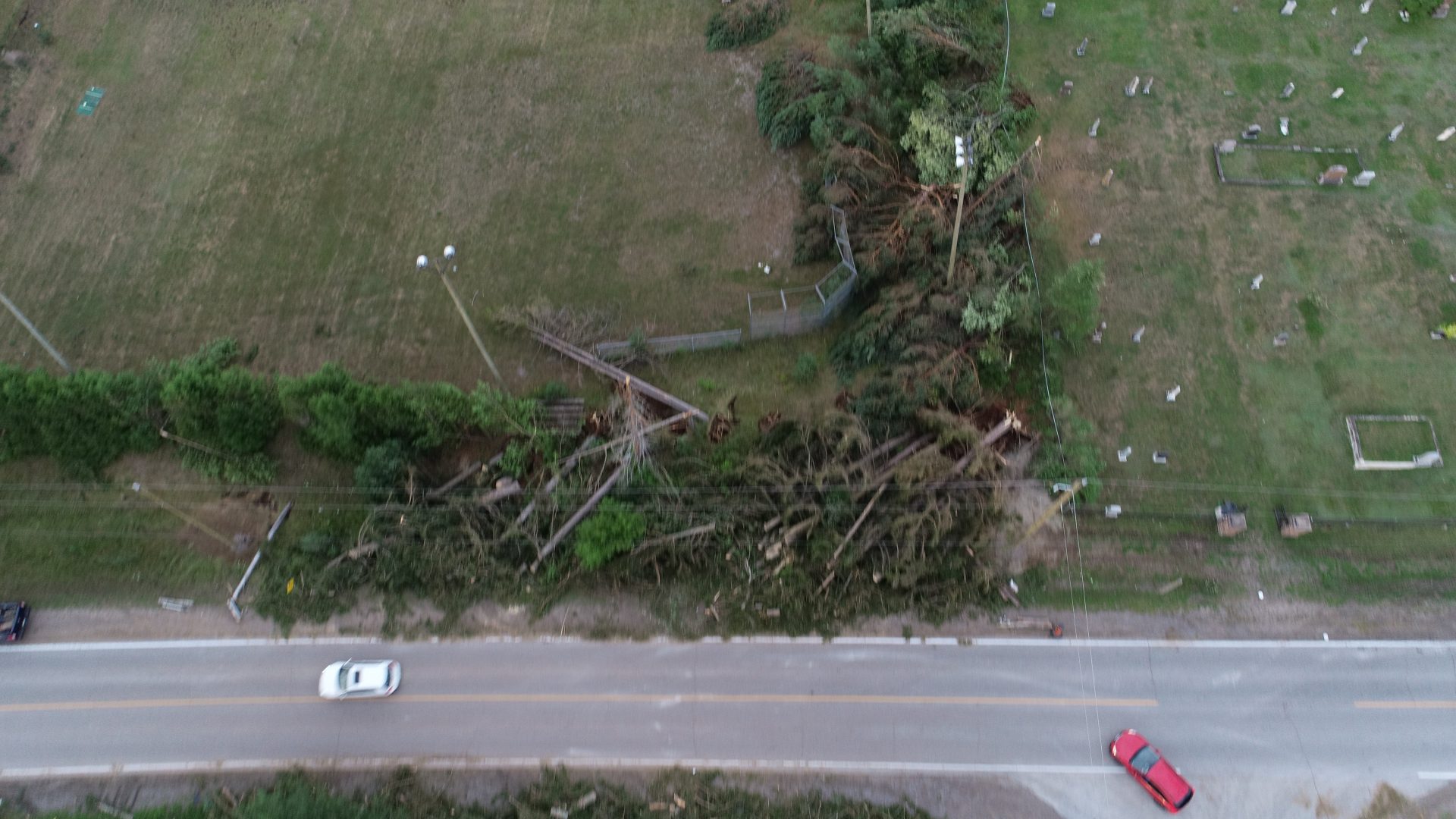
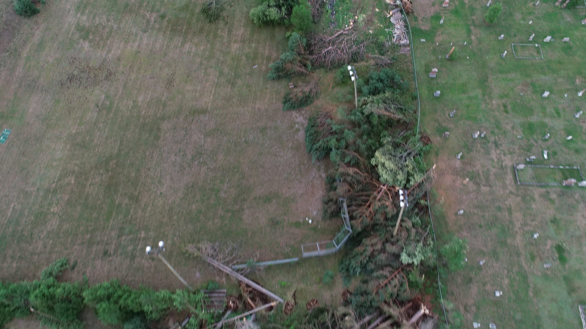
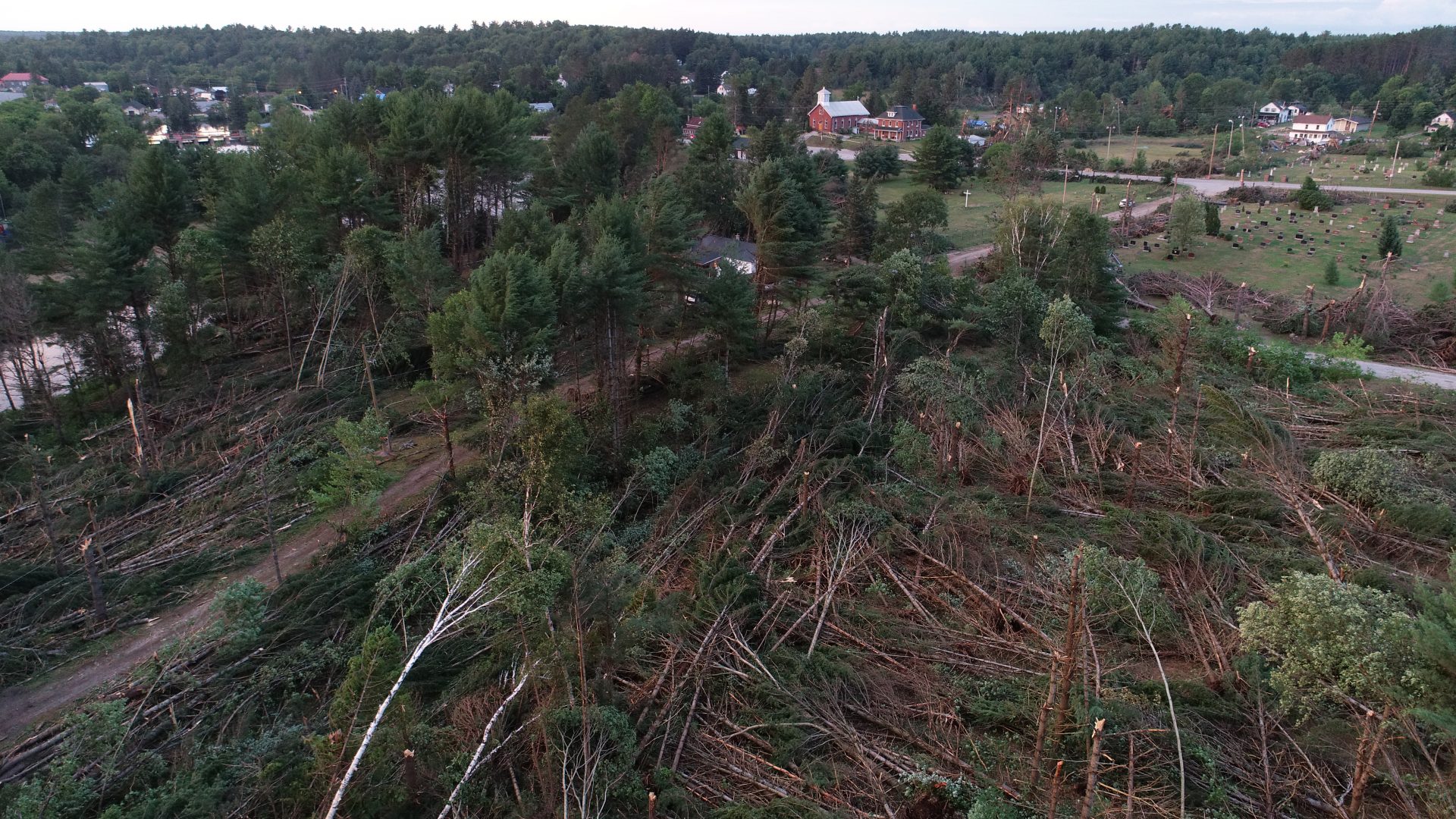
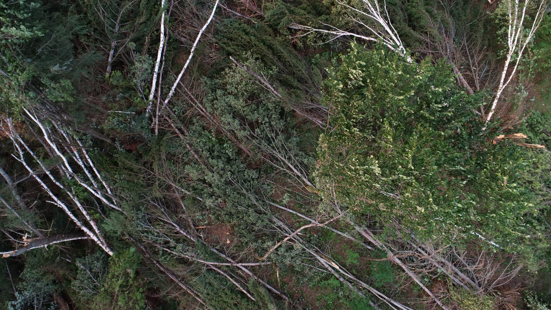
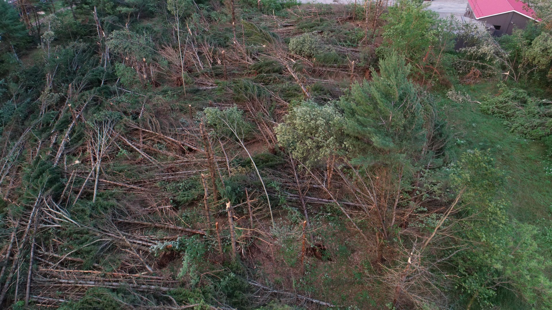
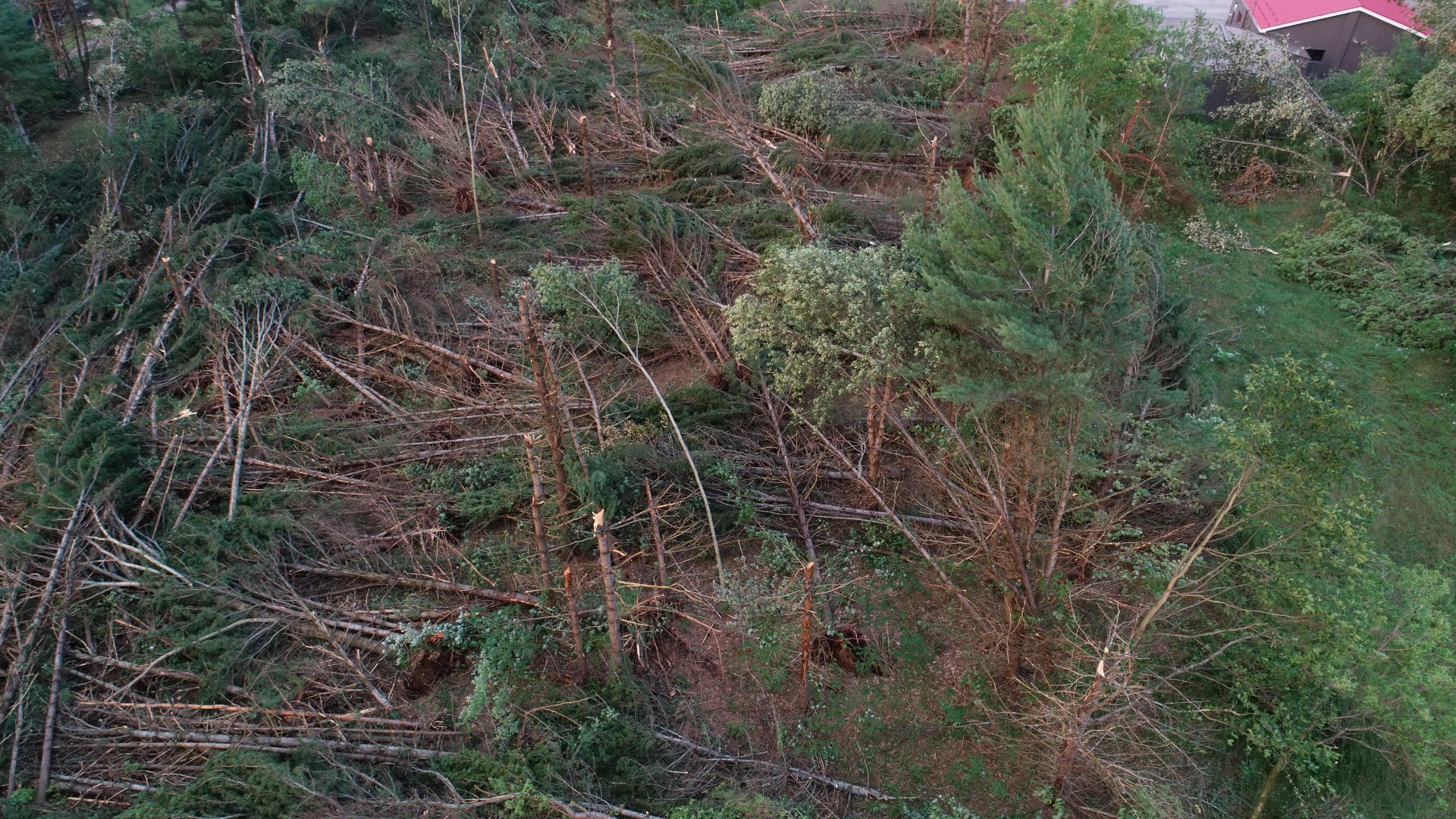
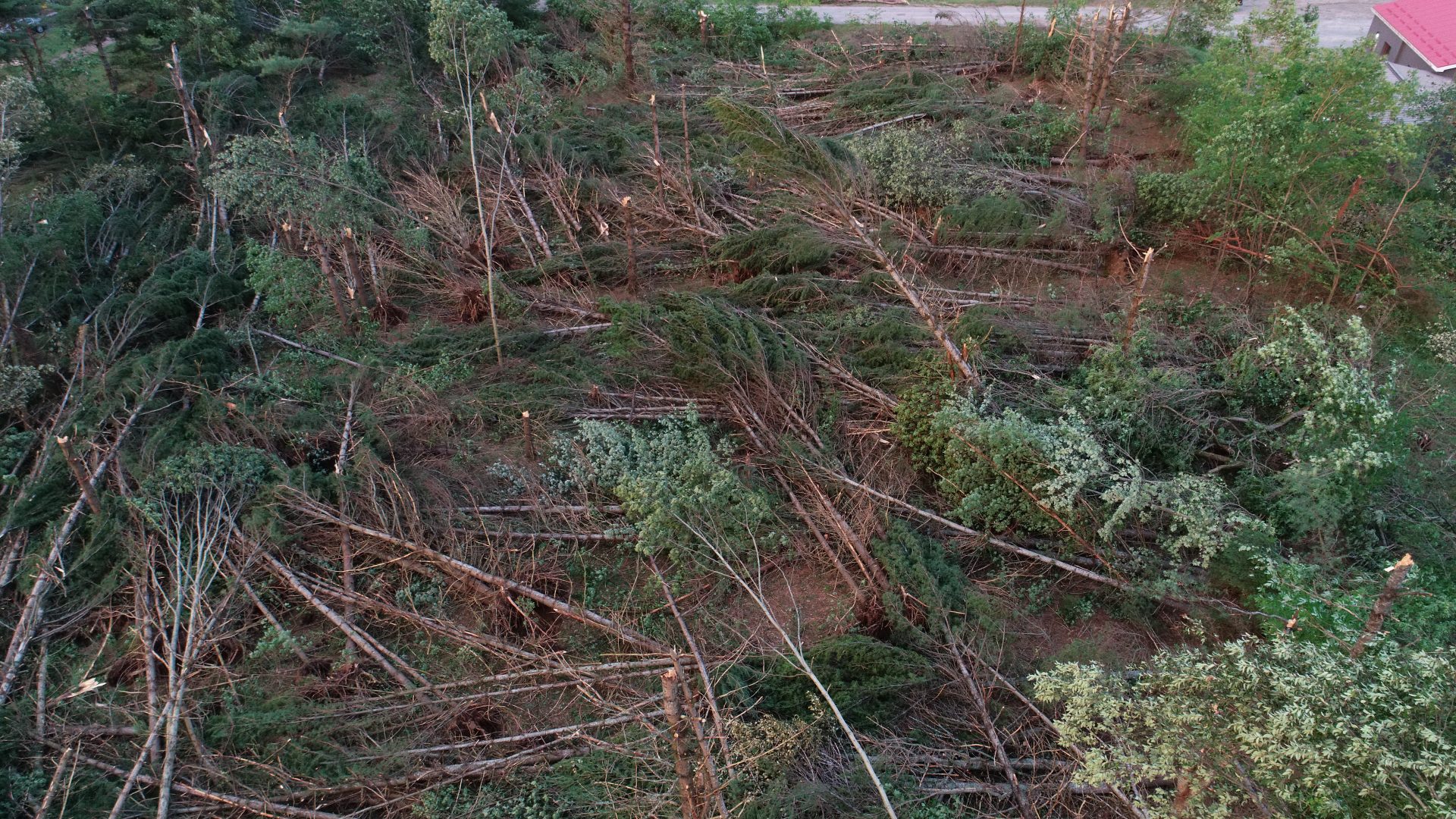
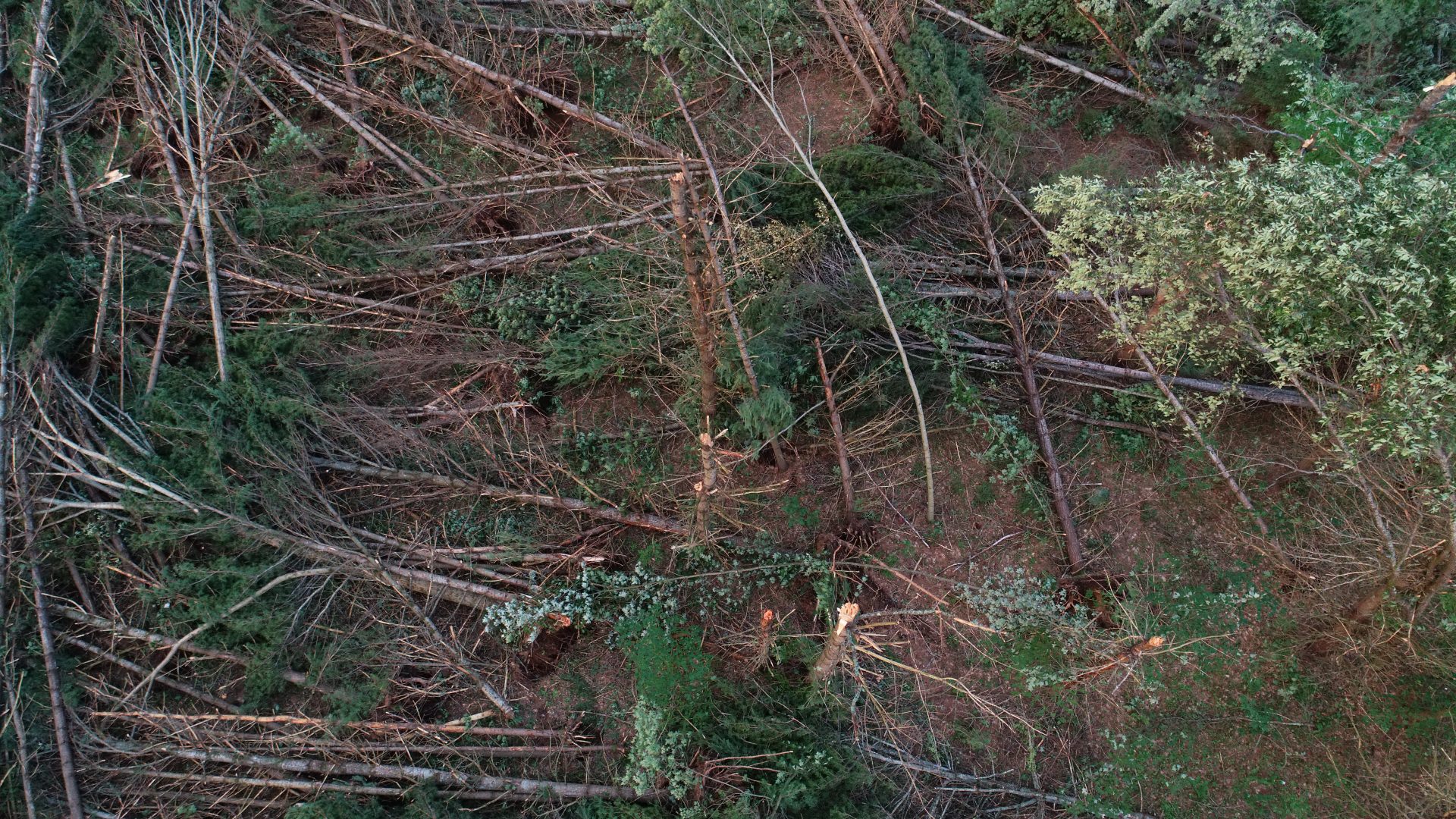
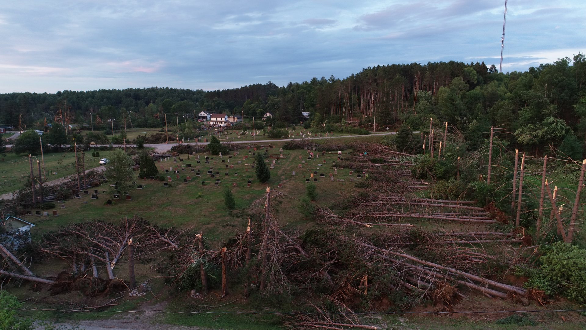
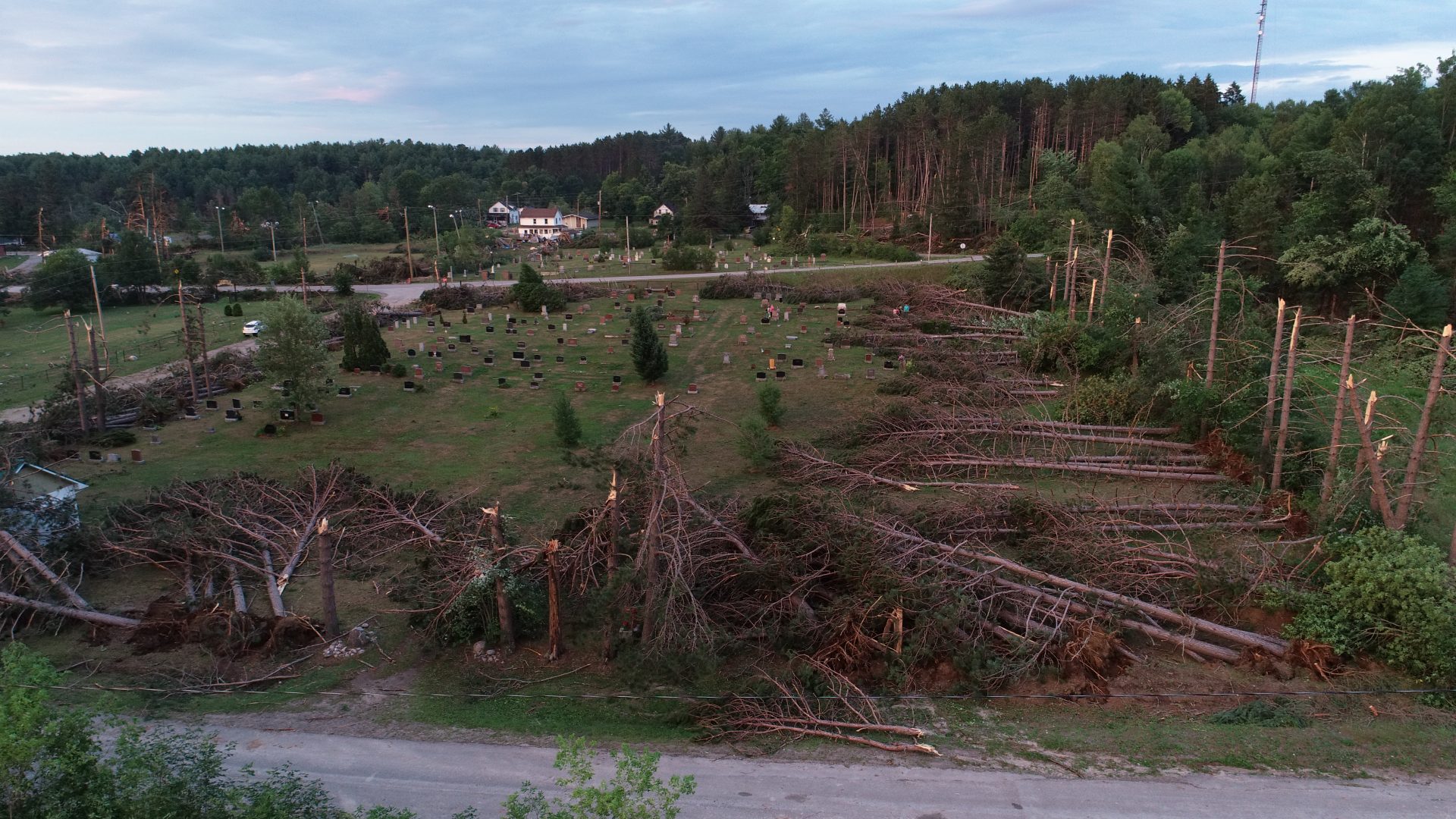
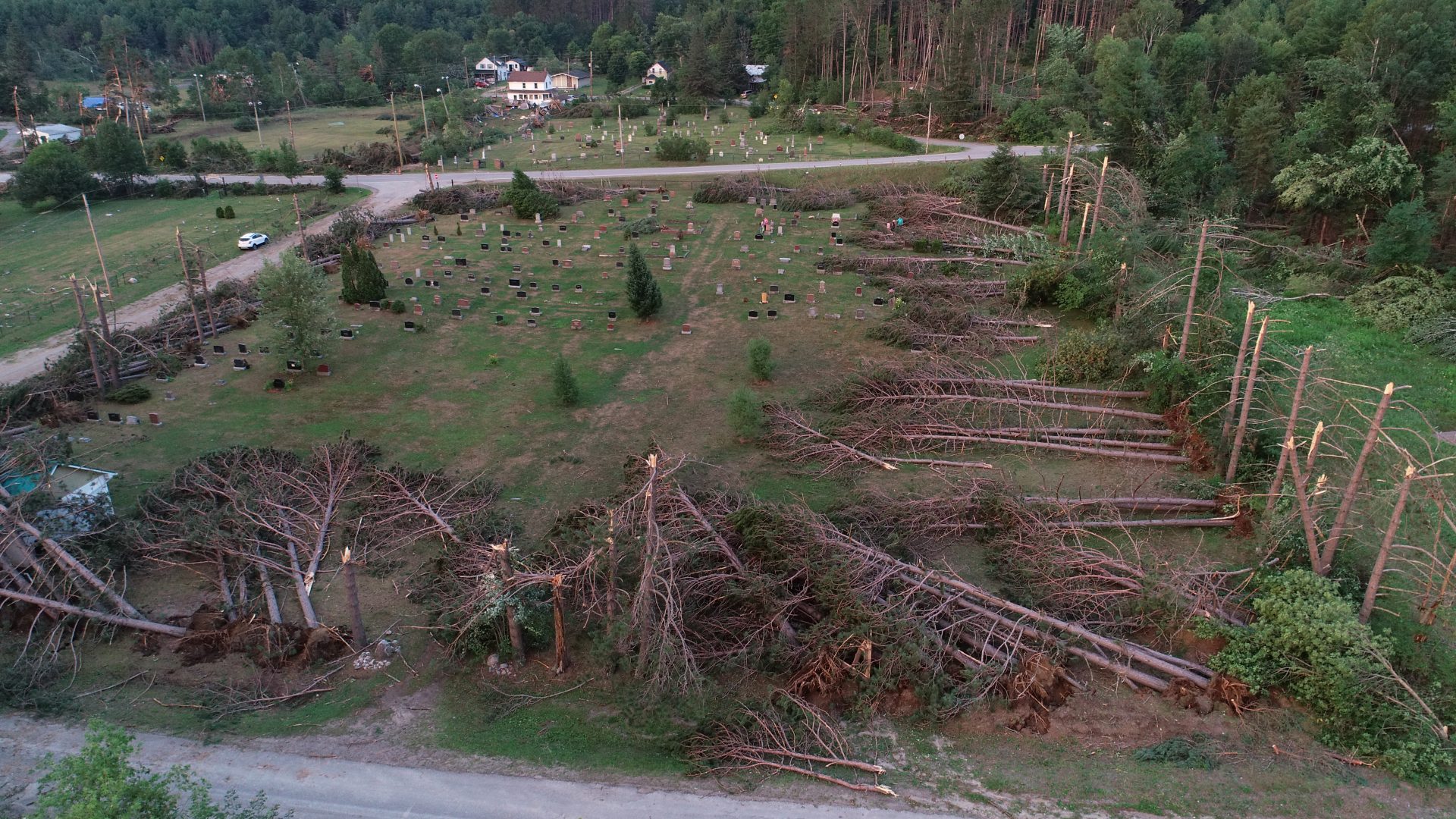
Between the river and Water Street the tornado decimated a large tract of forest on the north side of Majestic Drive, snapping and uprooting hundreds of trees in its path. It sliced through St Patrick’s cemetery, shearing every one of the mature pines that lined its perimeter. Trees on the south edge of the graveyard were blown to the north, while those on the north edge were blown to the west. At Highway 121, the tornado tore the cross off of St Patrick’s church as it took a jog to the northeast and churned into a residential section of town.
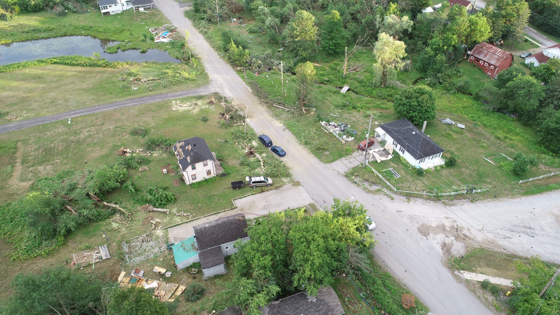
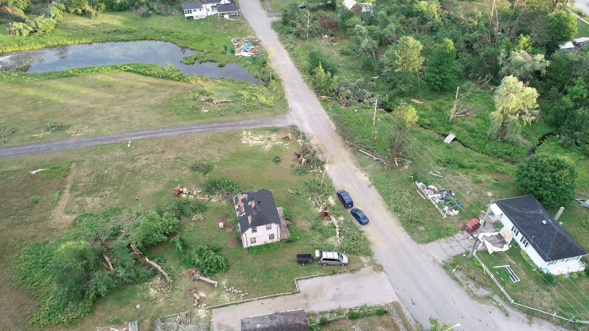
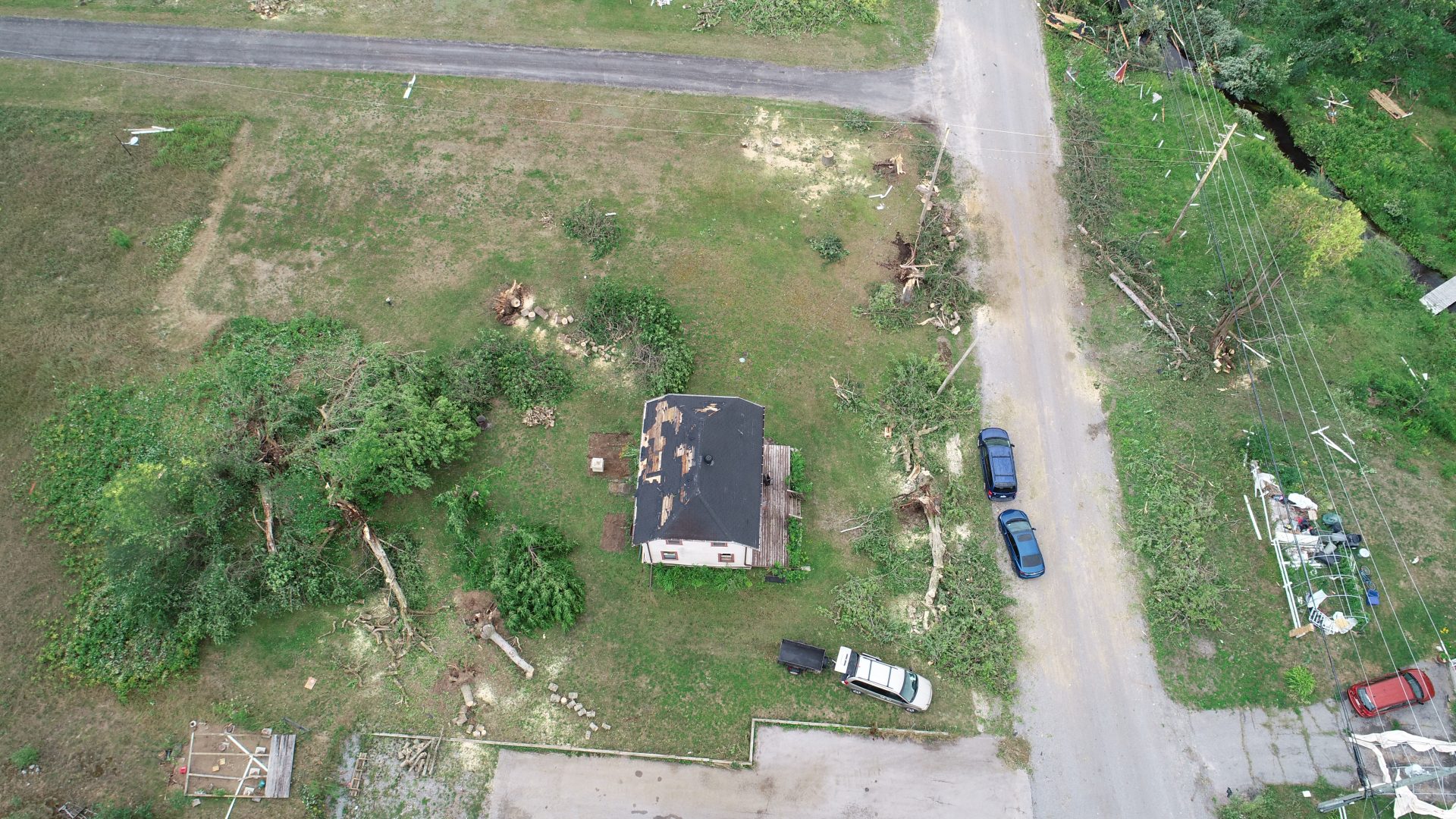
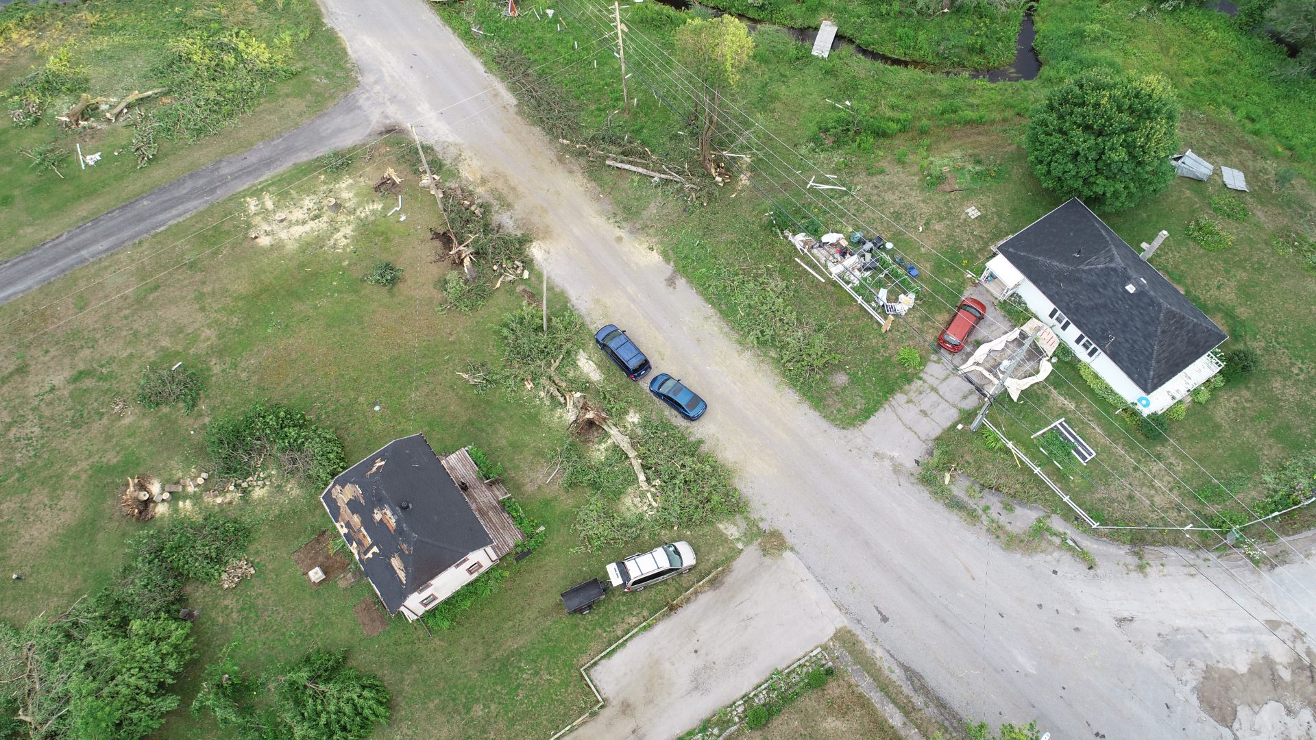
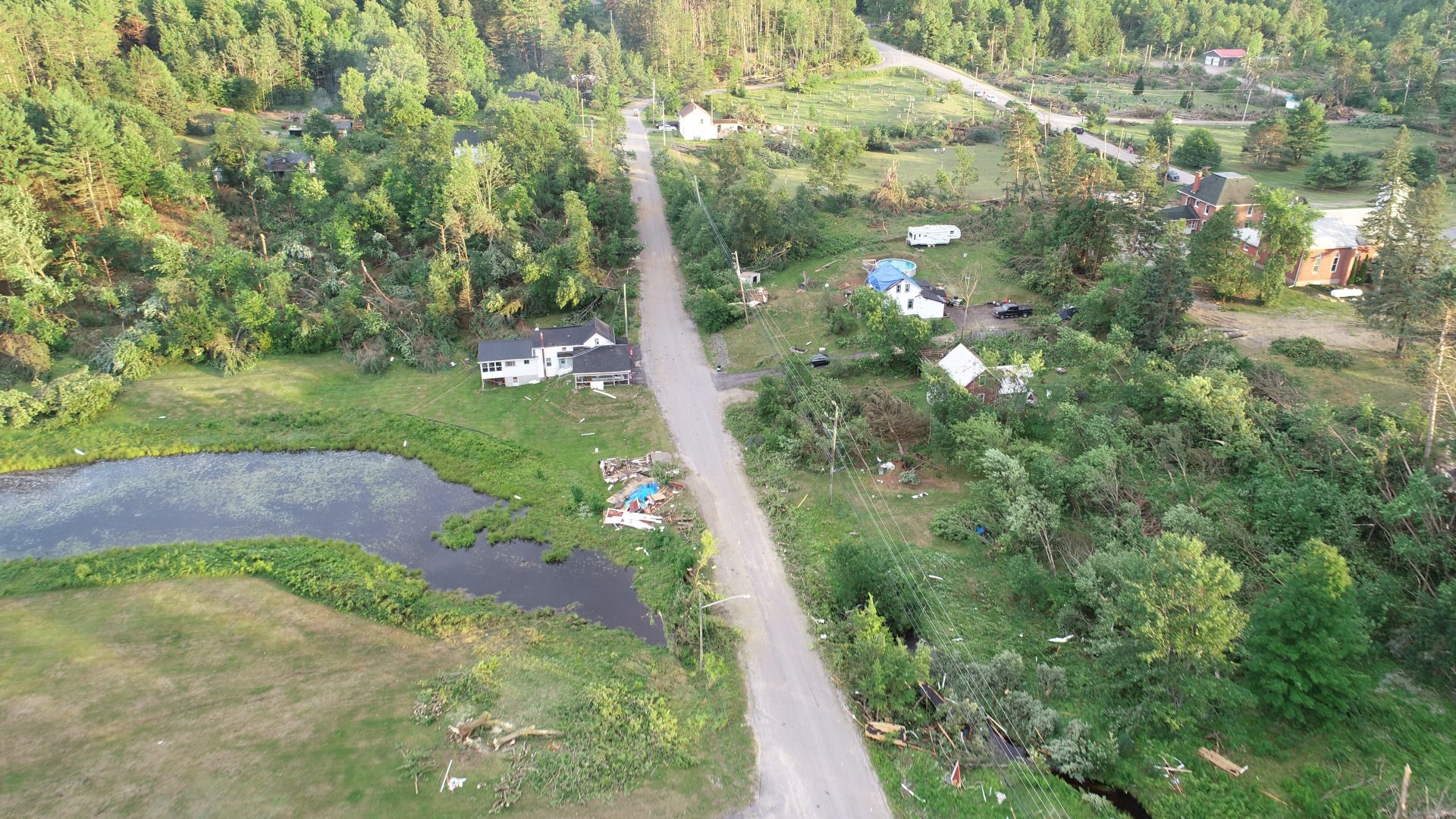
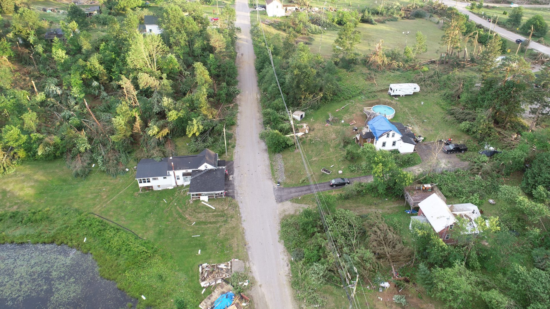
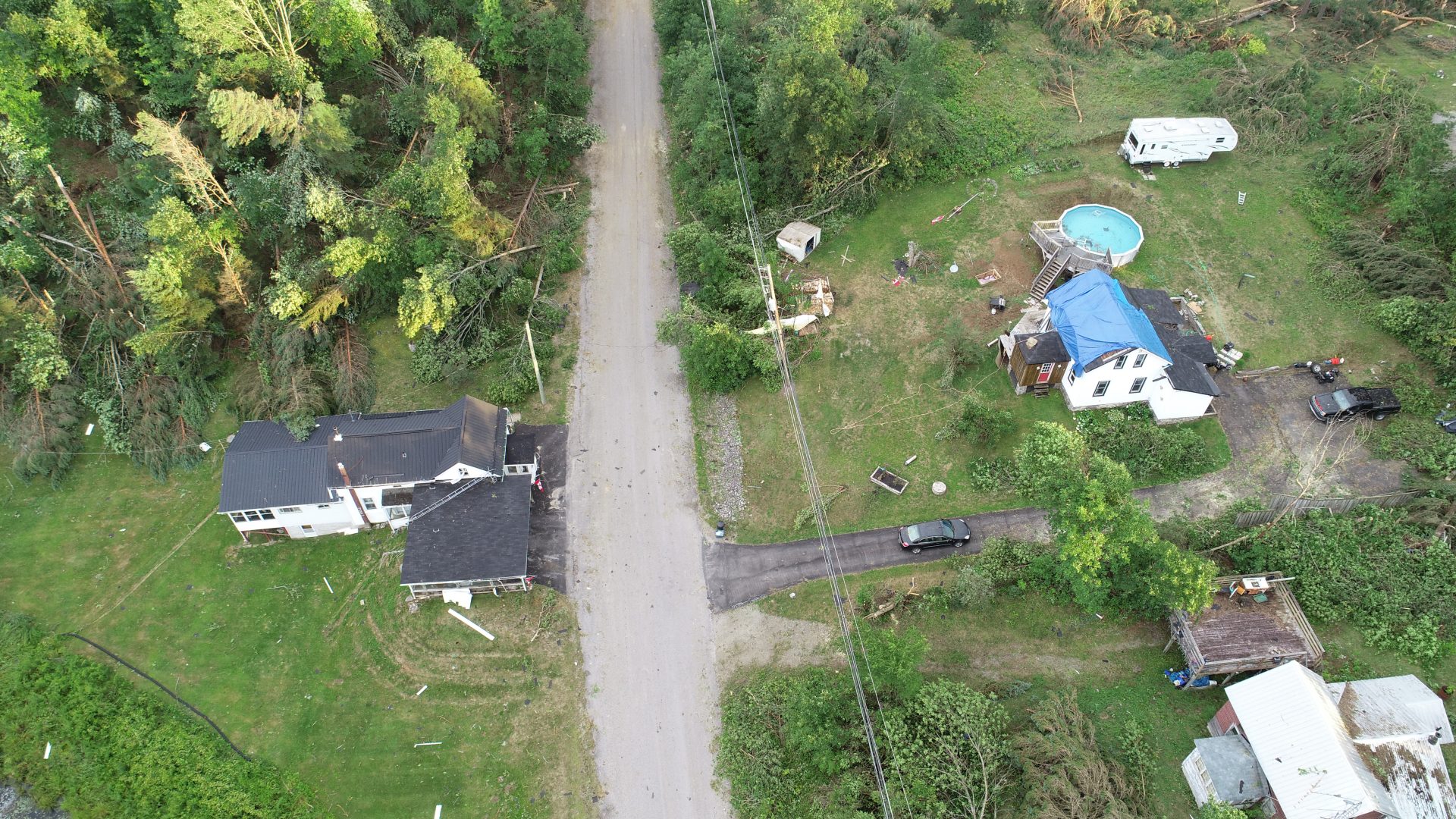
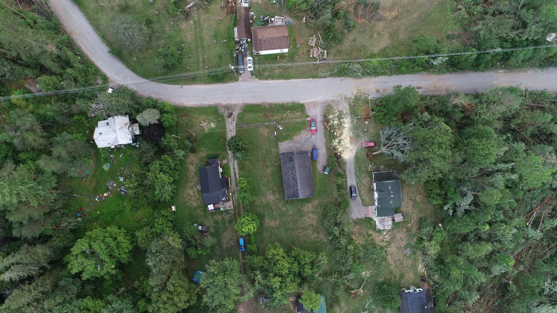
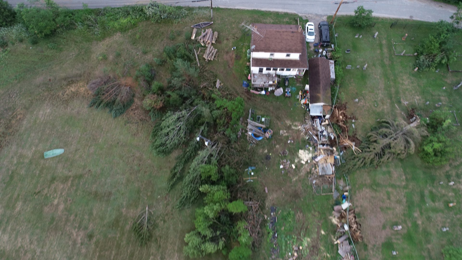
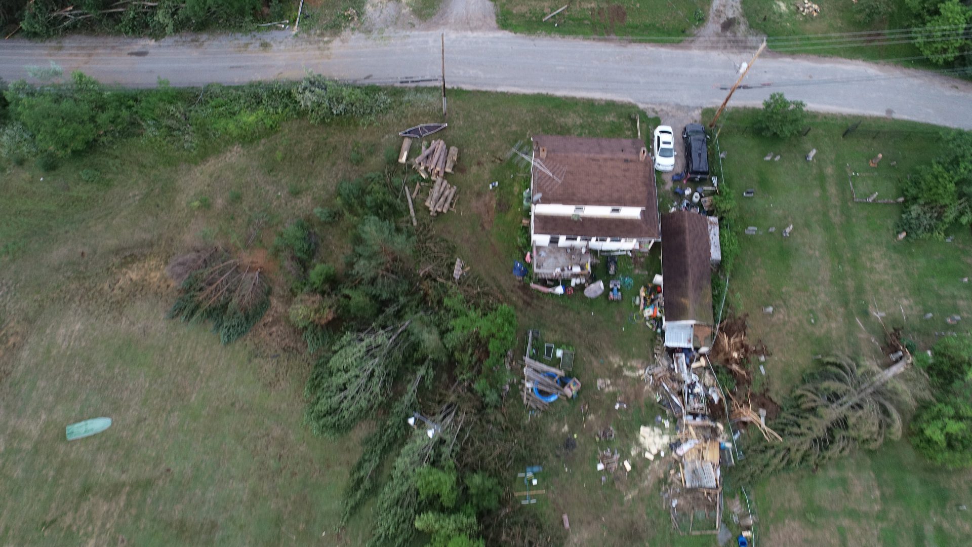
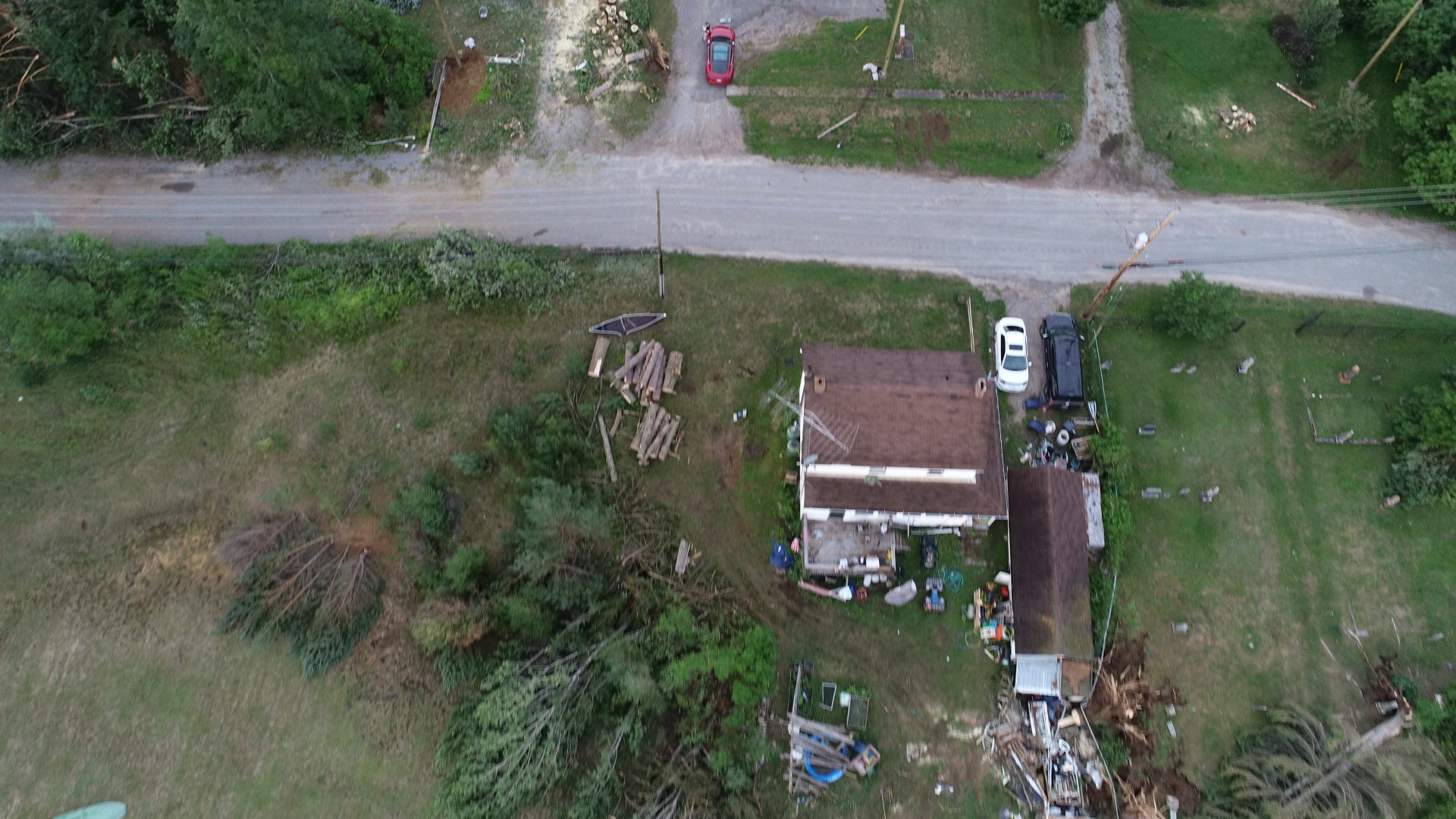
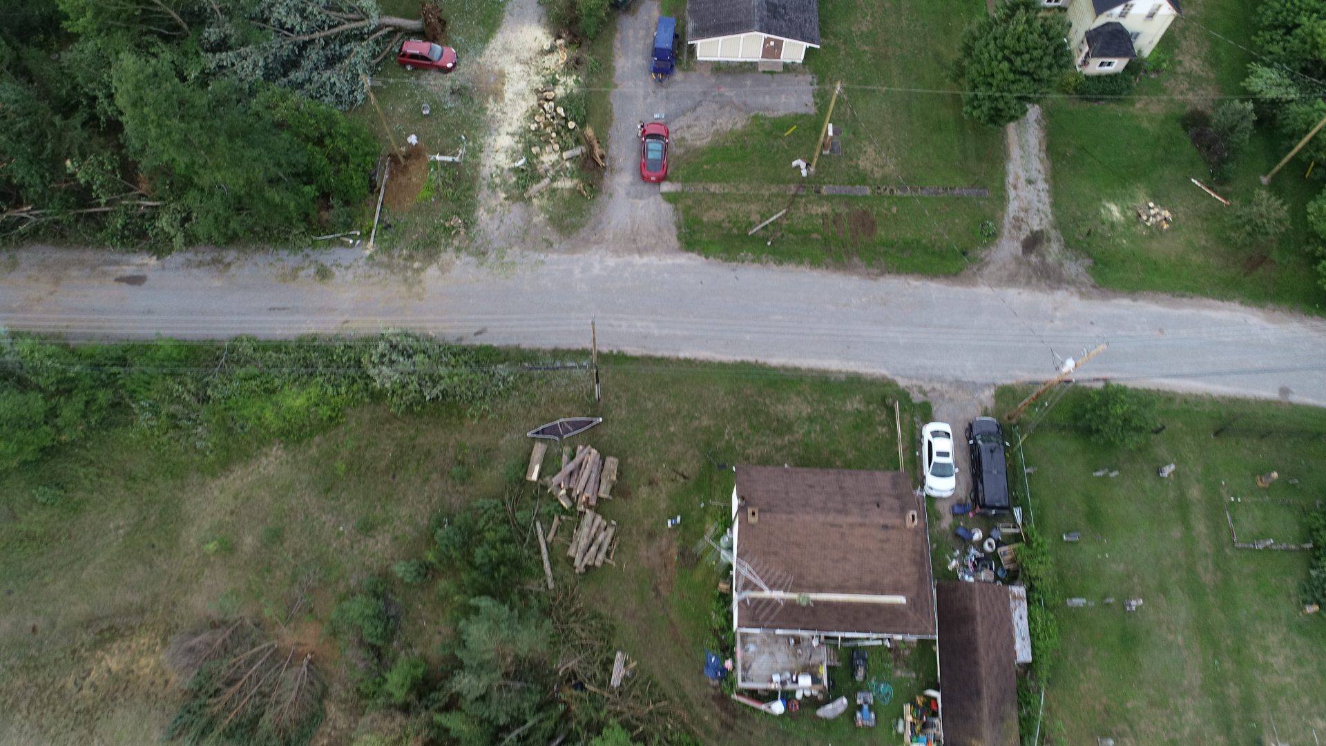
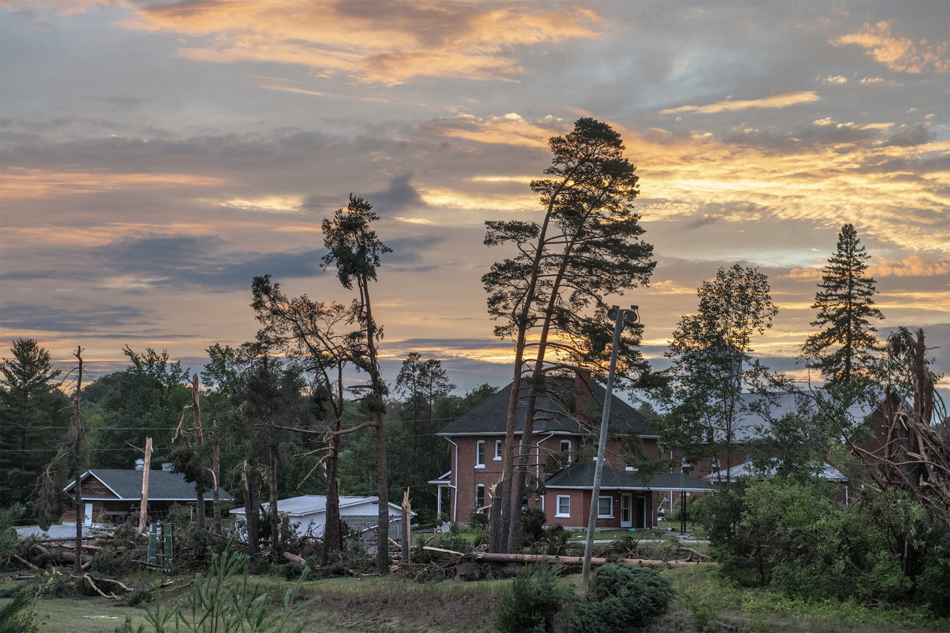
Twelve homes suffered varying degrees of damage; they were smashed by falling trees, impaled by debris, had roofing and siding torn off and windows blown out. One house on Bobcaygeon Road had doors and window frames ripped away, and two had curtains sucked out of exploded windows. Several outbuildings and garages were blown apart as well, with debris scattered through the neighbourhood. Two-by-fours and timber debris was blown into a pond on the east side of road, and siding was wrapped around trees and telephone wires to the west.
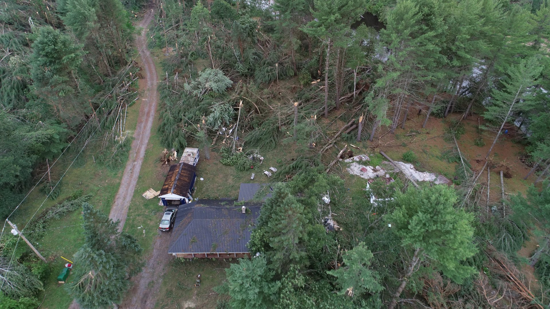
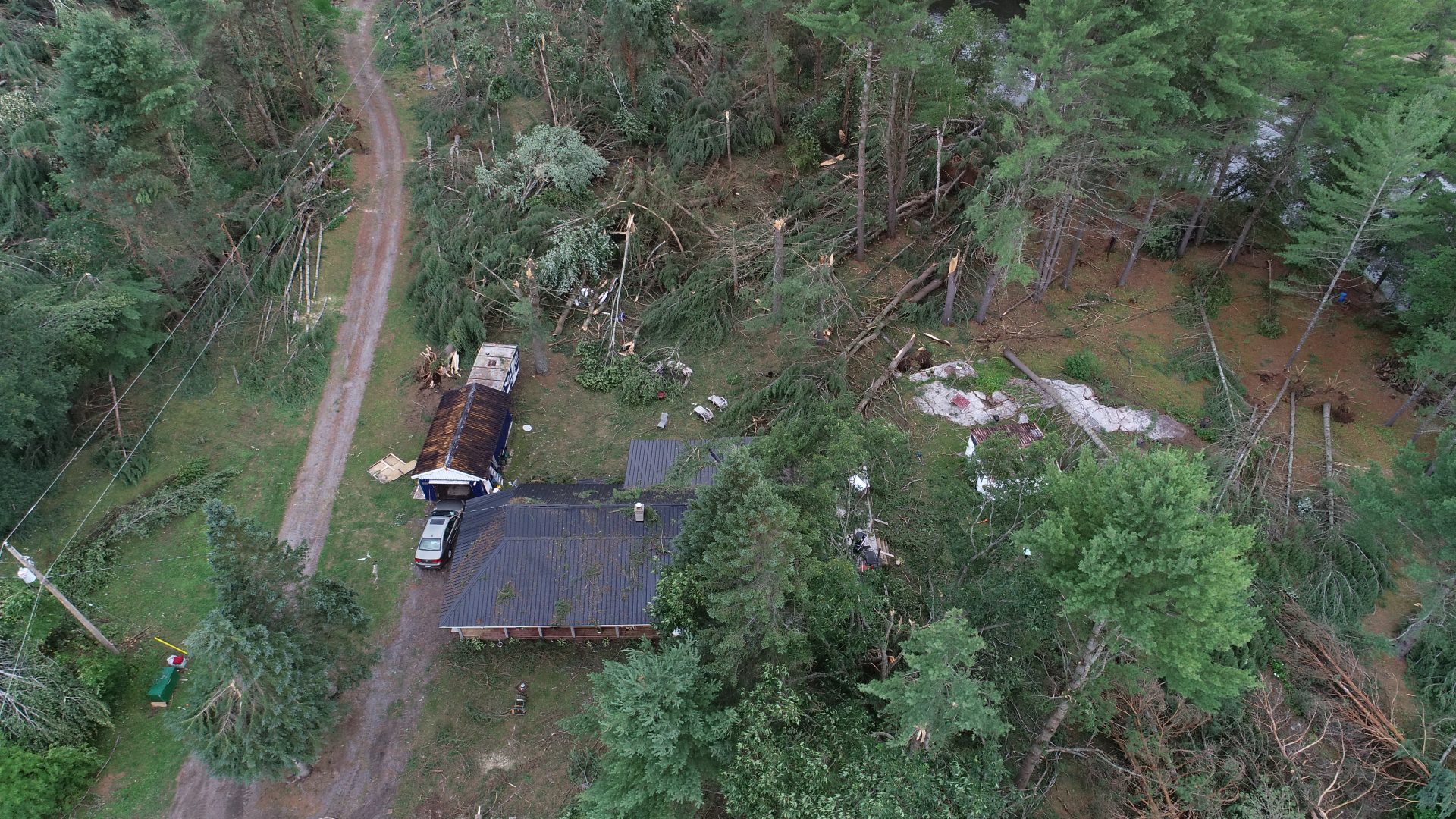
Exiting the residential area, the tornado weakened and turned more to the east. It passed through a dense area of forest and caused sporadic damage to trees before it dissipated on the north side of Kinmount Lake.