

This tornado touched down over the Detroit River not long after its parent supercell developed explosively as it crossed the Michigan-Ontario border. It then tore a swath directly through the south side of LaSalle, ripping a path to the northeast. It came ashore at the Island View Marina near Victory Street and Front Road, flinging boats through the air and snapping trees along the shoreline. From there it moved into blocks of houses, striking Runsteidler Drive, Jolly Avenue and Victory Street. As it passed through the neighbourhood, windows were shattered, siding and roofing was torn from homes, and trees were uprooted, snapped and shorn off at their tops. At one home, the twisted remains of a trampoline were left sitting atop the roof. Moving on from Victory Street, the tornado passed through open fields and dissipated before reaching the Essex Golf and Country Club and Gilbert Park. Its path was 2 km long and between 250m and 300m wide.
As it developed over the river the tornado was caught on film and reported by storm chaser/spotter Mark Robison. He then tracked it as it moved through the community and out into open farmland. As it went it was also caught in photos and on video by stunned residents, a tapered cone that was fully condensed to the ground. It was classic in appearance, a photogenic Wizard of Oz twister that was a sight much more familiar to the plains of Tornado Alley than to Southern Ontario. Indeed, it is possible that the highly visible nature of the tornado contributed to the fact that there were no injuries despite the lack of warning.
According to Sills, Hong, Jaffe, Stevenson and Kopp (2018), The LaSalle tornado travelled for 4.6 km and had a maximum width of 300 metres.
The storm continued in a northeastern direction and spawned another tornado, an EF2 in Windsor, which caused $10M dollars in property damage.
The Forecast
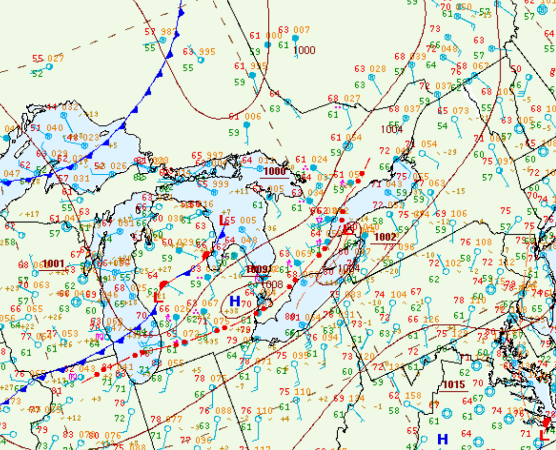
Figure 1 depicts the surface observations at 8:00 pm EDT, which shows a strong cold front moving across the U.S. Midwest, a prefrontal trough in northern Ontario and an ongoing thunderstorm (marked as a red ‘R’) over Detroit. This thunderstorm was responsible for two strong tornadoes in the late evening hours of August 24th.
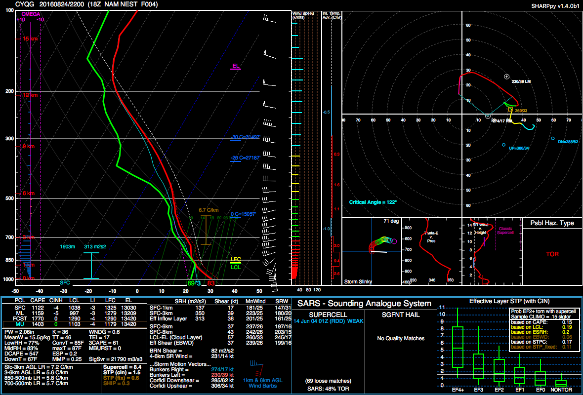
Figure 2 shows a forecast sounding at 6:00 pm, prior to the tornadoes. Figure 2 depicts a classic inverted-V sounding, a large and elongated hodograph, good shear, modest instability and around 5.8 C/km lapse rates. While this is not the most impressive sounding, it certainly depicts an environment conductive for tornadoes.
Sources
Sills, D., Hong, E., Jaffe, A., Stevenson, S. A. & Kopp, G. A. (2018). THE ‘CROSS-BORDER’ TORNADO OUTBREAK OF 24 AUGUST 2016 – ANALYSIS OF THE TWO TORNADOES IN ONTARIO. Proceedings of 29th Conference on Severe Local Storms, Stowe, VT.
NWS Weather Prediction Center Surface Analysis Archive. (2017). Surface analysis 00Z Thu Aug 25 2016. Retrieved from: https://www.wpc.ncep.noaa.gov/archives/web_pages/sfc/sfc_archive.php