

No damage was caused as this EF0 tornado tracked between Listowel and the Conestoga Lake Conservation Area. It was observed and caught on camera by Dave Patrick and a few other CANWARN spotters, as it touched down in the early evening. It formed at the leading edge of a squall line, and had a smokey and loose circular appearance without a distinguishable funnel cloud. Although it was on the ground for 8 km, no appreciable damage was caused.
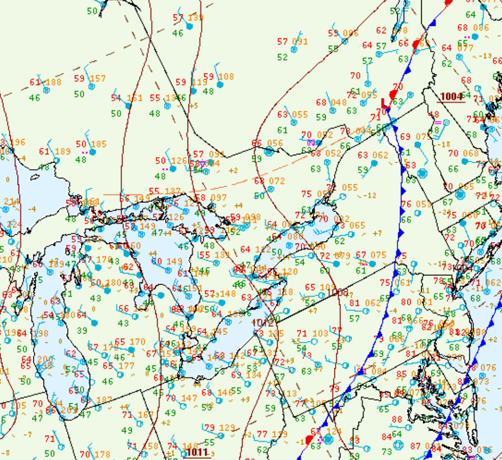
Figure 1 depicts the surface observations at 8:00 pm EDT, which shows a cold front moving across Lake Huron and southwestern Ontario. This front was the focus for intense thunderstorms in the evening hours of May 13th, which ultimately led to this tornado.
Sources
NWS Weather Prediction Center Surface Analysis Archive. (2017). Surface analysis 00Z Wed May 14 2014. Retrieved from: https://www.wpc.ncep.noaa.gov/archives/web_pages/sfc/sfc_archive.php