

The first tornado touched down at around 3:50 pm and was on the ground simultaneously with another twister near Malden Centre. It caused damage to crops and minor damage to the roof of a house, with small debris thrown up to 400 metres. Witness captured photographs of the dual tornadoes; this one a high funnel cloud with a swirl of debris at its base. The final tornado in the area was another F0.
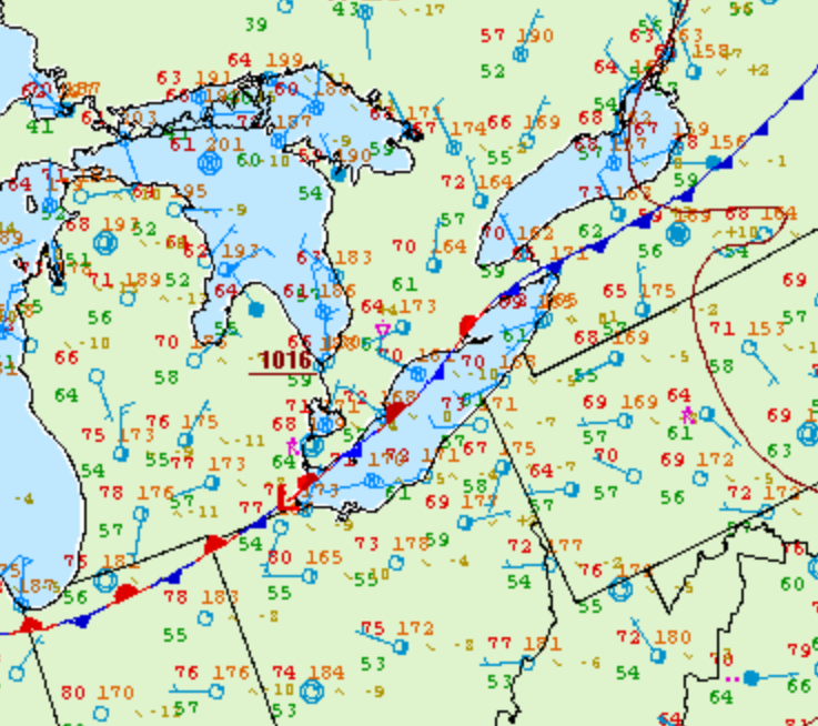
Figure 1 depicts the surface observations at 5:00 pm CDT, which shows a stationary front over Lake Erie. This front promoted convective development in extreme southwestern Ontario, which ultimately led to several tornadoes.
According to Environment and Climate Change Canada (2018), two F0 tornadoes touched down at 3:50 pm near Malden Centre, ON. The tornadoes travelled for 500 metres with a maximum width of 30 metres. The tornadoes caused no fatalities, injuries or property damage.
Sources
NWS Weather Prediction Center Surface Analysis Archive. (2017). Surface analysis 21Z Wed Sep 6 2006. Retrieved from: https://www.wpc.ncep.noaa.gov/archives/web_pages/sfc/sfc_archive.php
Environment and Climate Change Canada Data. (2018). Canadian National Tornado Database: Verified Events (1980-2009) – Public. Retrieved from: http://donnees.ec.gc.ca/data/weather/products/canadian-national-tornado-database-verified-events-1980-2009-public/