

Witnesses observed this cone tornado touch down briefly at 3:30 pm. It struck a lawn ornament centre, sending bird baths and garden gnomes flying through the air. In addition, trees were snapped and uprooted with one thrown over 150 metres.
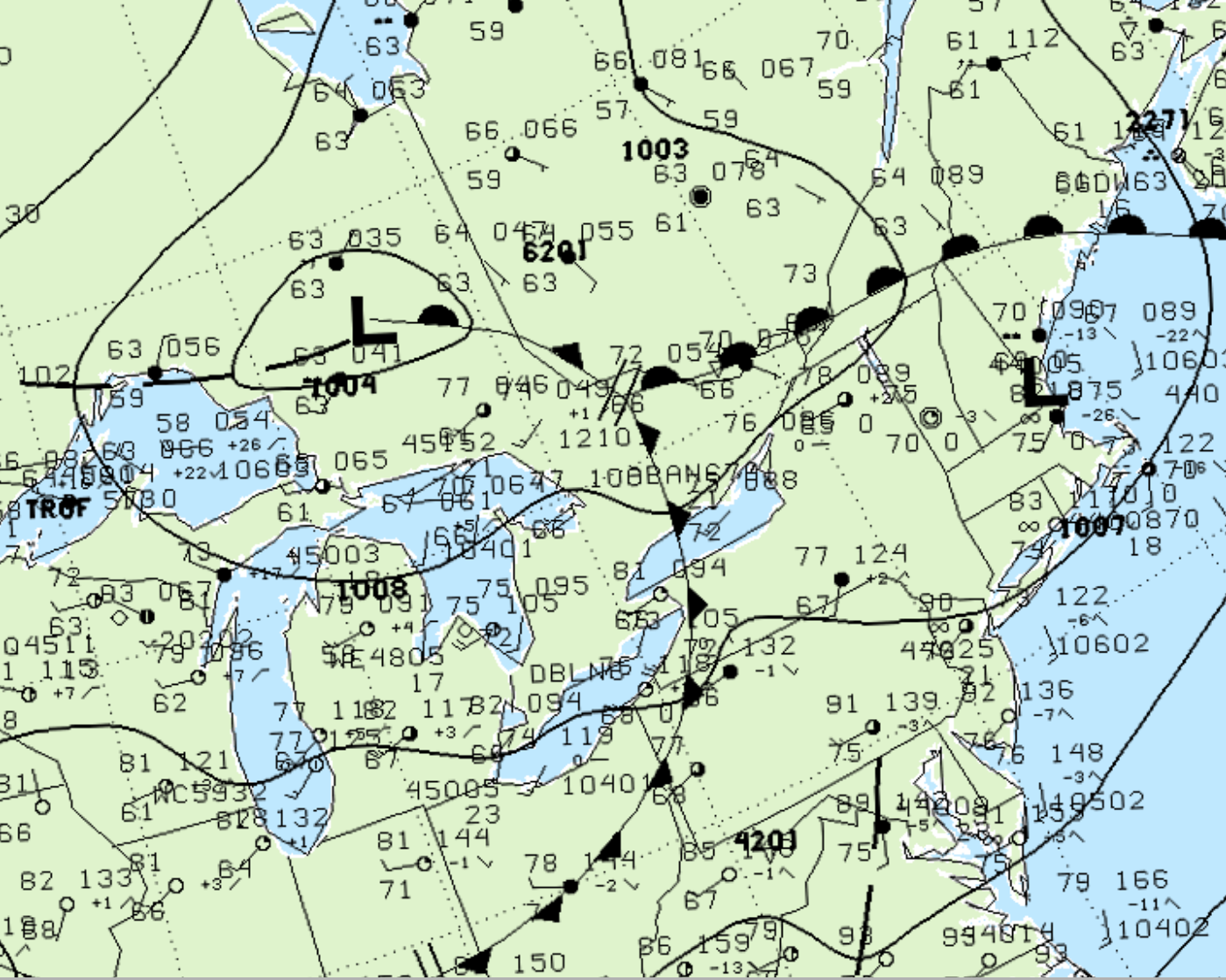
Figure 1 depicts the surface observations at 2:00 pm EDT, which shows a cold front slicing through eastern Ontario. This front became the focus of thunderstorms in the afternoon hours of August 7th, which ultimately led to this F0 tornado.
According to Environment and Climate Change Canada (2018), an F0 tornado touched down at 3:30 pm EDT near Manotick, ON. The tornado travelled for 500 metres and had a maximum width of 10 metres. The tornado caused no fatalities, injuries or property damage.
Sources
NWS Weather Prediction Center Surface Analysis Archive. (2017). Surface analysis 18Z Mon Aug 7 2000. Retrieved from: https://www.wpc.ncep.noaa.gov/archives/web_pages/sfc/sfc_archive.php
Environment and Climate Change Canada Data. (2018). Canadian National Tornado Database: Verified Events (1980-2009) – Public. Retrieved from: http://donnees.ec.gc.ca/data/weather/products/canadian-national-tornado-database-verified-events-1980-2009-public/