

The tornado carved an extensive path of damage through the forest, snapping, uprooting and shearing the tops off of trees. A sauna was destroyed and its debris scattered, and a 60 metre-long dock was picked up from the water and deposited up a hill and in the forest, hundreds of metres from the shore. Boats were also tossed and destroyed. The tornado hit at 6:00 pm and had a path that was 1.6 kilometres long and 200 metres wide.
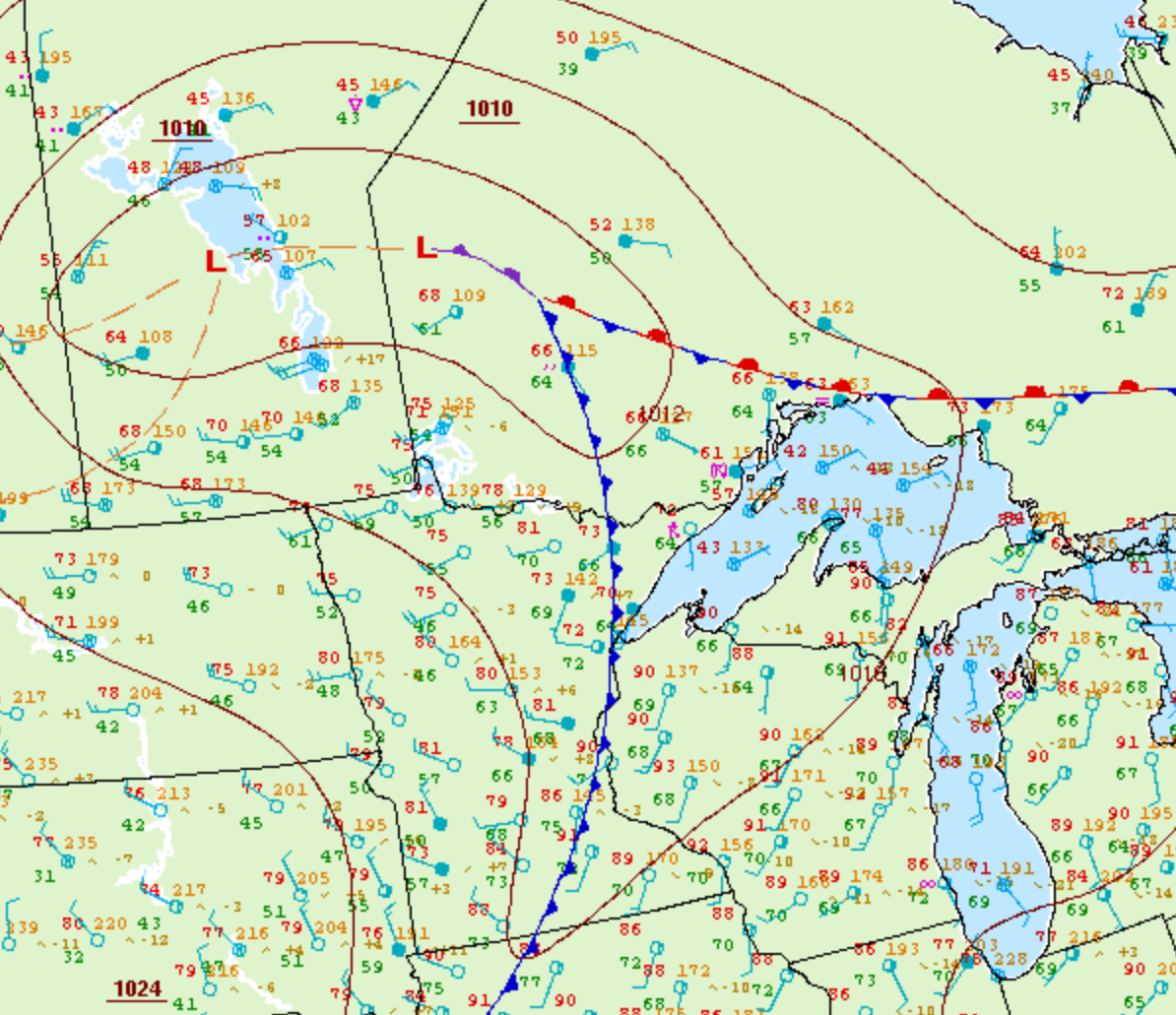
Figure 1 depicts the surface observations at 4:00 pm CDT, which shows a cold front west of Thunder Bay. This front became the focus for intense thunderstorms in the afternoon hours of June 26th, which ultimately led to this F1 tornado.
According to Environment and Climate Change Canada (2018), an F1 tornado touched down at 5:00 pm near Marks Lake, ON. The tornado travelled for 1.6 km with a maximum width was 200 metres. The tornado caused no fatalities or injuries, but caused an estimated $100 thousand dollars in property damage.
Sources
NWS Weather Prediction Center Surface Analysis Archive. (2017). Surface analysis 21Z Tue Jun 26 2007. Retrieved from: https://www.wpc.ncep.noaa.gov/archives/web_pages/sfc/sfc_archive.php
Environment and Climate Change Canada Data. (2018). Canadian National Tornado Database: Verified Events (1980-2009) – Public. Retrieved from: http://donnees.ec.gc.ca/data/weather/products/canadian-national-tornado-database-verified-events-1980-2009-public/