

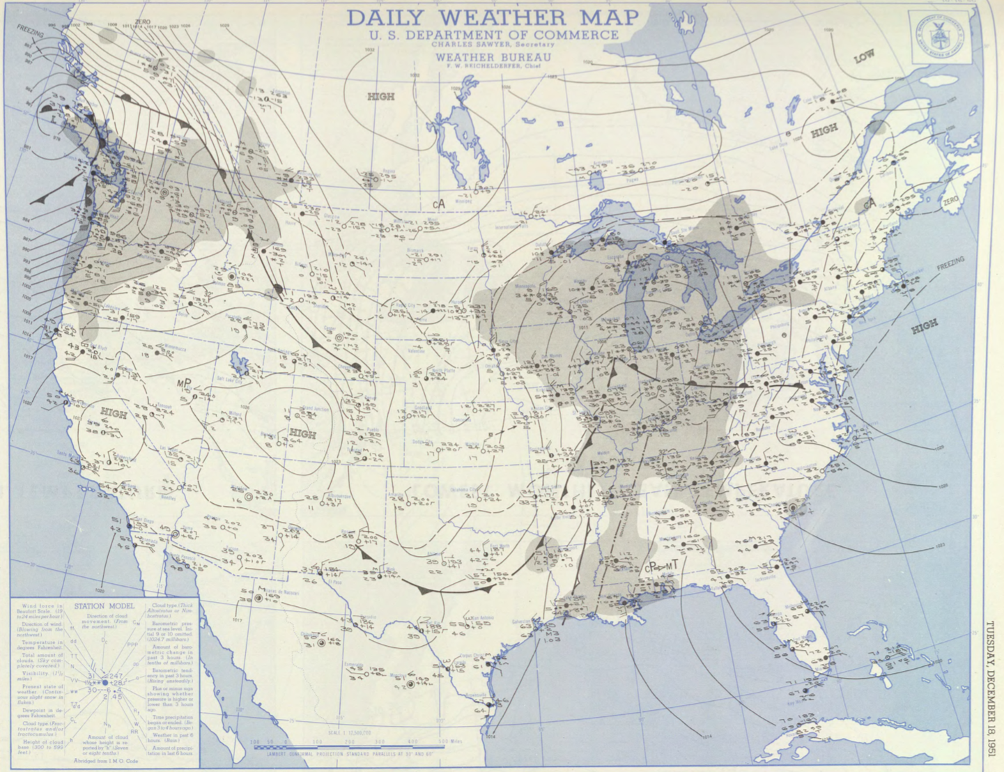
Figure 1 depicts the surface observations at 2:30 am EDT, which shows a warm front advecting northeastward across the United States. This front likely became the focus of thunderstorm activity in the late-afternoon to evening hours of December 18th, which ultimately led to this tornado.
The Martha’s Vineyard, MA F2 tornado of December 18, 1951 impacted Dukes County in Massachusetts. According to NOAA (2019), the F2 tornado caused no fatalities, injuries or property damage. The tornado touched down in Dukes County south of West Tisbury Road at 6:00 pm EST. The path of this tornado was not documented by the Weather Bureau. This F2 had a maximum width of 33 yards.
Sources
NOAA Central Library. (2019). U.S. Daily Weather Maps. Tuesday December 18, 1951 [PDF]. Retrieved from https://library.noaa.gov/Collections/Digital-Collections/US-Daily-Weather-Maps
NOAA National Centers for Environmental Information (2019). Storm Events Database. Retrieved from: https://www.ncdc.noaa.gov/stormevents/