

Figure 1 depicts the surface observations at 3:00 pm MDT.
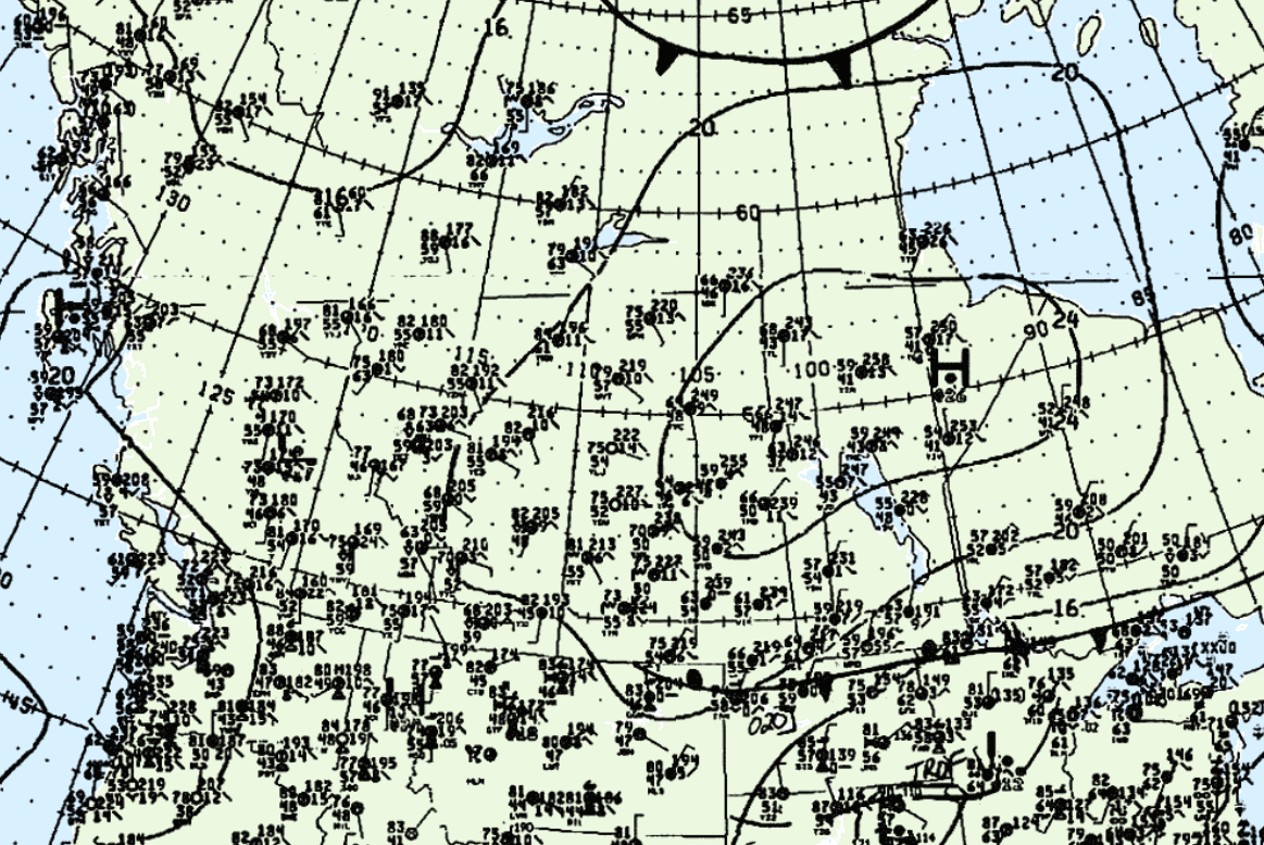
According to Environment and Climate Change Canada (2018), an F1 tornado touched down at 5:00 pm MDT near Mayerthorpe, AB. The path and width of the tornado was not documented by ECCC.
Sources
NWS Weather Prediction Center Surface Analysis Archive. (2017). Surface analysis 21Z Sun Aug 13 1989. Retrieved from: https://www.wpc.ncep.noaa.gov/archives/web_pages/sfc/sfc_archive.php
Environment and Climate Change Canada Data. (2018). Canadian National Tornado Database: Verified Events (1980-2009) – Public. Retrieved from: http://donnees.ec.gc.ca/data/weather/products/canadian-national-tornado-database-verified-events-1980-2009-public/