

A shed was thrown and 100s of trees were snapped and uprooted when the tornado touched down at 5:30 pm. It was on the ground for 3 kilometres and had a width of 400 metres.
This was one of three tornadoes to touch down in South Central Ontario on July 17, 2000. One of the others, a probable F0 tornado at Beeton, was reported by area residents but caused no damage. And the other, an F2 tornado that struck Guelph, tore through residential neighborhoods on the south side of the city, damaging hundreds of houses and causing millions in damage.
Figure 1 depicts the surface observations at 2:00 pm, which shows a cold front advancing toward southern Ontario. This eastward-moving front would have brought southerly winds blowing over Lake Erie and Lake Ontario across southern Ontario throughout the afternoon.
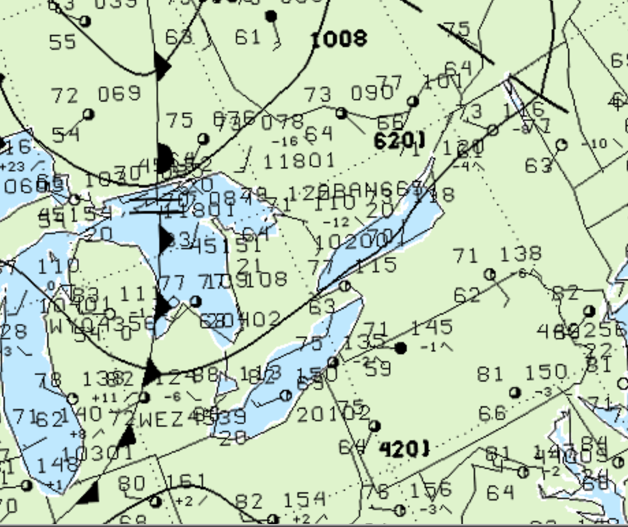
Ahead of the front, a very moist environment was present, with temperatures at 77F with a 63F dew point observed near Hamilton (Figure 1). As the cold front slowly moved east, strong forcing initiated thunderstorms across southwestern Ontario.
According to Environment and Climate Change Canada (2018), an F1 tornado touched down at 5:30 pm EDT near Melduf, ON. The tornado travelled for 3 km with a maximum width of 400 metres. The tornado caused no fatalities or injuries, but caused $10 thousand dollars in property damage.
Sources
NWS Weather Prediction Center Surface Analysis Archive. (2017). Surface analysis 18Z Mon Jul 17 2000. Retrieved from: https://www.wpc.ncep.noaa.gov/archives/web_pages/sfc/sfc_archive.php
Environment
and Climate Change Canada Data. (2018). Canadian
National Tornado Database: Verified Events (1980-2009) –
Public. Retrieved from: http://donnees.ec.gc.ca/data/weather/products/canadian-national-tornado-database-verified-events-1980-2009-public/