

Figure 1 depicts the surface observations at 8:00 am EDT, which shows a stationary front across the northeast United States. The interactions with this front and possible sea-breeze triggered thunderstorms across Massachusetts, which ultimately led to this tornado.

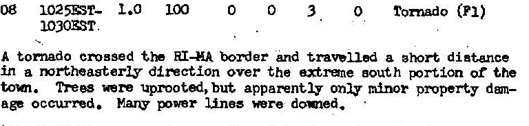
The Millville, MA F1 tornado of August 8, 1986 impacted Worcester County in Massachusetts. According to NOAA (2019), the F1 tornado caused no fatalities or injuries, but caused $2500 dollars in property damage. The tornado touched down near Miller Street at 10:25 am EDT and moved north toward Millville. The tornado travelled for 1 mile and had a maximum width of 100 yards.
Sources
NOAA Central Library. (2020). U.S. Daily Weather Maps. Friday August 8, 1986 [PDF]. Retrieved from https://library.noaa.gov/Collections/Digital-Collections/US-Daily-Weather-Maps
NOAA National Centers for Environmental Information (2020). Storm Events Database. Retrieved from: https://www.ncdc.noaa.gov/stormevents/