

This F1 tornado touched down to the northeast of Wawa, near Missanabie, producing tree damage as it passed through area forest.
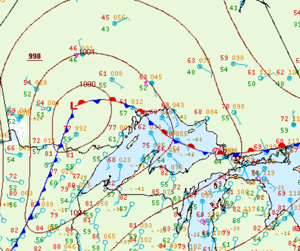
Figure 1 depicts the surface observations at 2:00 pm EDT, which shows a stationary front across Lake Superior. This front likely initiated storms in parts of Ontario as a warm front moved north, which ultimately led to this tornado.
Sources
NWS Weather Prediction Center Surface Analysis Archive. (2017).Surface analysis 18Z Mon Sep 12 2011. Retrieved from: https://www.wpc.ncep.noaa.gov/archives/web_pages/sfc/sfc_archive.php