

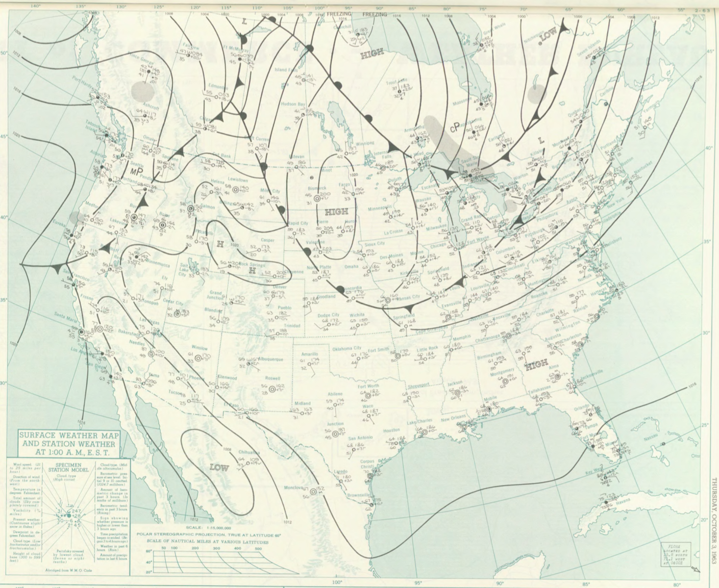
Figure 1 depicts the surface observations at 2:00 am EDT, which shows a cold front moving across southern Ontario. This front eventually moved east-southeast throughout the afternoon hours on October 3rd and initiated thunderstorms, which ultimately led to this tornado.
The Berkshire County, MA F1 tornado of October 3, 1963 impacted Berkshire County in Massachusetts. According to NOAA (2019), the F1 tornado caused no fatalities or injuries, but caused $2.5 thousand dollars in property damage. The tornado touched down in Berkshire County near Rockwell Road at 4:20 pm EDT. The tornado travelled for 3 miles and had a maximum width of 17 yards.
Sources
NOAA Central Library. (2019). U.S. Daily Weather Maps. Thursday October 3, 1963 [PDF]. Retrieved from https://library.noaa.gov/Collections/Digital-Collections/US-Daily-Weather-Maps
NOAA National Centers for Environmental Information (2019). Storm Events Database. Retrieved from: https://www.ncdc.noaa.gov/stormevents/