

This F1 tornado struck the Murillo area, flipping a tractor, tearing apart a barn and a horse riding facility, throwing their debris dozens of metres and damaging a house. It occurred about 16 km to the west of Thunder Bay during a severe thunderstorm that was also producing baseball-sized hail.
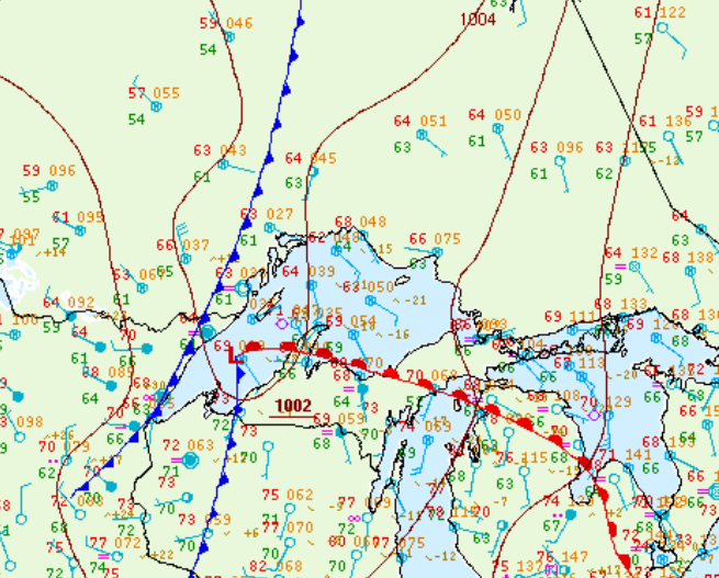
Figure 1 depicts the surface observations at 4:00 am CDT, which shows a cold front sitting just west of Thunder Bay, ON. This front became the focus for thunderstorm activity in the earl morning hours of September 2nd, which ultimately led to this F1 tornado.
Sources
NWS Weather Prediction Center Surface Analysis Archive. (2017). Surface analysis 09Z Fri Sep 2 2011. Retrieved from: https://www.wpc.ncep.noaa.gov/archives/web_pages/sfc/sfc_archive.php