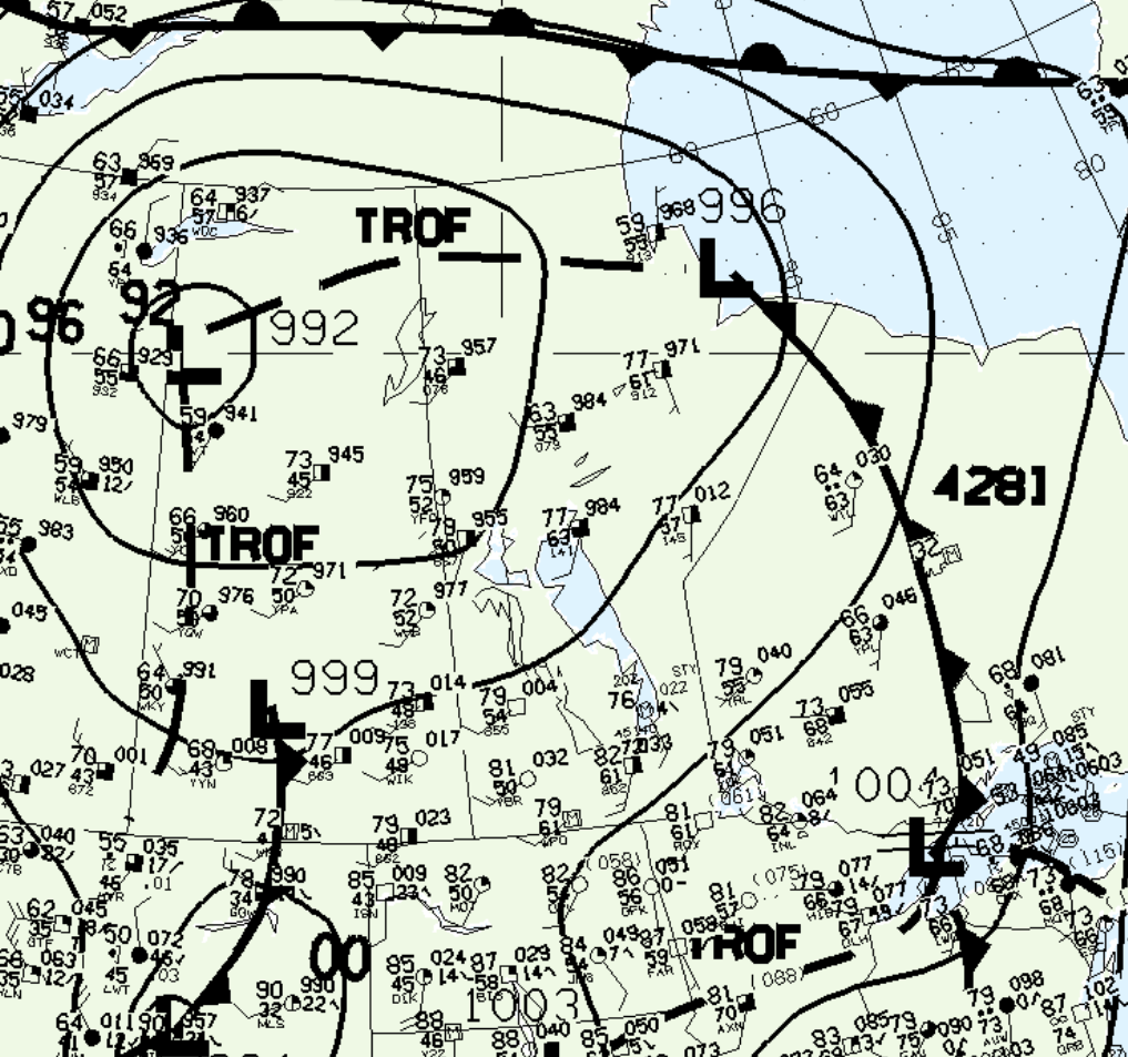
Figure 1 shows the surface observations at 4:00 pm CDT, which shows a low pressure system over Churchill with a cold front extending south across northwestern Ontario.

According to Environment and Climate Change Canada (2018), an F0 tornado touched down at 4:06 pm CDT 24 km west of Gillam Airport, MB. The track and width of the tornado was not documented by ECCC. The tornado caused no fatalities, injuries or property damage.
Sources
NWS Weather Prediction Center Surface Analysis Archive. (2017). Surface analysis 21Z Mon Aug 5 1996. Retrieved from: https://www.wpc.ncep.noaa.gov/archives/web_pages/sfc/sfc_archive.php
Environment and Climate Change Canada Data. (2018). Canadian National Tornado Database: Verified Events (1980-2009) – Public. Retrieved from: http://donnees.ec.gc.ca/data/weather/products/canadian-national-tornado-database-verified-events-1980-2009-public/

