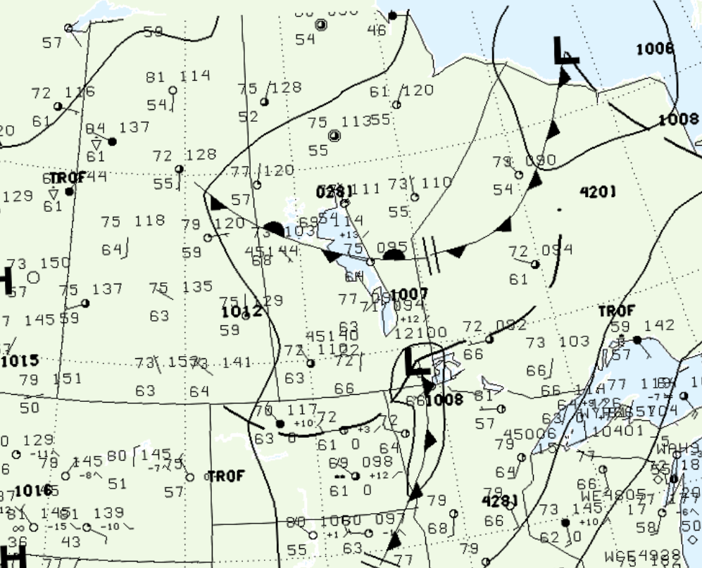
Figure 1 depicts the surface observations at 1:00 pm CDT, which shows a low pressure system in extreme southeastern Manitoba with a trough of low pressure moving south across North Dakota. A stationary front is also observed across central Manitoba. The backing of the winds from the low pressure and interaction with the Manitoba Escarpment likely triggered thunderstorms in the afternoon hours of July 25th, which ultimately led to this tornado.

According to Environment and Climate Change Canada (2018), an F1 tornado touched down at 6:25 pm CDT near Neepawa, MB. The path of the tornado was not documented by ECCC, but its maximum width was 800 metres. The tornado caused no fatalities, injuries or property damage.
Sources
NWS Weather Prediction Center Surface Analysis Archive. (2017). Surface analysis 18Z Tue Jul 25 2000. Retrieved from: https://www.wpc.ncep.noaa.gov/archives/web_pages/sfc/sfc_archive.php
Environment and Climate Change Canada Data. (2018). Canadian National Tornado Database: Verified Events (1980-2009) – Public. Retrieved from: http://donnees.ec.gc.ca/data/weather/products/canadian-national-tornado-database-verified-events-1980-2009-public/

