

This tornado touched down at 5:45 pm, leaving a path of damage from Go Home Bay on Lake of the Woods to Pipestone Lake in northern Ontario. Trees were snapped and twisted and hydro poles snapped.
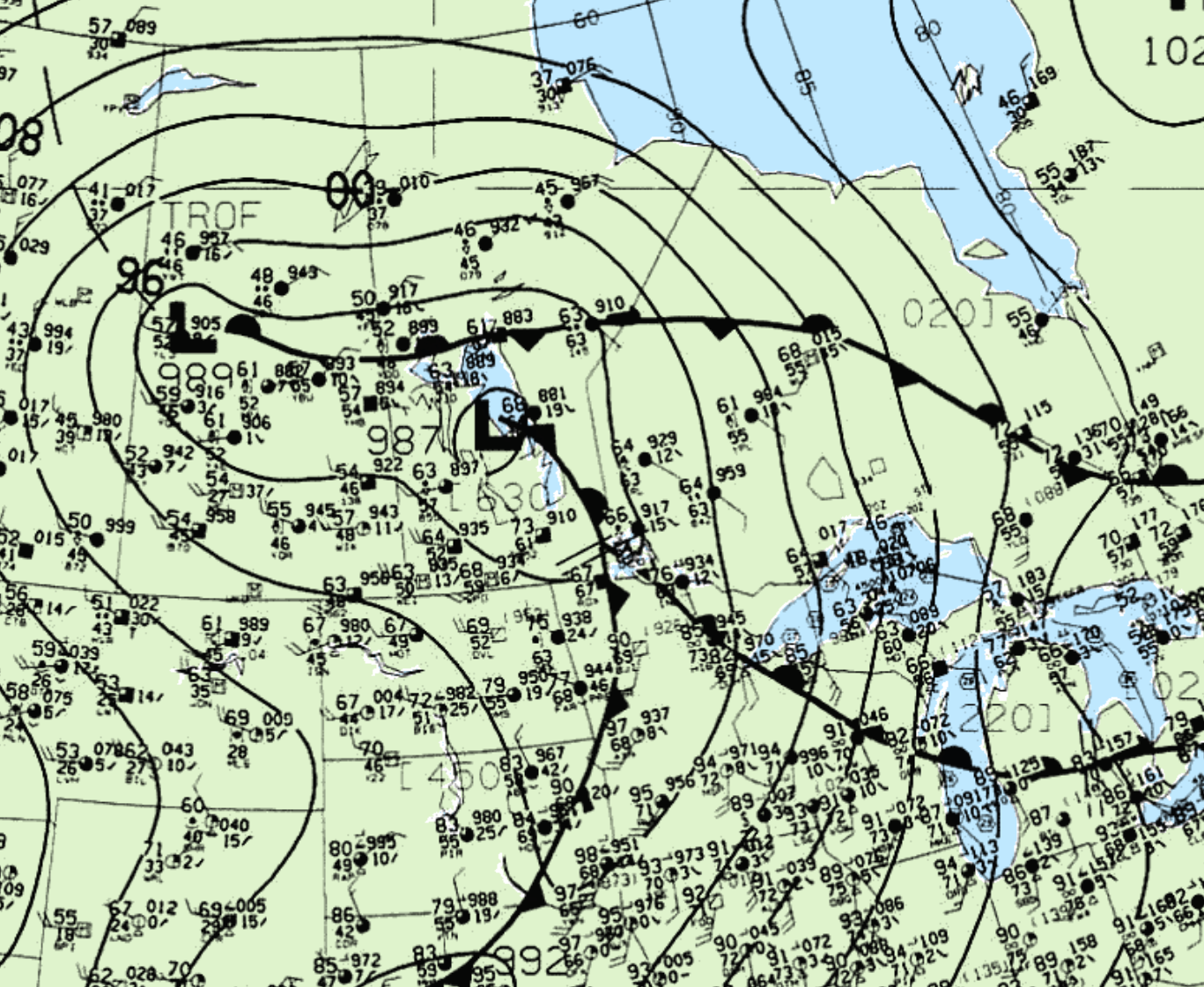
Figure 1 depicts the surface observations at 4:00 pm CDT, which shows split lows in Manitoba and Saskatchewan with their associated warm fronts extending into northern Ontario. Storms fired along the warm front as it lifted north and provided enhanced wind shear for this F2 tornado.
According to Environment and Climate Change Canada (2018), an F2 tornado touched down at 5:45 pm CDT near Nestor Falls, ON. The tornado travelled for 16 km with a maximum width of 800 metres. Fatalities, injuries and property damage were not catalogued by ECCC.
Source
NWS Weather Prediction Center Surface Analysis Archive. (2017). Surface analysis 21Z Tue Jun 14 1994. Retrieved from: https://www.wpc.ncep.noaa.gov/archives/web_pages/sfc/sfc_archive.php
Environment and Climate Change Canada Data. (2018). Canadian National Tornado Database: Verified Events (1980-2009) – Public. Retrieved from: http://donnees.ec.gc.ca/data/weather/products/canadian-national-tornado-database-verified-events-1980-2009-public/