

The F1 tornado from New Lowell to Edenvale, Ontario. This tornado formed near New Lowell at 5:30pm and tracked for 12.6km to Edenvale, west of Barrie. Its path was narrow, only 70m wide, and was through a sparsely-populated area, passing mostly over open fields and agricultural land. However, the tornado did strike two area farms and at each it removed the roofs from the farm houses, ripped off siding and left windows shattered. It also damaged trees and crops, collapsed a farm shed, knocked over irrigation equipment and moved a heavy farm trailer over 100 metres.
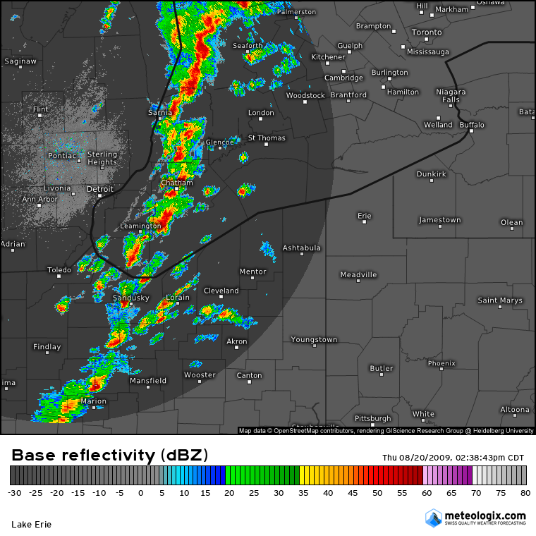
Figure 1 depicts a line of severe thunderstorms entering southwestern Ontario from Michigan. These thunderstorms were responsible for the tornado outbreak on this day.
The tornado was formidable in appearance with witness photographs showing a tapered stovepipe, fully condensed to the ground and a plume of debris swirling at its base. It was a perfect column, dark and ominous, something more familiar to the plains of Kansas or Oklahoma.
This was one of nineteen tornadoes that struck Southern and Central Ontario on August 20.
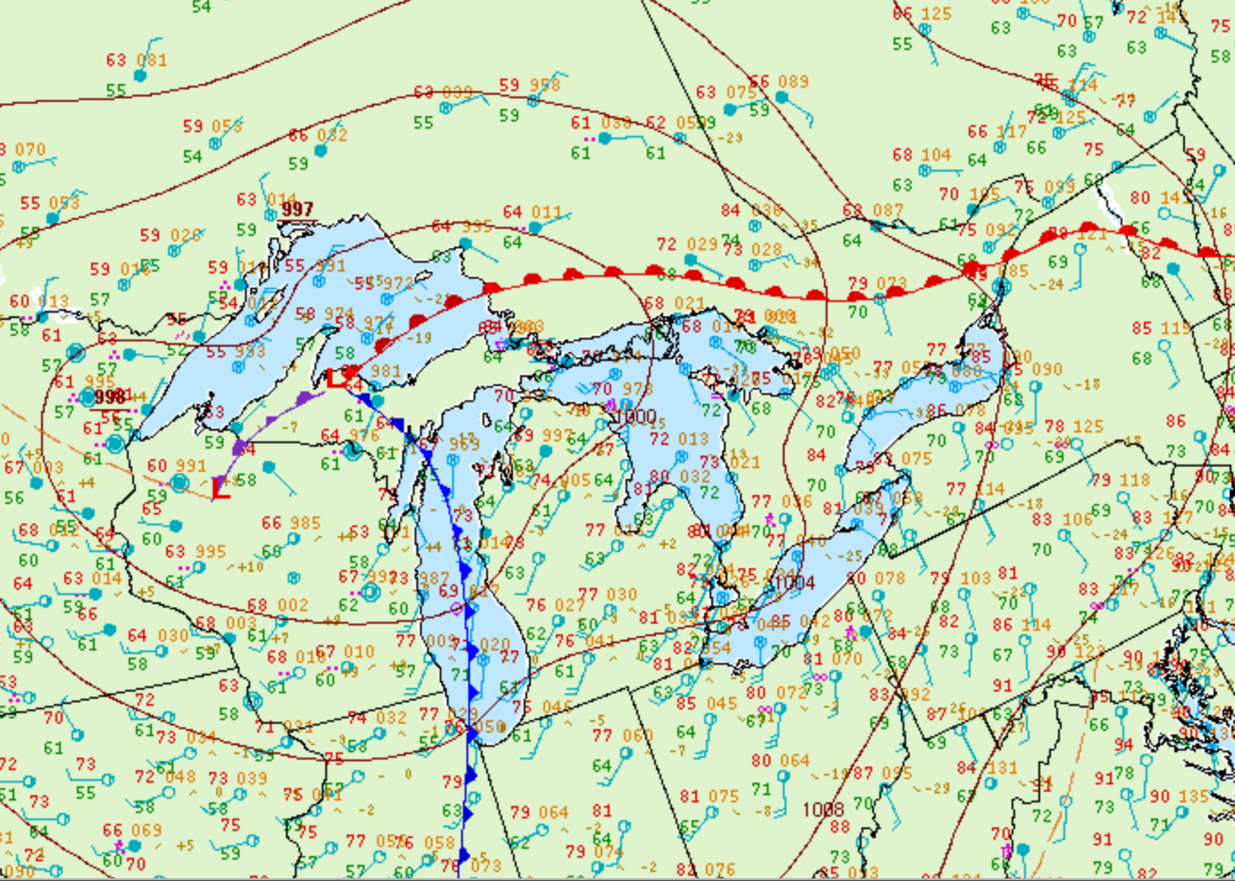
Figure 2 depicts the surface observations at 5:00 pm EDT, which shows a cold front moving through the Great Lakes and a warm front in central Ontario. The warm sector (southern Ontario), brought southerly winds moving across the open waters of Lake Ontario and Lake Erie. The advancing cold front and possible interactions with lake-breeze boundaries developed pre-frontal storms across southwestern Ontario, which moved east and brought one of the most significant tornado outbreak in Ontario’s history.
According to Environment and Climate Change Canada (2018), an F1 tornado touched down at 5:30 pm near New Lowell, ON. The tornado travelled for 12.6 km and had a maximum width of 70 metres. The tornado caused no injuries or fatalities, but caused $10 thousand dollars in property damage.
Sources
NWS Weather Prediction Center Surface Analysis Archive. (2017). Surface analysis 21Z Thu Aug 20 2009. Retrieved from: https://www.wpc.ncep.noaa.gov/archives/web_pages/sfc/sfc_archive.php
Environment and Climate Change Canada Data. (2018). Canadian National Tornado Database: Verified Events (1980-2009) – Public. Retrieved from: http://donnees.ec.gc.ca/data/weather/products/canadian-national-tornado-database-verified-events-1980-2009-public/