

Figure 1 depicts the surface observations at 7:00 am EDT, which shows a cold front moving through the Great Lakes. This front would move east-southeast, triggering thunderstorms, which ultimately led to this tornado.
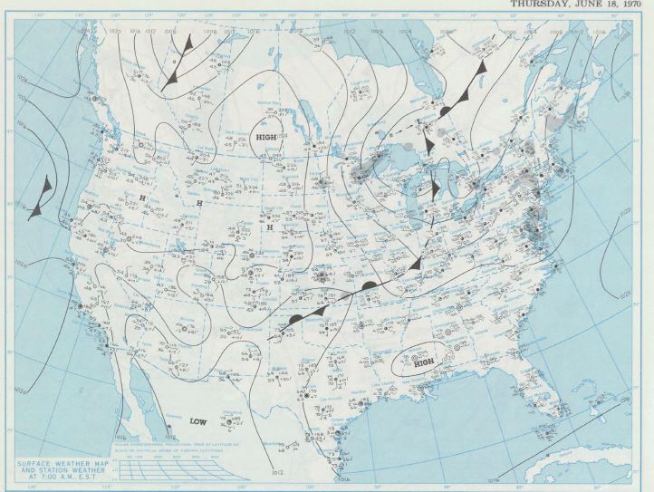
The North Adams , MA F1 tornado of June 18, 1970 impacted Berkshire County in Massachusetts. According to NOAA (2019), the F1 tornado caused no fatalities, but injured four people and caused $250 thousand dollars in property damage. The tornado touched down near Williamstown at 8:00 pm EDT. The tornado travelled for 18.7 miles and had a maximum width of 440 yards.
Sources
NOAA Central Library. (2019). U.S. Daily Weather Maps. Thursday June 18, 1970 [PDF]. Retrieved from https://library.noaa.gov/Collections/Digital-Collections/US-Daily-Weather-Maps
NOAA National Centers for Environmental Information (2019). Storm Events Database. Retrieved from: https://www.ncdc.noaa.gov/stormevents/