

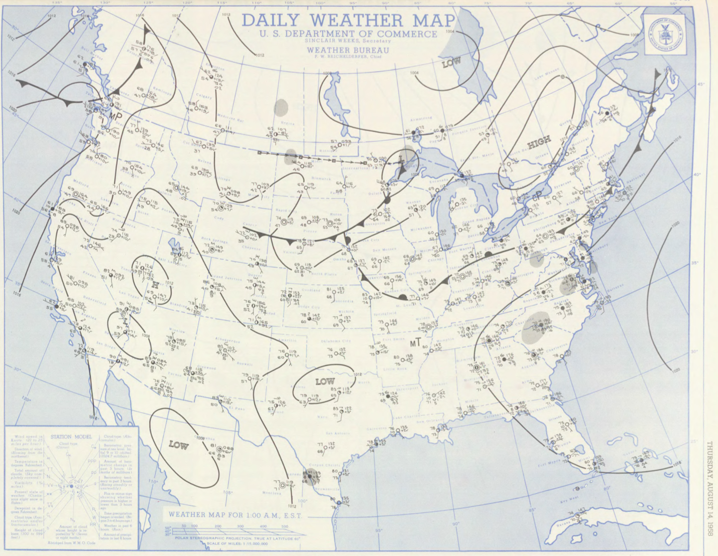
Figure 1 depicts the surface observations at 2:00 am EDT, which shows a cold front across Massachusetts and an stationary front across the northeast United States. The cold front likely became near-stationary throughout the day and triggered thunderstorms in the early evening hours (possibly aided by sea-breeze boundaries), which ultimately led to this tornado.
The Northampton, MA F2 tornado of August 14, 1958 impacted Hampshire County in Massachusetts. According to NOAA (2019), the F2 tornado caused no fatalities or injuries, but caused $250 thousand dollars in property damage. The tornado touched down in Hampshire County near King Street at 7:30 pm EDT. The tornado travelled for 1 mile and had a maximum width of 67 yards.
Sources
NOAA Central Library. (2019). U.S. Daily Weather Maps. Thursday August 14, 1958 [PDF]. Retrieved from https://library.noaa.gov/Collections/Digital-Collections/US-Daily-Weather-Maps
NOAA National Centers for Environmental Information (2019). Storm Events Database. Retrieved from: https://www.ncdc.noaa.gov/stormevents/