

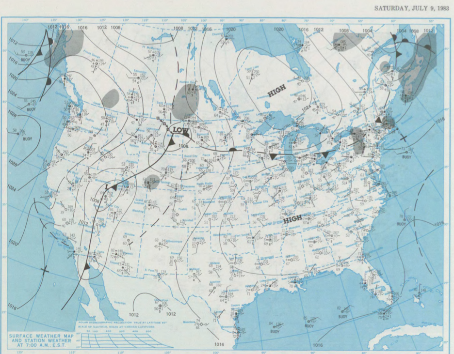
Figure 1 shows the surface observations at 7:00 am CDT, which shows a low pressure in eastern Montana with a cold front extending south and stationary front across North Dakota and the U.S. Midwest. A trough of low pressure is also observed across Saskatchewan. Thunderstorm activity is noted along the trough on the SK/MB border and likely continued throughout the day, which ultimately led to this tornado.
According to Environment and Climate Change Canada (2018), an F0 tornado touched down at 8:00 pm CDT near Oakburn, MB. The track and width of this tornado was not documented by ECCC. The tornado caused no injuries, fatalities or property damage.
Sources
NOAA Central Library. (2020). U.S. Daily Weather Maps. Saturday July 9, 1983 [PDF]. Retrieved from https://library.noaa.gov/Collections/Digital-Collections/US-Daily-Weather-Maps
Environment and Climate Change Canada Data. (2018). Canadian National Tornado Database: Verified Events (1980-2009) – Public. Retrieved from: http://donnees.ec.gc.ca/data/weather/products/canadian-national-tornado-database-verified-events-1980-2009-public/