

Witnesses reported observing this large probable tornado at around 6:00pm. Trees were snapped and granite tombstones blown over in a path that was between 200 and 500m wide.
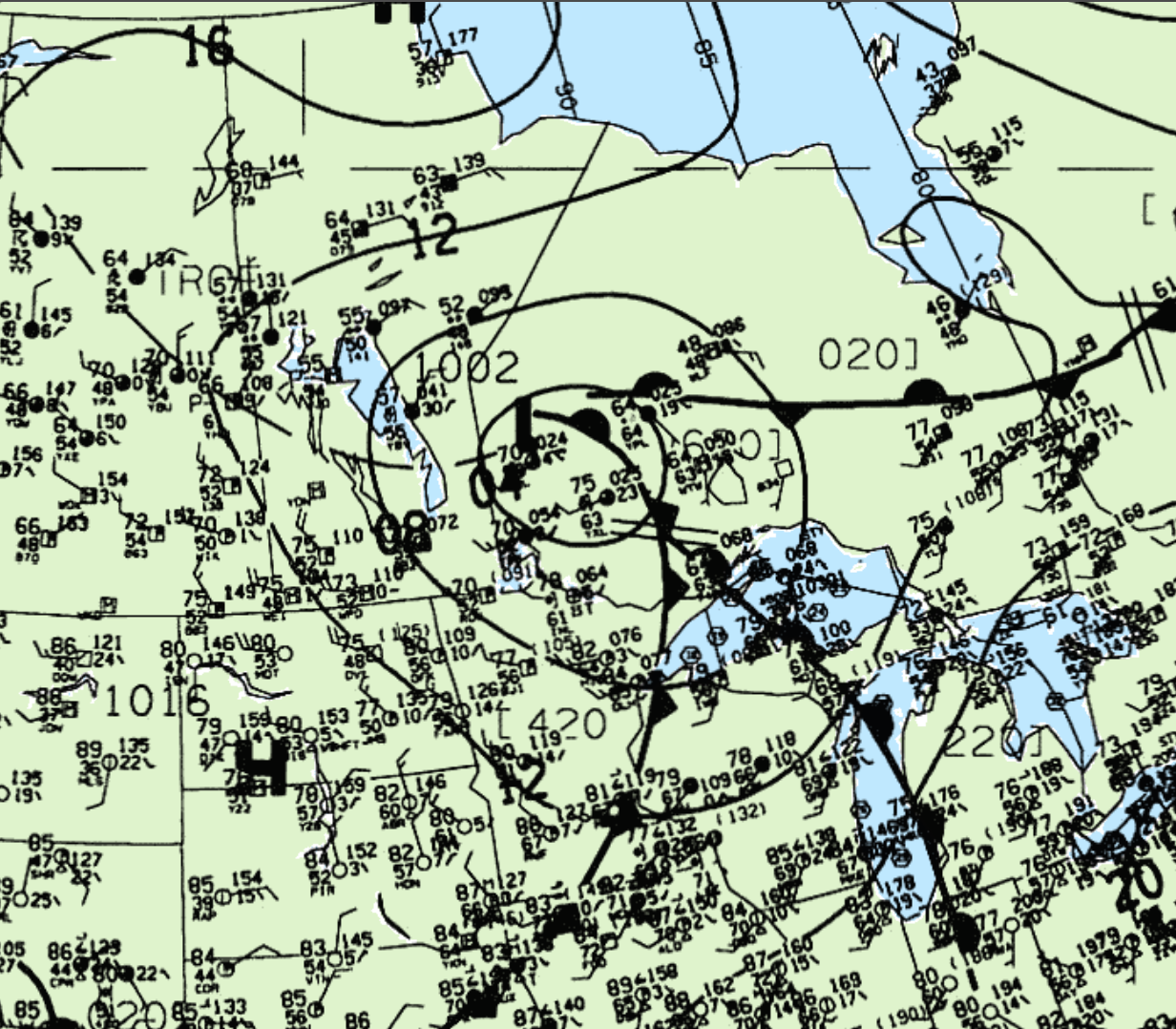
Figure 1 depicts the surface observations at 4:00 pm CDT. which depicts an occluding low/front just west of Pickle Lake. This frontal boundary became the focus for strong storms in the early evening hours and led to this F0 tornado.
According to Environment and Climate Change Canada (2018), an F0 tornado touched down at 6:00 pm CDT near Osnaburgh, ON. The width of the tornado was 500 metres, but the track was not documented by ECCC. Fatalities, injuries and property damage were not catalogued by ECCC.
Source
NWS Weather Prediction Center Surface Analysis Archive. (2017). Surface analysis 21Z Mon Jul 11 1994. Retrieved from: https://www.wpc.ncep.noaa.gov/archives/web_pages/sfc/sfc_archive.php
Environment and Climate Change Canada Data. (2018). Canadian National Tornado Database: Verified Events (1980-2009) – Public. Retrieved from: http://donnees.ec.gc.ca/data/weather/products/canadian-national-tornado-database-verified-events-1980-2009-public/