

The tornado touched down at 7:30 pm and travelled for 5 km through the west end of Ottawa, from Brittania Park to Carlington Heights. Along its path that was between 50m and 150m wide, the tornado snapped and uprooted trees, knocked down power poles and peeled the roofing from a few apartment complexes, earning it a high-end F0 rating. People reported witnessing a funnel cloud with swirling debris.
This was one of five tornadoes that touched down across the province on April 25; the others were an F0 at Round Lake Centre, an F1 at Breslau, an F0 at Guelph, and an F0 at Windsor.
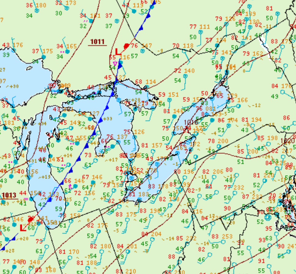
Figure 1 depicts the surface observations at 2:00 pm EDT, which shows a cold front over the Great Lakes and Michigan. This front became the focus of intense thunderstorms through the afternoon/evening hours of April 25th, which ultimately led to several tornadoes across southern Ontario.
According to Environment and Climate Change Canada (2018), an F0 tornado touched down at 7:30 pm near Ottawa, ON. The tornado travelled for 5 km and had a maximum width of 150 metres. The tornado caused no fatalities, injuries or property damage.
Sources
NWS Weather Prediction Center Surface Analysis Archive. (2017). Surface analysis 18Z Sat Apr 25 2009. Retrieved from: https://www.wpc.ncep.noaa.gov/archives/web_pages/sfc/sfc_archive.php
Environment and Climate Change Canada Data. (2018). Canadian National Tornado Database: Verified Events (1980-2009) – Public. Retrieved from: http://donnees.ec.gc.ca/data/weather/products/canadian-national-tornado-database-verified-events-1980-2009-public/