

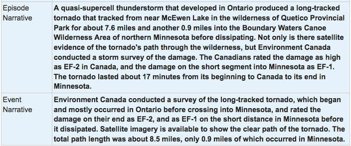
This tornado occurred at about 3:40 pm, spawned by one of several powerful supercells that tracked across Northwestern Ontario on July 6th. It touched down at Ottertrack Lake near the international border, west of Thunder Bay, and had a path that was 10 kilometres long and up to 500 metres wide. Along its path, the forest was decimated; according to Environment Canada, ‘most trees were flattened’. The damage path was located and the tornado was subsequently confirmed as the result of a Northern Ontario Tornado Project reconnaissance flight that scouted the remote area for damage in the days following the storm.
Although environment Canada’s original storm summary listed the damage path as being only 2 kilometres long and 100 metres wide, further analysis as part of the Northern Tornadoes Flyover Project revealed the length of the path and the width of the tornado to be significantly greater than originally thought. Aerial data collection including high-resolution photos and videos of the damage have been documented for the study that is a collaboration between researchers at the University of Western Ontario and at Environment Canada.
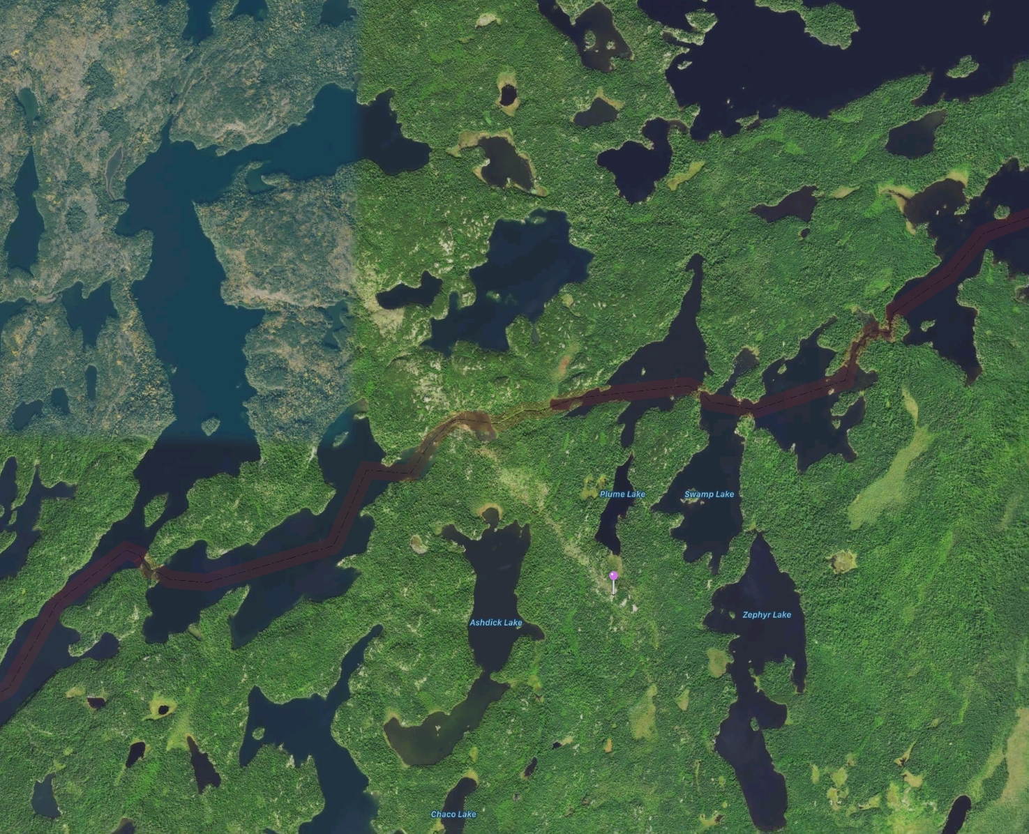
Figure 1 depicts the scarce left by this strong tornado via satellite. The tornado is seen to cross the international border into Minnesota and lift near Plume Lake.
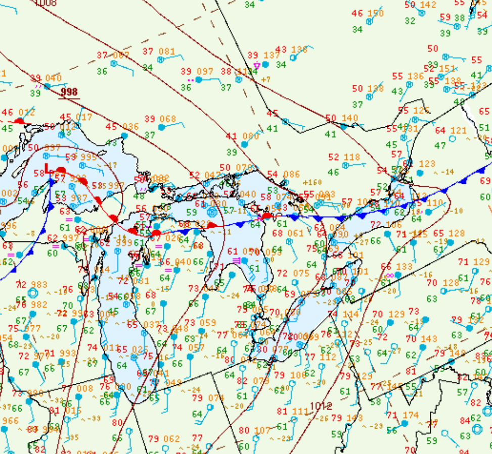
Figure 2 depicts the surface observations at 4:00 pm CDT, which shows a strong cold front moving across northwestern Ontario, a warm front across Lake Superior and a low pressure in northeastern Minnesota. A thunderstorm (marked as a red ‘R’) is also observed in extreme northeastern Minnesota. Three hours prior to Figure 2, the warm front moved across the ON/MN border and began its retreat southeastward. The warm front triggered an intense supercell just near the ON/MN border, spawning a strong EF2 tornado. The storm/tornado then followed the warm front southeastward aided by the advancing cold front, which led to the southeasterly track of the tornado into Minnesota.
Sources
NWS Weather Prediction Center Surface Analysis Archive. (2017). Surface analysis 21Z Thu Jul 6 2017. Retrieved from: https://www.wpc.ncep.noaa.gov/archives/web_pages/sfc/sfc_archive.php
NOAA NCEI. (2020). Storm Event Database: July 6, 2017. Retrieved from https://www.ncdc.noaa.gov/stormevents/eventdetails.jsp?id=763824