

With a path that was 1.5 kilometres long and 15 metres wide, the tornado tossed and destroyed two small sheds, scattering debris for over 100 metres. Witnesses reported seeing a funnel cloud which touched down at around 4:15 pm.
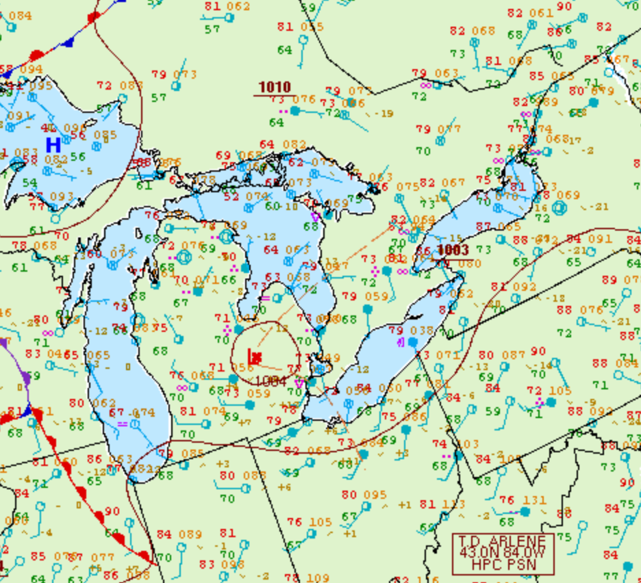
Figure 1 depicts the surface observations at 2:00 pm EDT, which shows a low pressure in Michigan with a trough extending into southern Ontario. This trough helped with possible lake-breeze generated from Lake Ontario initiated some thunderstorms across southern Ontario, which ultimately led to this F0 tornado.
According to Environment and Climate Change Canada (2018), an F0 tornado touched down at 4:15 pm near Oustic, ON. The tornado travelled for 1.5 km with a maximum width of 20 metres. The tornado caused no fatalities, injuries or property damage.
Sources
NWS Weather Prediction Center Surface Analysis Archive. (2017). Surface analysis 18Z Mon Jun 13 2005. Retrieved from: https://www.wpc.ncep.noaa.gov/archives/web_pages/sfc/sfc_archive.php
Environment and Climate Change Canada Data. (2018). Canadian National Tornado Database: Verified Events (1980-2009) – Public. Retrieved from: http://donnees.ec.gc.ca/data/weather/products/canadian-national-tornado-database-verified-events-1980-2009-public/