

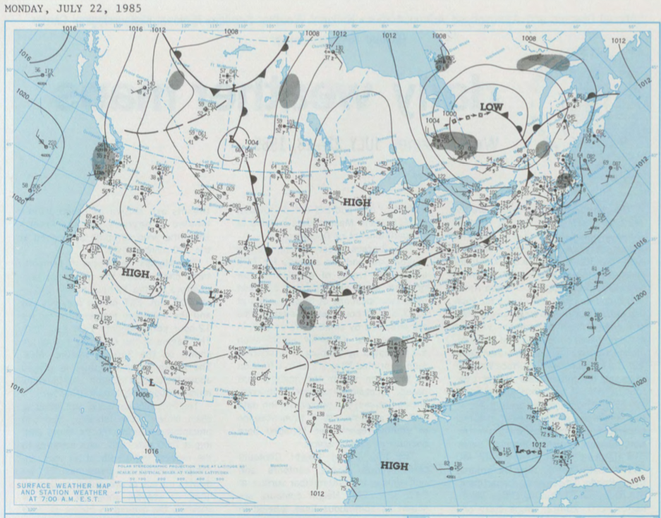
Figure 1 depicts the surface observations at 7:00 am EST.
According to Environment and Climate Change Canada (2018), an F2 tornado touched down at 6:30 pm MDT near Picture Butte, AB. The path and width of the tornado was not documented by ECCC.
Sources
NOAA Central Library. (2019). U.S. Daily Weather Maps. Monday July 22, 1985 [PDF]. Retrieved from https://library.noaa.gov/Collections/Digital-Collections/US-Daily-Weather-Maps
Environment and Climate Change Canada Data. (2018). Canadian National Tornado Database: Verified Events (1980-2009) – Public. Retrieved from: http://donnees.ec.gc.ca/data/weather/products/canadian-national-tornado-database-verified-events-1980-2009-public/