

Figure 1 depicts the surface observations at 2:00 pm EDT, which shows a warm front extending into Massachusetts. This front became the focus for thunderstorm activity, which ultimately led to this tornado.

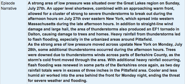
The Pittsfield, MA EF1 tornado of July 27, 2014 impacted Berkshire County in Massachusetts. According to NOAA (2019), the EF1 tornado caused no fatalities, injuries or property damage. The tornado touched down near South Street at 4:55 pm EDT. The tornado travelled for 0.25 miles and had a maximum width of 20 yards.
Sources
NWS Weather Prediction Center Surface Analysis Archive. (2017). Surface analysis 18Z Sun Jul 27 2014. Retrieved from: https://www.wpc.ncep.noaa.gov/archives/web_pages/sfc/sfc_archive.php
NOAA National Centers for Environmental Information (2020). Storm Events Database. Retrieved from: https://www.ncdc.noaa.gov/stormevents/