

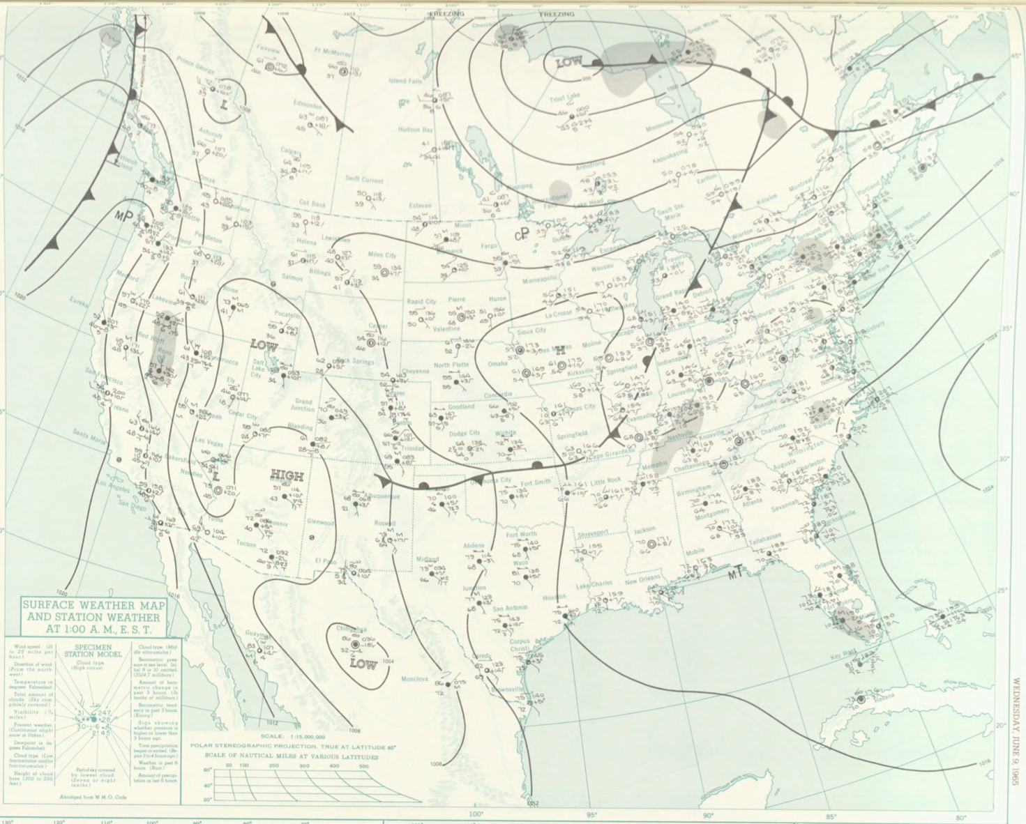
Figure 1 depicts the surface observations at 2:00 am EDT, which shows a cold front moving across the Great Lakes. This front eventually made its way to Massachusetts, triggering thunderstorms, which ultimately led to this tornado.
The Plymouth County, MA F0 tornado of June 9, 1965 impacted Plymouth County in Massachusetts. According to NOAA (2019), the F0 tornado caused no fatalities or injuries, but caused $30 dollars in property damage. The tornado touched down in Plymouth County over US-MA 195 at 4:50 pm EDT. The tornado travelled for 0.1 miles and had a maximum width of 33 yards.
Sources
NOAA Central Library. (2019). U.S. Daily Weather Maps. Wednesday June 9, 1965 [PDF]. Retrieved from https://library.noaa.gov/Collections/Digital-Collections/US-Daily-Weather-Maps
NOAA National Centers for Environmental Information (2019). Storm Events Database. Retrieved from: https://www.ncdc.noaa.gov/stormevents/