

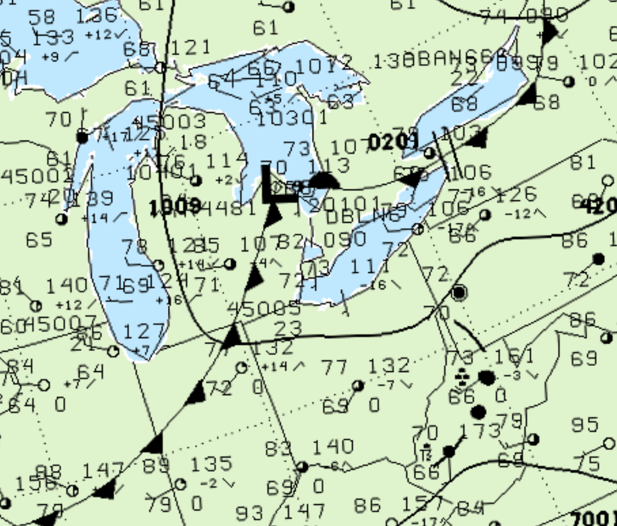
Figure 1 depicts the surface observations at 2:00 pm EDT, which shows a low pressure setting up on Michigan’s ‘thumb’ with a cold front extending south into Michigan. This front became the focus for intense thunderstorms in the afternoon hours of August 9th, which ultimately led to this F1 tornado.
According to Environment and Climate Change Canada (2018), an F1 tornado touched down at 5:20 pm EDT near Prairie Siding, ON. The path of the tornado was not documented by ECCC, but the tornado had a maximum width of 40 metres. The tornado caused no fatalities, injuries or property damage.
Sources
NWS Weather Prediction Center Surface Analysis Archive. (2017). Surface analysis 18Z Wed Aug 9 2000. Retrieved from: https://www.wpc.ncep.noaa.gov/archives/web_pages/sfc/sfc_archive.php
Environment
and Climate Change Canada Data. (2018). Canadian
National Tornado Database: Verified Events (1980-2009)
– Public. Retrieved from: http://donnees.ec.gc.ca/data/weather/products/canadian-national-tornado-database-verified-events-1980-2009-public/