

Touching down at 3:00 pm, this tornado partially unroofed a barn, scattering boards and sheet metal through nearby fields. It then struck the Dufferin County Roads building, tearing shingles off of the roof and damaging cars with flying debris.
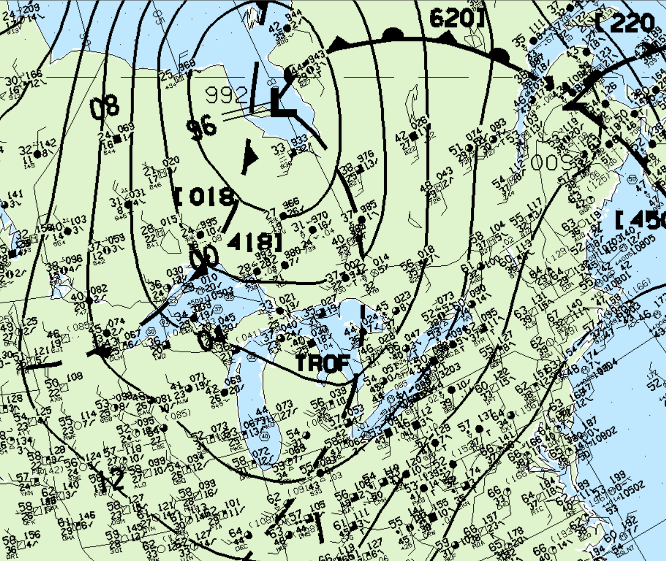
Figure 1 depicts a strong low pressure occluding over Hudson Bay. This low pressure is extending a trough of low pressure into southern Ontario. This area of convergence played a role in triggering thunderstorms in the early afternoon of May 1st.
According to Environment and Climate Change Canada (2018), an F0 tornado touched down at 3:00 pm EDT near Primrose, ON. The tornado travelled for 500 metres and had a maximum width of 270 metres. The tornado caused no fatalities, injuries or property damage.
Source
NWS Weather Prediction Center Surface Analysis Archive. (2017). Surface analysis 18Z Wed May 1 1996. Retrieved from: https://www.wpc.ncep.noaa.gov/archives/web_pages/sfc/sfc_archive.php
Environment and Climate Change Canada Data. (2018). Canadian National Tornado Database: Verified Events (1980-2009) – Public. Retrieved from: http://donnees.ec.gc.ca/data/weather/products/canadian-national-tornado-database-verified-events-1980-2009-public/