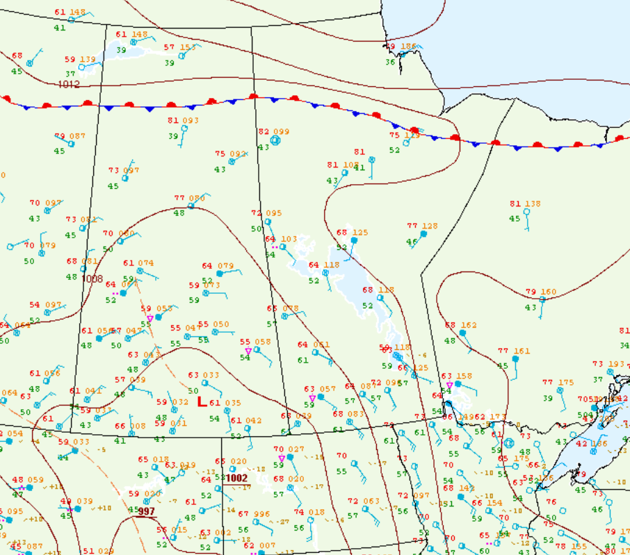
Figure 1 depicts the surface observations at 4:00 pm CDT, which shows a subtle low pressure system over southern Saskatchewan with a trough of low pressure extending northwest from it.

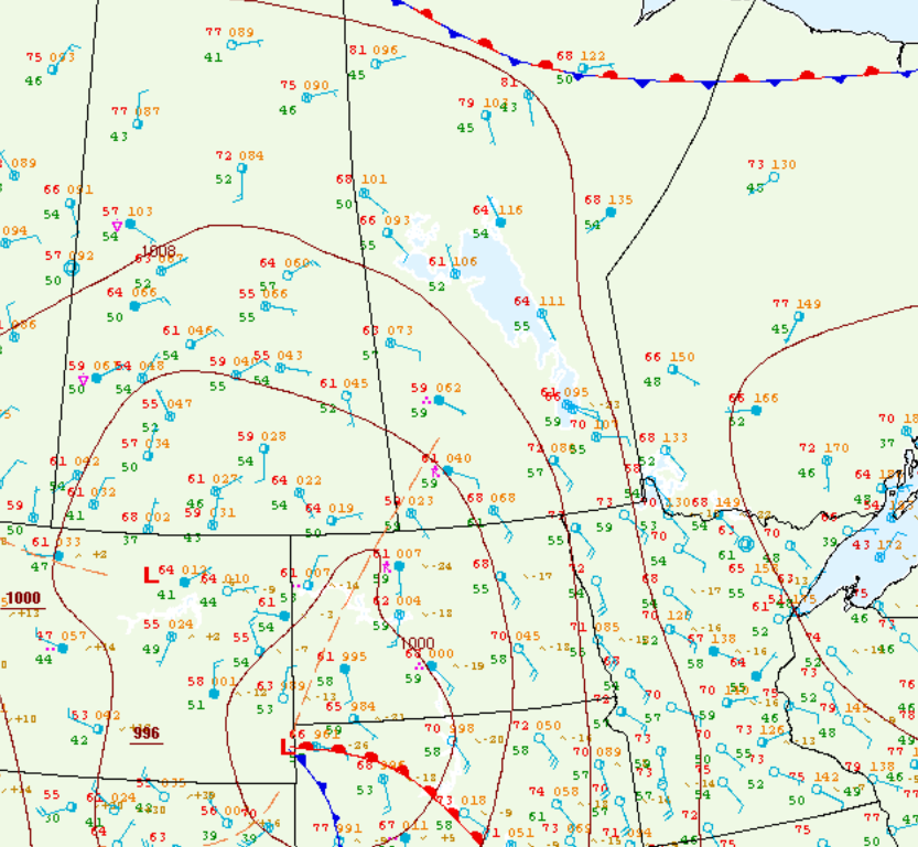
Figure 2 depicts the surface observations at 7:00 pm CDT, which shows a trough of low pressure extending across southwestern Manitoba. This trough, likely aided by the terrain influences of the Manitoba Escarpment, was the focus for intense thunderstorm development through the afternoon and evening hours of June 1st.
Three tornadoes occurred on this day:

According to Environment and Climate Change Canada (2018), an F0 tornado touched down at 6:45 pm CDT 13 km north of Rivers, MB. The path and width of the tornado was not documented by ECCC. The tornado caused no fatalities, injuries or documented property damage.
Sources
NWS Weather Prediction Center Surface Analysis Archive. (2017). Surface analysis 21Z Wed Jun 1 2005. Retrieved from: https://www.wpc.ncep.noaa.gov/archives/web_pages/sfc/sfc_archive.php
NWS Weather Prediction Center Surface Analysis Archive. (2017). Surface analysis 00Z Thu Jun 2 2005. Retrieved from: https://www.wpc.ncep.noaa.gov/archives/web_pages/sfc/sfc_archive.php
Environment and Climate Change Canada Data. (2018). Canadian National Tornado Database: Verified Events (1980-2009) – Public. Retrieved from: http://donnees.ec.gc.ca/data/weather/products/canadian-national-tornado-database-verified-events-1980-2009-public/

