

Witnesses reported seeing this tornado form over the lake at 3:30pm, remaining over the water for several minutes before passing onto the shore. Canoes were thrown, a garage and a shed were damaged, and trees were uprooted by this probable tornado.
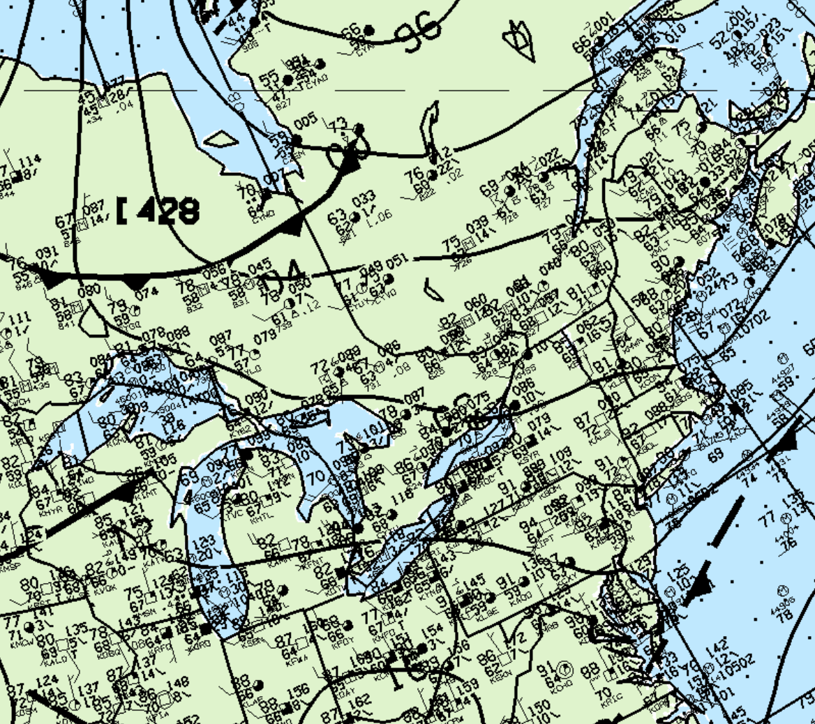
Figure 1 depicts the surface observations at 2:00 pm, which shows some thunderstorm activity near Sudbury. The 21Z map is missing from the archive and would be critical for a proper synopsis of the conditions leading to this tornado. Therefore, the tornado’s path was estimated and is likely not a realistic depiction of the tornado’s length and exact path.
According to Environment and Climate Change Canada (2018), an F0 tornado touched down at 3:30 pm EDT at Round Lake, ON. The path and width of the tornado was not documented by ECCC. The tornado caused no fatalities, injuries or property damage.
Sources
NWS Weather Prediction Center Surface Analysis Archive. (2017). Surface analysis 18Z Thu Jul 17 1997. Retrieved from: https://www.wpc.ncep.noaa.gov/archives/web_pages/sfc/sfc_archive.php
Environment and Climate Change Canada Data. (2018). Canadian National Tornado Database: Verified Events (1980-2009) – Public. Retrieved from: http://donnees.ec.gc.ca/data/weather/products/canadian-national-tornado-database-verified-events-1980-2009-public/