

Figure 1 depicts the surface observations at 8:00 am EDT, which shows a cold front off the northeast coast of the United States. This front moved across Massachusetts in the early morning hours of September 16th, which ultimately led to this tornado.

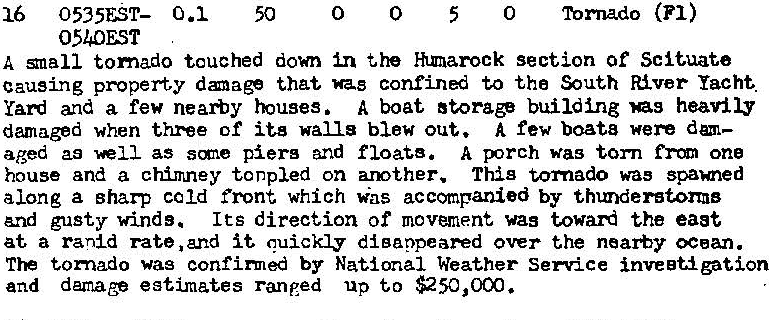
The Scituate, MA F1 tornado of September 16, 1986 impacted Plymouth County in Massachusetts. According to NOAA (2019), the F1 tornado caused no fatalities or injuries, but caused $250 thousand dollars in property damage. The tornado touched down near Porter Road at 5:35 am EDT. The tornado travelled for 0.1 mile and had a maximum width of 50 yards.
Sources
NOAA Central Library. (2020). U.S. Daily Weather Maps. Tuesday September 16, 1986 [PDF]. Retrieved from https://library.noaa.gov/Collections/Digital-Collections/US-Daily-Weather-Maps
NOAA National Centers for Environmental Information (2020). Storm Events Database. Retrieved from: https://www.ncdc.noaa.gov/stormevents/