

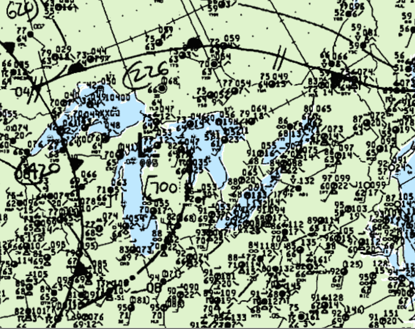
This brief tornado occurred on the afternoon of June 15th in southern Ontario. Figure 1 depicts the surface analysis at 5:00 pm EDT (25 mins prior to tornado), while this map is lacking observations in areas near the tornado, the 00z chart (8:00 pm EDT) show thunderstorms ongoing in the area.
Looking at Figure 1, we can see a line of thunderstorms crossing Michigan at the time of the reported tornado. Therefore, we can assume that a storm formed ahead of the line and dropped this tornado, possibly influenced by southerly flow over Lake Erie.
According to Environment and Climate Change Canada (2018), an F0 tornado touched down at 5:25 pm EDT near Sebringville, ON. The track and width of the tornado was not documented by ECCC. The tornado caused no injuries, fatality or property damage.
Sources
NWS Weather Prediction Center Surface Analysis Archive. (2017). Surface analysis 18Z Tue Aug 15 1989. Retrieved from: https://www.wpc.ncep.noaa.gov/archives/web_pages/sfc/sfc_archive.php
Environment and Climate Change Canada Data. (2018). Canadian National Tornado Database: Verified Events (1980-2009) – Public. Retrieved from: http://donnees.ec.gc.ca/data/weather/products/canadian-national-tornado-database-verified-events-1980-2009-public/