

Shelburne tornado becomes first in Canada rated using Enhanced Fujita Scale: EF1
The first Canadian tornado ever to be rated using the Enhanced Fujita Scale, this early-season EF1 twister touched down at the leading edge of a squall line, about 6 kilometres to the northwest of Shelburne. Travelling for 10 km and with a width of 75m, the tornado narrowly missed a farmhouse but destroyed a large barn on the property. The building lost its roof and two walls, with debris thrown 100m and embedded in the ground. Along its path, trees and hydro lines were also snapped and uprooted.
According to Environment Canada (2013), the tornado touched down west of 8th Line SW at 1:30 pm EDT and travelled for 10.3 km to end just east of Highway 10 at 5:30 pm.
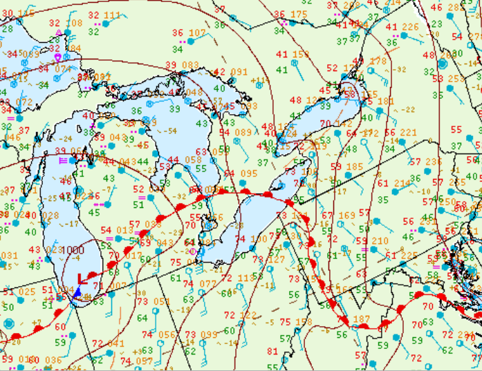
Figure 1 depicts the surface observations at 11:00 am EDT, which shows a warm front entering southwestern Ontario. This front became the focus for intense thunderstorms as it continued its progression northward, which ultimately led to this tornado.
Sources
NWS Weather Prediction Center Surface Analysis Archive. (2017). Surface analysis 15Z Thu Apr 18 2013. Retrieved from: https://www.wpc.ncep.noaa.gov/archives/web_pages/sfc/sfc_archive.php