

This tornado first touched down at 3:15 pm near the hamlet of Flannigan Corners, then travelled to the northeast for 10 kilometres through area farms. Its path was only 30m in width, along which trees were snapped and fields of corn were flattened, farm vehicles were moved about and machinery tossed for hundreds of metres. In addition, calf hutches were thrown through the air and four of the animals were killed. Crop and property damage from the tornado was estimated at $50,000.
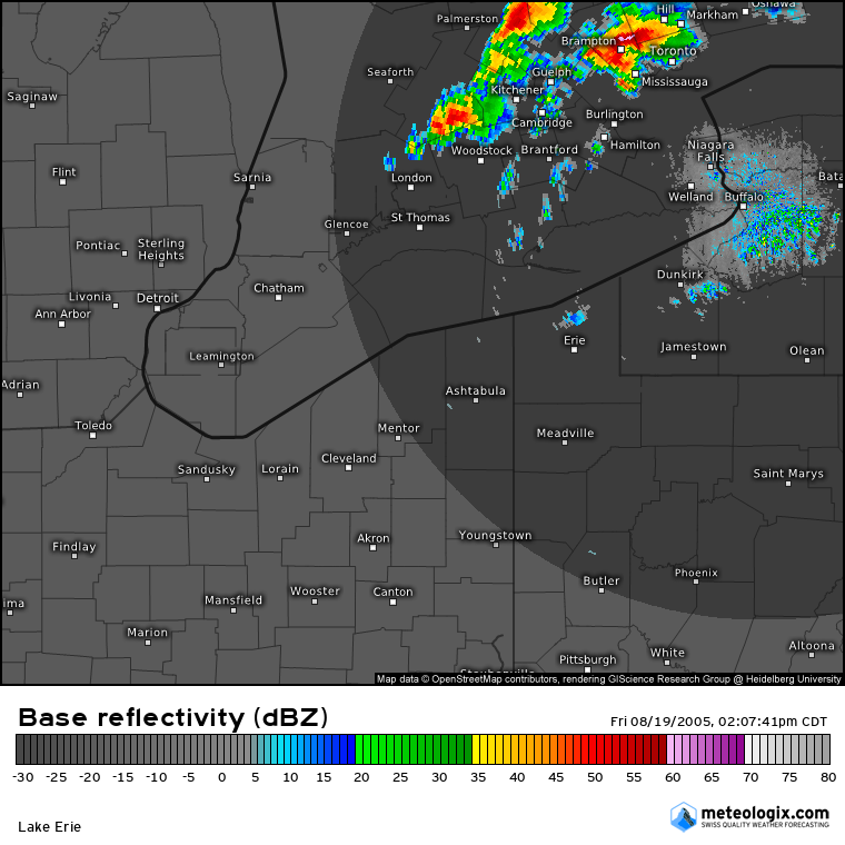
Figure 1 depicts the Doppler radar reflectivity at 3:07 pm, roughly eight minutes prior to this F1 tornado. A large hook echo is seen over Brampton, which surprisingly did not develop a tornado. The storm near Woodstock, depicted in Figure 1, is the one that dropped this F1 tornado.
This was the first of three tornadoes that touched down on August 19, 2005, and it was the day’s only tornado that was visible and sighted by witnesses. Area residents described the tornado as being a ‘broad column that tapered to its base’. The other two tornadoes were larger and more damaging, up to a kilometre in width and totally wrapped in rain.It was followed two damaging tornadoes:
- F2 that struck Milverton, to north of Dorking and Conestoga Lake
- F2 that struck Salem, to north of Fergus and Belwood Lake
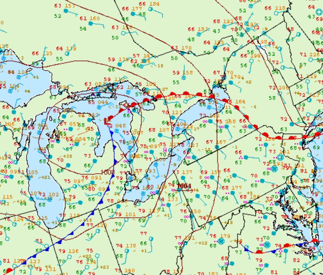
Figure 2 depicts the surface observations at 11:00 am EDT, which shows a strong low pressure system over Lake Huron with a warm front extending into southern Ontario and a cold front extending into Michigan. The environment at 11:00 am was already primed for severe thunderstorms in the warm sector (southern Ontario) with 68/66 F dew point spread near Kitchener, which is favourable for tornadoes.
According to Environment and Climate Change Canada (2018), an F1 tornado touched down at 3:15 pm near South Easthope, ON. The tornado travelled for 10 km with a maximum width of 30 metres. The tornado caused no fatalities or injuries, but caused $50 thousand dollars in property damage.
Sources
NWS Weather Prediction Center Surface Analysis Archive. (2017). Surface analysis 15Z Fri Aug 19 2005. Retrieved from: https://www.wpc.ncep.noaa.gov/archives/web_pages/sfc/sfc_archive.php
Environment and Climate Change Canada Data. (2018). Canadian National Tornado Database: Verified Events (1980-2009) – Public. Retrieved from: http://donnees.ec.gc.ca/data/weather/products/canadian-national-tornado-database-verified-events-1980-2009-public/