


This tornado was the third and strongest of the June 5-6 event. It was only on the ground for 740m with a path that was 190m wide, but caused devastating damage to a farm as it blasted across Ridge Road, southeast of Harrow. There, the tornado shifted a farmhouse off of its foundation and left it with shattered windows, a toppled chimney, as well as shingle and siding damage. It tore apart a large well-built barn, collapsed a garage and tossed farm equipment and an outhouse for hundreds of metres through the fields. The tornado left almost all of the trees on the property uprooted, snapped or shorn off at their tops.
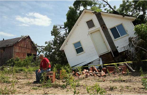
The most spectacular display of damage was to two large greenhouses on the property, the metal structures of which were left twisted and skeletal, their exploded glass spread far through neighbouring farm properties. Along the path, insulation and debris from destroyed buildings was left tangled in fences and caught in the broken limbs of damaged trees, boards were driven deep into the ground and metal wrapped around the trunks of snapped trees.
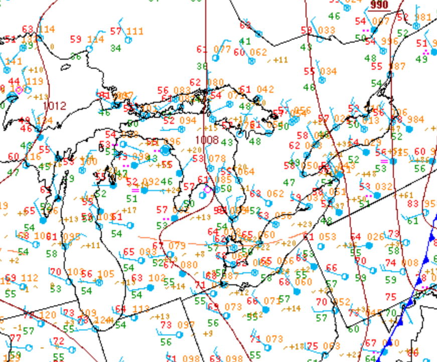
Figure 3 depicts the surface observations at 2:00 pm EDT, which shows a trough of low pressure moving across extreme southwestern Ontario in the early afternoon hours of June 6th. This front promoted thunderstorm development by destabilizing the environment, possibly aided by lake-breeze interactions, which ultimately led to this strong F2 tornado.
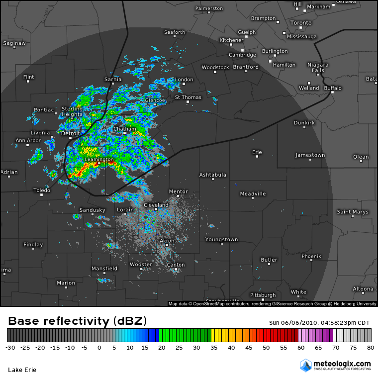
Figure 4 shows the Doppler radar and the thunderstorms responsible for the strong tornado southeast of Harrow (west of Leamington, ON).
Sources
The Windsor Star. (2010). Gallery: Tornado upgraded to F2. Retrieved from http://www.canada.com/news/Gallery+Tornado+upgraded/3137999/story.html
NWS Weather Prediction Center Surface Analysis Archive. (2017). Surface analysis 18Z Sun Jun 6 2010. Retrieved from: https://www.wpc.ncep.noaa.gov/archives/web_pages/sfc/sfc_archive.php