

Figure 2 depicts the surface observations at 1:00 pm CDT, which shows a low pressure system in southwestern Manitoba with a cold front extending south into North Dakota and a trough of low pressure across central Manitoba. According to Bisson and Paola (2000), several thunderstorms developed along the trough with several rounds of storms.

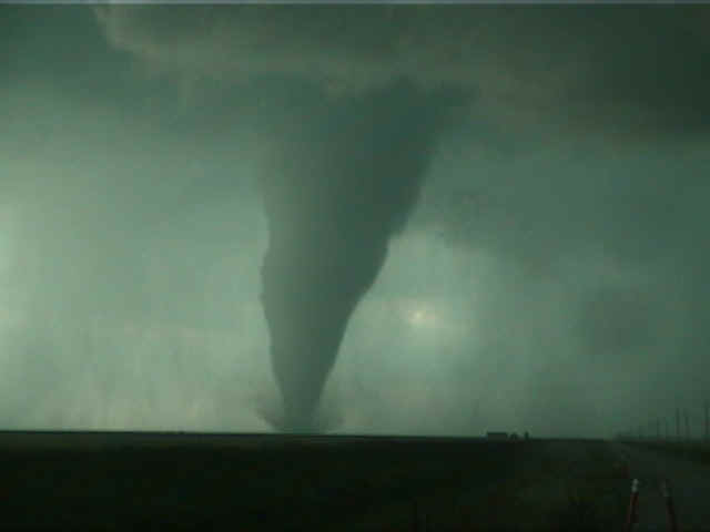
According to Environment and Climate Change Canada (2018), an F0 tornado touched down at 6:10 pm CDT near Brunkild, MB. The path and width of the tornado was not documented by ECCC. The tornado caused no fatalities, injuries or property damage. According to Bisson and Paola (2000), the tornado was on the ground for approximately 10 minutes.
Sources
Bisson, M. J. R. & Paola, R. (2000). An example of tornadogenesis in a low shear multicell storm environment over southern Manitoba, Canada. Retrieved from http://www.umanitoba.ca/environment/envirogeog/weather/radarstudies/brunkild/BrunkildTornado.html
NWS Weather Prediction Center Surface Analysis Archive. (2017). Surface analysis 18Z Mon Jul 24 2000. Retrieved from: https://www.wpc.ncep.noaa.gov/archives/web_pages/sfc/sfc_archive.php
Environment and Climate Change Canada Data. (2018). Canadian National Tornado Database: Verified Events (1980-2009) – Public. Retrieved from: http://donnees.ec.gc.ca/data/weather/products/canadian-national-tornado-database-verified-events-1980-2009-public/