

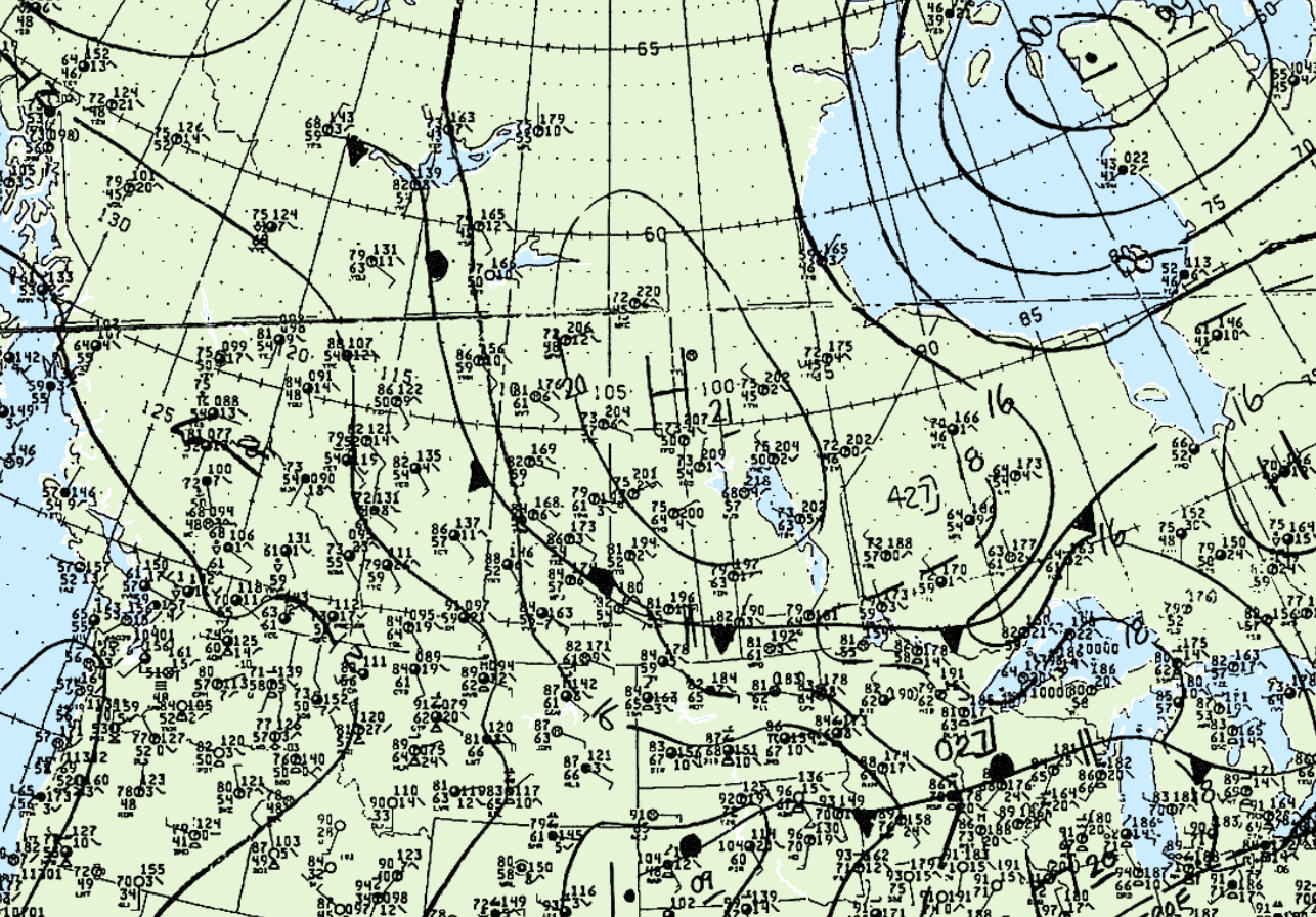
Figure 1 depicts the surface observations at 3:00 pm MDT, which shows a stationary front across Alberta and Saskatchewan. This front was the focus for thunderstorms across the afternoon and evening hours of July 25th, which ultimately resulted in eight tornadoes across Alberta.
The other tornadoes that occurred on this day were:
- Ghost Pine Creek, AB F1 Tornado
- Eckville, AB F0 Tornado
- Blindman Valley, AB F1 Tornado
- Milo, AB F2 Tornado
- Bow Island, AB F1 Tornado
- Jalna, AB F1 Tornado
- Esther, AB F1 Tornado
According to Environment and Climate Change Canada (2018), an F1 tornado touched down at 5:00 pm MDT near Springbank, AB. The path and width of the tornado was not documented by ECCC.
Sources
NWS Weather Prediction Center Surface Analysis Archive. (2017). Surface analysis 21Z Sat Jul 25 1987. Retrieved from: https://www.wpc.ncep.noaa.gov/archives/web_pages/sfc/sfc_archive.php
Environment and Climate Change Canada Data. (2018). Canadian National Tornado Database: Verified Events (1980-2009) – Public. Retrieved from: http://donnees.ec.gc.ca/data/weather/products/canadian-national-tornado-database-verified-events-1980-2009-public/