

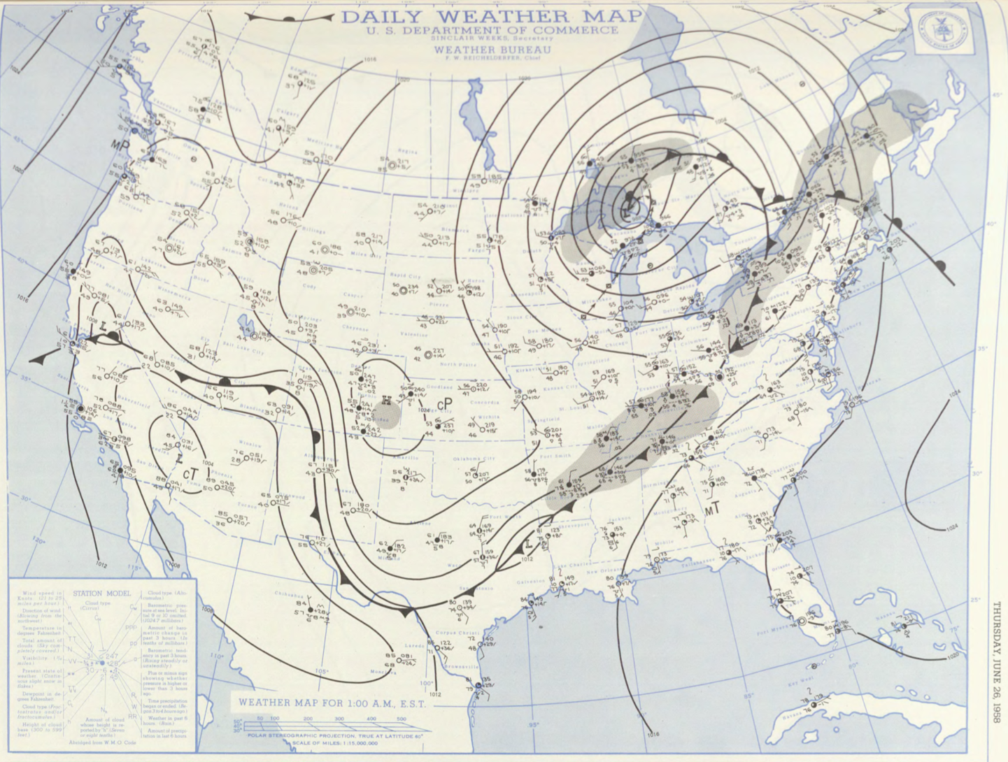
Figure 1 depicts the surface observations at 2:00 am EDT, which shows a cold front moving across the northeast United States and a warm from advecting northeast as well. A large area of precipitation is also observed along the fronts in Figure 1 (shaded grey). The cold front moved east throughout the afternoon hours of June 26th and initiated thunderstorms, which ultimately led to this F1 tornado.
The Springfield, MA F1 tornado of July 5, 1957 impacted Hampden County in Massachusetts. According to NOAA (2019), the F1 tornado caused no fatalities or injuries, but caused $250 dollars in property damage. The tornado touched down in Hampden County near Burt Road at 4:50 pm EDT. The tornado travelled for 0.1 miles and had a maximum width of 33 yards.
Sources
NOAA Central Library. (2019). U.S. Daily Weather Maps. Friday July 5, 1957 [PDF]. Retrieved from https://library.noaa.gov/Collections/Digital-Collections/US-Daily-Weather-Maps
NOAA National Centers for Environmental Information (2019). Storm Events Database. Retrieved from: https://www.ncdc.noaa.gov/stormevents/