

The tornado was spawned by a severe thunderstorm passed across St. Joseph Island, about 40 kilometres southeast of Sault Ste. Marie in the late afternoon. It left a path of intermittent tree damage that was 5 kilometres long and 50 metres wide.
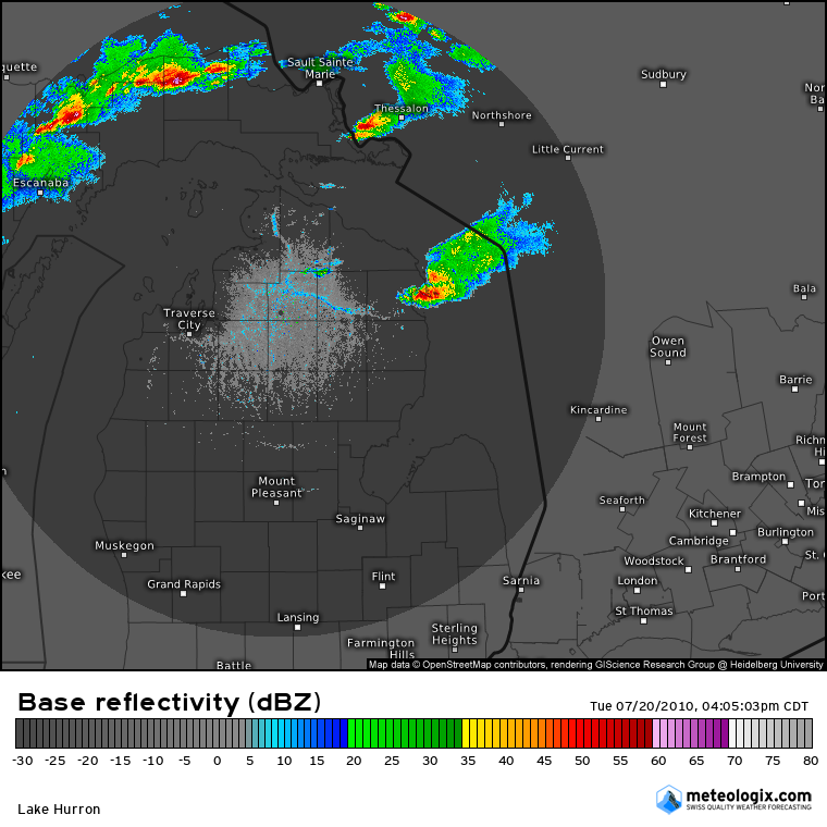
Figure 1 depicts the radar at 5:05 pm EDT, which shows several supercells. The storm southeast of Sault Ste Marie and directly southwest of Thessalon in Ontario shows a classic ‘flying eagle’ or ‘y-shape’ on radar, which is a classic depiction of a supercell on radar. This storm was responsible for this F0 tornado over St Joseph Island.
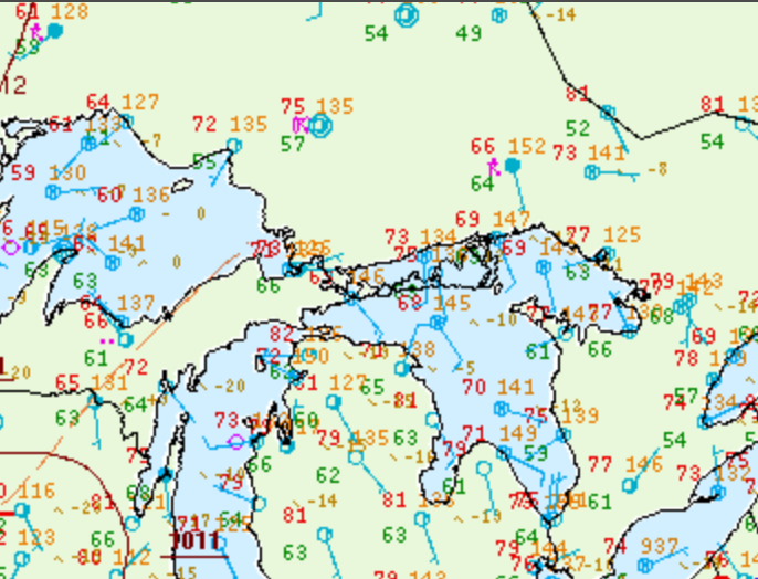
Figure 2 depicts the surface observations at 5:00 pm EDT, which shows no major frontal boundaries. However, southerly flow is observed over the Great Lakes, which leads us to believe these storms may have been initiated by pre-existing boundaries and/or by lake-breeze boundaries. An outflow boundary seem present in northern Michigan at 1:00 pm EDT, which seem to have initiated our storm in Michigan, southwest of Sault Ste Marie around the same time. This storm moved eastward and intensified before crossing into Ontario.
Sources
NWS Weather Prediction Center Surface Analysis Archive. (2017). Surface analysis 21Z Tue Jul 20 2010. Retrieved from: https://www.wpc.ncep.noaa.gov/archives/web_pages/sfc/sfc_archive.php