

According to Public Safety Canada (2019), tornadoes, high winds and thunderstorms caused crop damage and destruction of several buildings in the communities of Lobo, Komoka, Frome, Port Stanley, Southwold and Kendall where six minor injuries were reported.
This tornado touched down just north of Newtonville, near the intersection of Concession 4 and Gilmore Road, and had a path that was 3 km long and 70 metres wide. Along its track, barns and sheds were levelled, and trees were snapped and stripped of their leaves. On one property that was most extensively damaged, the house was partially unroofed and a neighboring barn was levelled. A truck was reportedly ‘sucked up’ and a garage was swept away, although the boat that had been inside of it was left sitting untouched.
The tornado, described by witnesses as a dust-filled funnel going hundreds of feet into the air, struck at 5:20 pm. This was one of three tornadoes that touched down in Southern Ontario on August 28.
The Forecast
According to Environment Canada (1990), a sharp cold front was crossing southern Ontario on the late afternoon of August 28, 1990 (Figure 1).
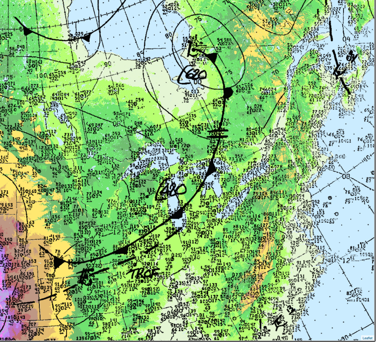
The cold front would become the focus for intense convection later in the day for southern Ontario.
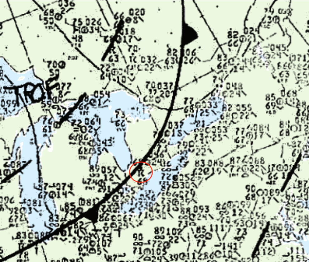
Figure 2 depicts the positioning of the cold front and the thunderstorm that developed along it. Figure 2 is a depiction 30 minutes prior to the F3 tornado that developed and impacted Port Stanley, ON on August 28, 1990.
Recap
According to ECCC (2018), the Starkville F1 tornado touched down at 5:20 pm local time southeast of Starkville, ON and tracked for 2 km moving in a southeasterly direction and ending east of Newtonville Road. The maximum width of the tornado was not documented. The F1 tornado caused no fatalities or injuries. The total damage by this tornado was $500 thousand dollars.
Sources
Public Safety Canada. (2019). Canadian Disaster Database. Retrieved from: https://cdd.publicsafety.gc.ca/prnt-eng.aspx?cultureCode=en-Ca&provinces=9&eventTypes=%27EP%27%2C%27IN%27%2C%27PA%27%2C%27AV%27%2C%27CE%27%2C%27DR%27%2C%27FL%27%2C%27GS%27%2C%27HE%27%2C%27HU%27%2C%27SO%27%2C%27SS%27%2C%27ST%27%2C%27TO%27%2C%27WF%27%2C%27SW%27%2C%27EQ%27%2C%27LS%27%2C%27TS%27%2C%27VO%27&normalizedCostYear=1&dynamic=false
Environment Canada (1990, Aug 27 to Sept 2). A weekly review of Canadian climate and water. Climatic Perspectives, Vol. 12, No 35, p.1.
NWS Weather Prediction Center. (2017). Surface analysis 18Z Tue Aug 28 1990. Retrieved from: https://www.wpc.ncep.noaa.gov/archives/web_pages/sfc/sfc_archive.php
Environment
and Climate Change Canada (2018). Canadian National Tornado
Database: Verified Events (1980-2009) – Public. Retrieved from: http://donnees.ec.gc.ca/data/weather/products/canadian-national-tornado-database-verified-events-1980-2009-public/?lang=en