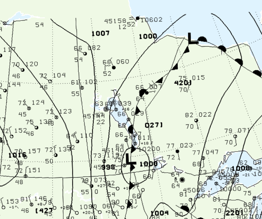
Figure 1 depicts the surface observations at 7:00 pm CDT, which shows a low pressure system in southern Manitoba with a stationary front extending north across central Manitoba and a cold front extending south across eastern North Dakota. The stationary front eventually became more of a cold front, moving eastward and triggering thunderstorm, which ultimately resulted in this long-track tornado.

According to Environment and Climate Change Canada (2018), an F1 tornado touched down at 11:00 pm CDT near Stead, MB. The tornado travelled for 6.4 km and had a maximum width of 200 metres. The tornado caused no fatalities, injuries or documented property damage.
Sources
NWS Weather Prediction Center Surface Analysis Archive. (2017). Surface analysis 00Z Thu Aug 21 2003. Retrieved from: https://www.wpc.ncep.noaa.gov/archives/web_pages/sfc/sfc_archive.php
Environment and Climate Change Canada Data. (2018). Canadian National Tornado Database: Verified Events (1980-2009) – Public. Retrieved from: http://donnees.ec.gc.ca/data/weather/products/canadian-national-tornado-database-verified-events-1980-2009-public/

