

The F2 tornado at Blue Mountains, Ontario. Touching down at 4:40pm with a path that was 12km long and 400m wide, the tornado moved from south of Thornbury to the northeast. Trees and power poles were snapped, apple orchards were ravaged, houses and chalets had their roofs torn off, and at Georgian Peaks Ski Resort, storage buildings and lift houses were demolished. The tornado’s path which took it over the crest of the Blue Mountains was particularly unique, and made for an unbelievable sight as stunned residents watched it tear through.
Several witnesses captured photos and videos of the tornado which was fast-moving, large and barrel-shaped. As it approached the ridge of the the Blue Mountains themselves, it was a dark and churning mass that sporadically exhibited a multiple vortex structure. Cresting the ridge, it briefly became a wedge, then tapered again into a fat stovepipe as it descended the slope. As the tornado moved out over the waters of Georgian Bay, it became ghostly white as it sucked up ring of spray from the water’s surface. Video shows violent motion at this stage of the tornado’s lifecycle, however the tornado moved away from land and out over the vast expanse of the bay, dissipating before reaching the distant shore.
This was one of nineteen tornadoes that struck Southern and Central Ontario on August 20th. Figure 1 depicts a line of severe thunderstorms entering southwestern Ontario from Michigan. These thunderstorms were responsible for the tornado outbreak on this day.
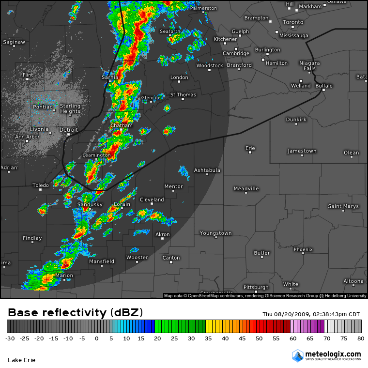
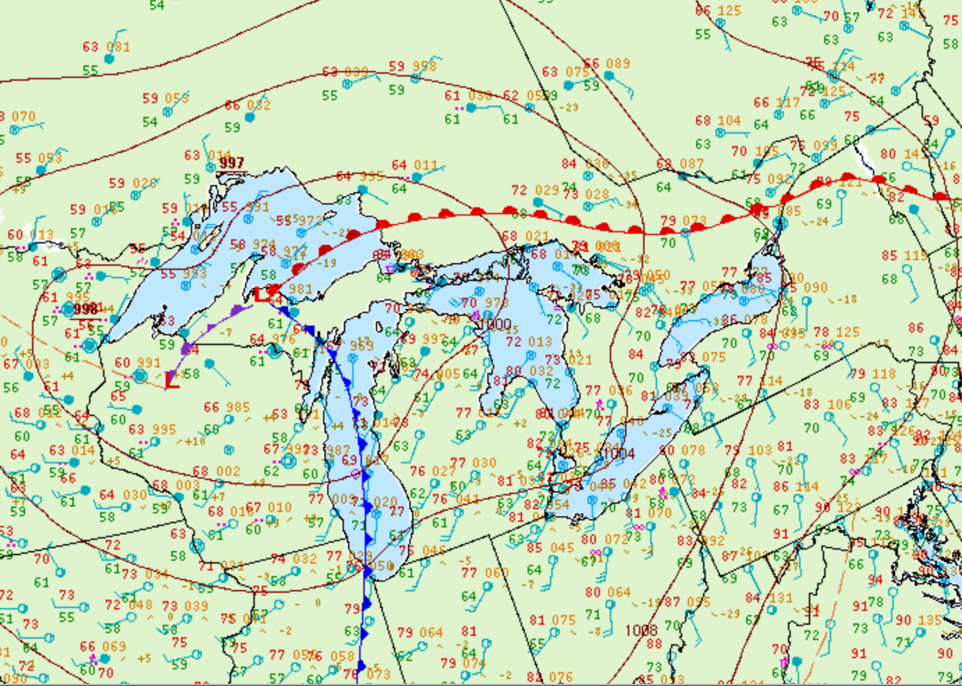
Figure 2 depicts the surface observations at 5:00 pm EDT, which shows a cold front moving through the Great Lakes and a warm front in central Ontario. The warm sector (southern Ontario), brought southerly winds moving across the open waters of Lake Ontario and Lake Erie. The advancing cold front and possible interactions with lake-breeze boundaries developed pre-frontal storms across southwestern Ontario, which moved east and brought one of the most significant tornado outbreak in Ontario’s history.
According to Environment and Climate Change Canada (2018), an F2 tornado touched down at 4:40 pm near The Blue Mountains, ON. The tornado travelled for 12.5 km and had a maximum width of 400 metres. The tornado caused no fatalities, injuries or property damage.
Sources
NWS Weather Prediction Center Surface Analysis Archive. (2017). Surface analysis 21Z Thu Aug 20 2009. Retrieved from: https://www.wpc.ncep.noaa.gov/archives/web_pages/sfc/sfc_archive.php
Environment and Climate Change Canada Data. (2018). Canadian National Tornado Database: Verified Events (1980-2009) – Public. Retrieved from: http://donnees.ec.gc.ca/data/weather/products/canadian-national-tornado-database-verified-events-1980-2009-public/