Touisset, MA EF0 Tornado of July 23, 2008


Figure 1 depicts the surface observations at 2:00 pm EDT, which shows a stationary front across the northeastern United States. This front became the focus for thunderstorm activity throughout the afternoon hours of July 23rd, which ultimately led to this tornado.
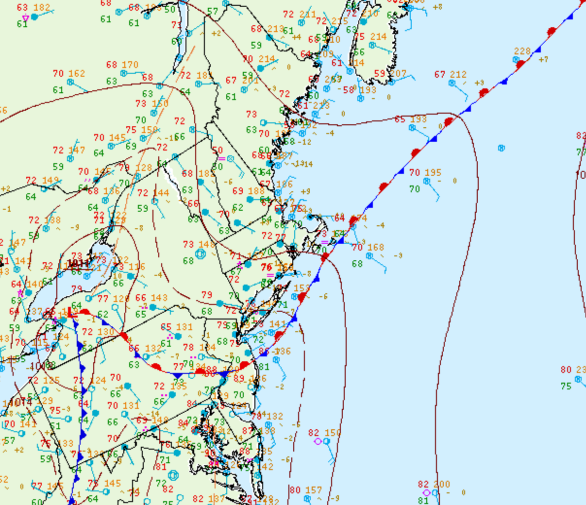
Figure 1. Surface analysis at 18Z on July 23, 2008 showing mean sea-level pressure (MSLP) contours, surface observations, fronts and pressure centres (WPC, 2017)

The Touisset, MA F0 tornado of July 23, 2008 impacted Bristol County in Massachusetts. According to NOAA (2019), the EF0 tornado caused no fatalities or injuries, but caused $15 thousand dollars in property damage. The tornado began as a waterspout that occurred just off of Rumstick Point in Barrington, Rhode Island and impacted Bristol County at 4:06 pm EDT. The tornado travelled for 1.31 miles and had a maximum width of 40 yards as it moved through Bristol County.


Sources

NWS Weather Prediction Center Surface Analysis Archive. (2017). Surface analysis 18Z Wed Jul 23 2008. Retrieved from: https://www.wpc.ncep.noaa.gov/archives/web_pages/sfc/sfc_archive.php

NOAA National Centers for Environmental Information (2020). Storm Events Database. Retrieved from: https://www.ncdc.noaa.gov/stormevents/

National Centers for Environmental Information reports:

A National Weather Service Damage Survey team concluded that an EF1 tornado moved through portions of eastern Rhode Island and southeastern Massachusetts. The tornado began as a waterspout that occurred just off of Rumstick Point in Barrington, Rhode Island. The waterspout then moved onto land over the southern portion of Warren near the Warren/Bristol line at Hanley Farm Road. It continued eastward across the Kickemuit River in the Touisset Highlands section of Warren then crossed the Cole River and continued to cause damage in the Ocean Grove section of Swansea.

Most of the damage had a rating of EF0 on the Enhanced Fujita Scale with wind speeds of 65 to 75 mph. However, there was one small section of Warren that experienced EF1 damage. Wind speeds in that area were estimated at 90 mph.

The tornado path length was 4.2 miles and for the most part was continuous. It was very narrow with a path width of only 40 yards. The waterspout was first observed off of Barrington at 4:00PM EDT. It moved onto land in Warren at 4:05PM EDT and into Massachusetts at 4:10PM EDT.

No injuries were reported. The majority of the damage was to trees, some of which fell onto power lines and houses. There were numerous eyewitness accounts of dark funnels, swirling debris, and intense roaring. At least one garage door bowed out toward the path of the tornado.