

This tornado touched down at 6:30 pm, damaging signs and trees, a number of which were snapped and uprooted. Figure 1 depicts the surface map at 5:00 pm EDT, which shows a warm front extending into central Ontario. Figure 1 also depicts ongoing storms along the warm front at the time, one of which is responsible for the F0 tornado on this day.
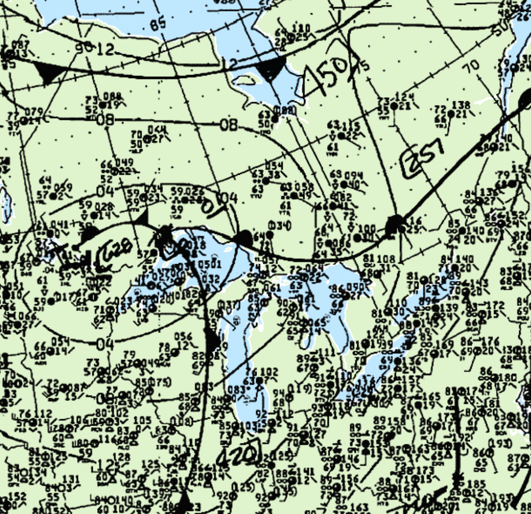
According to Environment and Climate Change Canada (2018), an F0 tornado touched down at 6:30 pm EDT near Trout Creek, ON. The tornado tracked for 370 metres with a maximum width of 140 metres. The tornado caused no injuries, fatalities or property damage.
Sources
NWS Weather Prediction Center Surface Analysis Archive. (2017). Surface analysis 21Z Sun Jun 17 1990. Retrieved from: https://www.wpc.ncep.noaa.gov/archives/web_pages/sfc/sfc_archive.php
Environment and Climate Change Canada Data. (2018). Canadian National Tornado Database: Verified Events (1980-2009) – Public. Retrieved from: http://donnees.ec.gc.ca/data/weather/products/canadian-national-tornado-database-verified-events-1980-2009-public/