

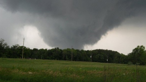
The supercell that produced the tornado at Midland spawned this second tornado about a half hour later, at 8:00 pm EDT. It touched down near Maple Valley, then travelled for 12 km to just east of Washago. The tornado uprooted and snapped trees and caused damage at a farm, destroying its barn, silos and garage. This was one of three tornadoes that touched down in Southern Ontario on June 23th.
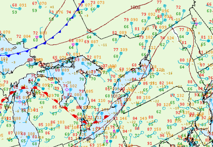
Figure 2 depicts the surface observations at 5:00 pm EDT, which shows a warm front across Michigan and entering Ontario. This front moved into southwestern Ontario throughout the evening hours of June 23rd and with the help of an outflow boundary (observed at 15Z south of Midland), initiated intense thunderstorms, which ultimately led to a long-track F2 tornado in Midland and a long-track F1 tornado that ended in Washago.
Sources
Andrews, R. (2020). Retrieved from https://www.ctvnews.ca/midland-storm-was-an-f2-tornado-experts-confirm-1.526200
NWS Weather Prediction Center Surface Analysis Archive. (2017). Surface analysis 21Z Wed Jun 23 2010. Retrieved from: https://www.wpc.ncep.noaa.gov/archives/web_pages/sfc/sfc_archive.php