

This tornado touched down briefly, only on the ground for 200 metres and with a width of 20-30 metres. Witnesses described seeing a funnel cloud and swirling debris as the tornado knocked over shallow-rooted trees and caused minor damage to two houses, one of which had patio furniture thrown through a window.
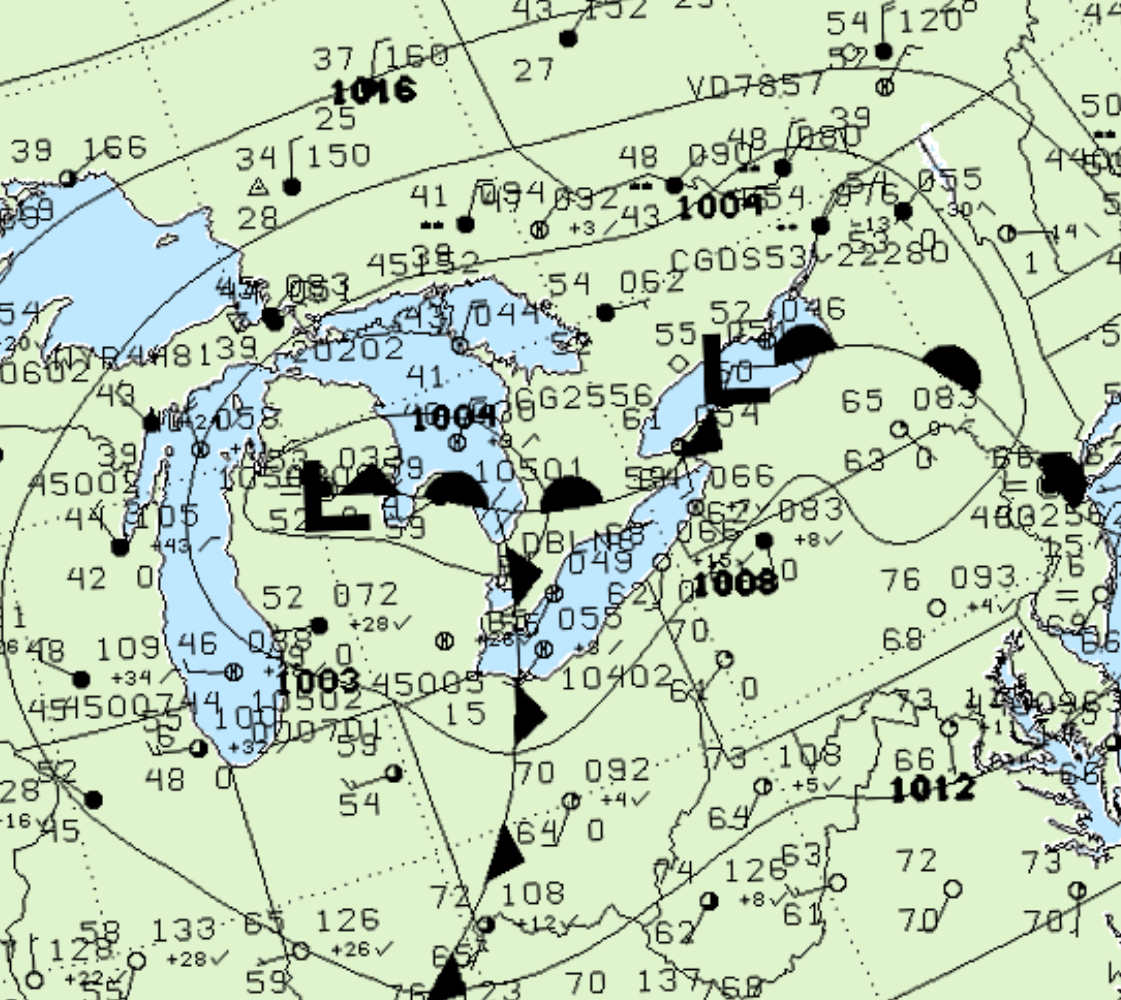
Figure 1 depicts the surface observations at 8:00 am EDT, which shows an occluding low pressure system over Michigan, with a warm front extending into southwestern Ontario. This warm front became the focus for thunderstorms in the early morning hours of May 24th, which ultimately led to this F0 tornado.
According to Environment and Climate Change Canada (2018), an F0 tornado touched down near Belton, ON. The path and width of the tornado was not documented by ECCC. The tornado caused no fatalities, injuries or property damage.
Sources
NWS Weather Prediction Center Surface Analysis Archive. (2017). Surface analysis 12Z Mon May 24 2004. Retrieved from: https://www.wpc.ncep.noaa.gov/archives/web_pages/sfc/sfc_archive.php
Environment and Climate Change Canada Data. (2018). Canadian National Tornado Database: Verified Events (1980-2009) – Public. Retrieved from: http://donnees.ec.gc.ca/data/weather/products/canadian-national-tornado-database-verified-events-1980-2009-public/